Tamaulipas
Huastec villages on the edge of Mesoamerica, Escandón's ranching frontier of 1748, a border state shaped by the Rio Grande, Tampico's oil and the cotton of Matamoros.
Capital: Ciudad Victoria · Became a state: 1824 · Checked 3 Nov 2026
Interactive maptap or click a state to open its page
Tamaulipas in figures from its history
Huastec terraces and the hunters of the plains
People have lived in what is now Tamaulipas for at least 8,000 years. Caves in the Sierra de Tamaulipas, studied as the Diablo complex, hold some of the earliest traces. Over the millennia the land split into two worlds. In the south and the mountain valleys lived the Huastecs, farmers who belonged to Mesoamerica. Across the north and the coastal plains ranged mobile hunter-gatherers and fishing peoples, whom the Spanish later lumped together as Chichimecs.
Indigenous languages spoken today
Speakers aged 3 and over, census of 2020 5
INEGI's 2020 census counted 22,651 speakers aged 3 and over (0.67% of that population). INEGI's state sociodemographic report gives only the two largest languages, as shares of that total (Nahuatl 49.9%, Tének or Huastec 23.6%); the counts above apply those shares to the total and are rounded. Totonac is also spoken.

The Huastec edge left real towns. Balcón de Montezuma, 18 km from Ciudad Victoria, has roughly 90 to 100 circular stone platforms and a stairway of more than 80 steps cut into the rock; INAH dates its main occupation to the first centuries CE, with links both to the Huasteca and to the cultures of the southeastern part of North America. El Sabinito, near Soto la Marina, has more than 600 structures and was lived in from about 200 to 1300 CE. Near Tula, the cone-shaped Cuizillo at Tammapul measures some 41 m across. The state's name comes from a Huastec word, Tamaholipa, whose meaning is still argued over. Today 22,651 people speak an Indigenous language, most of them Nahuatl and Tének (Huastec).
Nuevo Santander: missions, villas and open range
Spain came slowly to this coast. The Franciscan Andrés de Olmos set up a mission on a Huastec village by the Pánuco in 1532, and San Luis de Tampico, founded in 1554, was one of the first permanent Spanish towns on the Gulf coast. Pirate raids emptied it in 1684. Inland, the friar Juan Bautista de Mollinedo founded Tula on 22 Jul 1617, today counted as the oldest town in the state. For a century and a half the north stayed out of Spanish hands, held by peoples who resisted missions and the cattle that came behind them.
Interactive maptap or click a state to open its page
That changed with José de Escandón. The province of Nuevo Santander was created in the 1740s, and between 1748 and 1755 Escandón's expedition planted a chain of villas: Llera on 25 Dec 1748, Camargo on 5 Mar 1749, Reynosa on 14 Mar 1749 with 279 settlers, Aguayo (today Ciudad Victoria) on 6 Oct 1750, Soto la Marina in Sep 1750. Settler families raised cattle and sheep on open range along the Rio Grande, and the villas also served as a defensive line. The ranching pushed native groups off their land, and repeated revolts followed. By 1790 the province had 43,739 people.
Places in its history
Ciudad Victoria
City · 1750
Founded as Santa María de Aguayo in 1750; state capital as Ciudad Victoria from 1825. 6
Balcón de Montezuma
Archaeological site · c. 600-900
Hilltop Huastec-frontier town of circular stone platforms, 18 km from the capital. 18
Tula
Mission · 1617
Franciscan foundation of 1617, the oldest town in Tamaulipas; Tammapul's stone cone stands nearby. 13
Tampico
Port · 1554; 1823
Early Spanish town on the coast, refounded in 1823; the great oil port of the early 1900s. 7
Madero refinery
Oil field · 1914
Opened by El Águila in 1914; nationalised with the 1938 expropriation. 22
Reynosa
City · 1749
Escandón villa of 14 Mar 1749 with 279 settlers; a maquiladora city in the late 20th century. 11
Matamoros
City · 1749; 1913
Ranching settlement of 1749, Civil War cotton town, and scene of the first land grant of the Revolution. 8
A state on the Rio Grande
Independence reached Tamaulipas by sea. On 15 Apr 1817 the Spanish liberal Francisco Xavier Mina landed at Soto la Marina with a small force and brought the province its first printing press; the royalists retook the town two months later. Tamaulipas entered the federation as a state on 7 Feb 1824, and Aguayo became the capital as Ciudad Victoria in Apr 1825. Tampico, refounded on the north bank of the Pánuco in 1823, saw off Spain's last attempt at reconquest in Sep 1829. The border then moved against it. Texas claimed the land north of the Rio Grande in 1836, and after the war with the USA, the 1848 treaty took more than a quarter of the state's territory.
1810 to 1920 in Tamaulipas
From the timeline below, coloured by era
- 1817Francisco Xavier Mina lands at Soto la Marina on 15 Apr to fight for independence. 16
- 1824Tamaulipas becomes a state of the federation on 7 Feb. 1
- 1829Spain's attempt to retake Mexico is defeated at Tampico in Sep. 7
- 1848The Treaty of Guadalupe Hidalgo leaves the state without more than a quarter of its territory. 1
- 1861-65Confederate cotton flows out through Matamoros and the port of Bagdad; the town reaches about 30,000 people. 8
- 1866Republicans under Mariano Escobedo defeat imperial forces at Santa Gertrudis, near Camargo, on 16 Jun. 17
- 1913Lucio Blanco divides Hacienda Los Borregos on 30 Aug, the first land distribution of the Revolution. 9
- 1914El Águila opens its refinery at what is now Ciudad Madero. 21
The new border made Matamoros a trading town, the Mexican gate to the lower Rio Grande. It was declared a free trade zone in 1858, and during the American Civil War Confederate cotton went out through the nearby port of Bagdad, swelling the town to about 30,000 people by 1865. Against the French intervention, Republicans under Mariano Escobedo won at Santa Gertrudis, near Camargo, on 16 Jun 1866, and Matamoros fell a week later. Under Porfirio Díaz, who ruled from 1876 to 1911, the railway reached Tampico, and trade grew. In the Revolution, Lucio Blanco took Matamoros on 4 Jun 1913 and on 30 Aug divided Hacienda Los Borregos among its peons, the estate workers bound to it by debt, the first land distribution of the Revolution.
Oil at Tampico, cotton on the river, plants on the border
Oil turned the south of the state first. Edward Doheny drilled one of Mexico's first oil wells at Ébano, just across the line in San Luis Potosí, in 1901 and based his operations in Tampico in 1902. El Águila opened a refinery at what is now Ciudad Madero in 1914. Tampico became the chief oil-exporting port of the Americas, and in Apr 1914 a quarrel there between Mexican soldiers and USA sailors led to the occupation of Veracruz. The 1938 expropriation put the refinery in national hands, and Madero and Tampico stayed oil towns.
The region, c. 1600 and today
What each state turned on, by the era table below; Tamaulipas outlined in gold.
Interactive maptap or click a state to open its page
c. 1600
Tamaulipas: Frontier: missions, presidios, independent peoples
- Silver mining districts
- Towns, farms and workshops of the old heartland
- Ports, sugar and cacao
- Frontier: missions, presidios, independent peoples
Today
Tamaulipas: Export manufacturing
- Export manufacturing
- Oil and gas
- Tourism
- Farming and agro-exports
- Mining
- Services and government
Its places in the modern era
Numbered as on the map above
- 5Madero refinery · 1914
Opened by El Águila in 1914; nationalised with the 1938 expropriation. 22
In the north, irrigated cotton along the lower Rio Grande gave Matamoros its Cotton Age between 1948 and 1962, when it was the country's largest producer and exporter. When cotton faded and the Bracero years ended, the 1942-64 programme that sent Mexican farmworkers north to the USA, the border looked to factories. The Border Industrialization Program of 1965 opened the way for maquiladoras, foreign-owned assembly plants staffed mainly by women, in Matamoros, Reynosa and the other border towns. Foreign investment grew further after NAFTA took effect in 1994, while Altamira, north of Tampico, grew into a petrochemical and container port.
The border set the pace. On 15 Apr 2000 the World Trade International Bridge opened between Nuevo Laredo and Laredo, Texas, and it carries all of Laredo's cross-border truck traffic. The north of the state stayed bound to Texas through the maquiladoras of Reynosa, Matamoros and Nuevo Laredo, while the south lived on the petrochemical plants around Altamira, the refinery at Ciudad Madero and the oil-service firms of Tampico. The frontier Escandón settled with cattle along the Rio Grande has become a crossing for the trade between Mexico and the USA, and the oil coast of the south still turns on Tampico.
Tamaulipas, date by date
Before the Spanish before 1519
- c. 6000 BCE
People have lived in the region for at least 8,000 years; the Diablo complex in the Sierra de Tamaulipas holds early traces. 1
- c. 200 CE
Building begins at El Sabinito, a Huastec town that grows to more than 600 structures before it is left by 1300. 20
- c. 600-900
Balcón de Montezuma flourishes in the Sierra Madre Oriental, with some 90 circular platforms. 18
The colonial centuries 1519 to 1809
- 1554
San Luis de Tampico is founded, one of the first permanent Spanish towns on the Gulf coast. 7
- 1617
Friar Juan Bautista de Mollinedo founds Tula on 22 Jul, today the oldest town in the state. 14
- 1748-55
José de Escandón's expedition founds the villas of Nuevo Santander, from Llera to Reynosa and Camargo. 10
- 1750
Villa de Santa María de Aguayo, the future Ciudad Victoria, is founded on 6 Oct. 6
Independence and the Reform 1810 to 1875
- 1817
Francisco Xavier Mina lands at Soto la Marina on 15 Apr to fight for independence. 16
- 1824
Tamaulipas becomes a state of the federation on 7 Feb. 1
- 1829
Spain's attempt to retake Mexico is defeated at Tampico in Sep. 7
- 1848
The Treaty of Guadalupe Hidalgo leaves the state without more than a quarter of its territory. 1
- 1861-65
Confederate cotton flows out through Matamoros and the port of Bagdad; the town reaches about 30,000 people. 8
- 1866
Republicans under Mariano Escobedo defeat imperial forces at Santa Gertrudis, near Camargo, on 16 Jun. 17
The Revolution 1910 to 1920
Modern Mexico after 1920
- 1938
The oil expropriation puts Tampico's industry in national hands. 7
- 1948-62
The Cotton Age makes Matamoros the country's largest cotton producer and exporter. 8
- 1965-94
Maquiladoras spread along the border after 1965, and investment grows after NAFTA in 1994. 8
- 2000
The World Trade International Bridge opens between Nuevo Laredo and Laredo, Texas, on 15 Apr. 26
Where Tamaulipas stood: c. 1600, 1910 and today
Interactive maptap or click a state to open its page
c. 1600
Silver, the heartland and the frontier
Tamaulipas: Frontier: missions, presidios, independent peoples
- Silver mining districts
- Towns, farms and workshops of the old heartland
- Ports, sugar and cacao
- Indigenous south: cochineal, maize, tribute
- Maya lands under encomienda or beyond Spanish rule
- Frontier: missions, presidios, independent peoples
1910
The Porfiriato at its height
Tamaulipas: Oil
- Mining
- Oil
- Henequén
- Sugar and textile mills
- Haciendas: grain, pulque, cattle
- Export crops: coffee, tobacco, cacao, chicle, timber
- Steel, cotton and the railway north
- Ranching frontier
- The national capital
Today
What each state turns on now
Tamaulipas: Export manufacturing
- Export manufacturing
- Oil and gas
- Tourism
- Farming and agro-exports
- Mining
- Ports and logistics
- Services and government
Why Mexico's own reading of what each state's economy turned on in that period, drawn from the sources listed in each state's room; a classification, not a measurement.
Today's numbers for Tamaulipas
Output, exports, jobs, wages and investment now, each with its source and date.
The bookBook 6, Where to Go in Mexico, chapter 13
Where to Go in Mexico: The Texas-Facing North, the corridor this state belongs to.
Why MexicoThe national timeline
The turning points of the whole country, each dated, each with its source.
Sources, each with its date
- Wikipedia (English), Tamaulipas, History section, 3 Nov 2026 · read 3 Nov 2026 · link
- Wikipedia (Spanish), Tamaulipas, Historia section, 3 Nov 2026 · read 3 Nov 2026 · link
- Tercer Censo de Población de los Estados Unidos Mexicanos 1910, Table VI, population by entity in 1895, 1900 and 1910 (Universidad Veracruzana reproduction), 1910 · read 3 Nov 2026 · link
- INEGI, Censo de Población y Vivienda 2020, results for Tamaulipas (press release 41/21), 26 Jan 2021 · read 3 Nov 2026 · link
- INEGI, Panorama sociodemográfico de Tamaulipas, Censo de Población y Vivienda 2020, 2021 · read 3 Nov 2026 · link
- Wikipedia (English), Ciudad Victoria, 3 Nov 2026 · read 3 Nov 2026 · link
- Wikipedia (English), Tampico, 3 Nov 2026 · read 3 Nov 2026 · link
- Wikipedia (English), Matamoros, Tamaulipas, 3 Nov 2026 · read 3 Nov 2026 · link
- Wikipedia (English), Lucio Blanco, 3 Nov 2026 · read 3 Nov 2026 · link
- Wikipedia (English), Nuevo Santander, 3 Nov 2026 · read 3 Nov 2026 · link
- Wikipedia (English), Reynosa, 3 Nov 2026 · read 3 Nov 2026 · link
- Wikipedia (English), Camargo, Tamaulipas, 3 Nov 2026 · read 3 Nov 2026 · link
- Wikipedia (English), Tula, Tamaulipas, 3 Nov 2026 · read 3 Nov 2026 · link
- Wikipedia (Spanish), Ciudad Tula, 3 Nov 2026 · read 3 Nov 2026 · link
- Wikipedia (Spanish), Soto la Marina, 3 Nov 2026 · read 3 Nov 2026 · link
- Wikipedia (Spanish), Francisco Xavier Mina, 3 Nov 2026 · read 3 Nov 2026 · link
- Wikipedia (Spanish), Batalla de Santa Gertrudis, 3 Nov 2026 · read 3 Nov 2026 · link
- Wikipedia (English), Balcón de Montezuma, 3 Nov 2026 · read 3 Nov 2026 · link
- INAH, Lugares INAH, Balcón de Montezuma archaeological zone, 3 Nov 2026 · read 3 Nov 2026 · link
- Wikipedia (Spanish), El Sabinito, 3 Nov 2026 · read 3 Nov 2026 · link
- Wikipedia (Spanish), Refinería Francisco I. Madero, 3 Nov 2026 · read 3 Nov 2026 · link
- Wikipedia (English), Ciudad Madero, 3 Nov 2026 · read 3 Nov 2026 · link
- Wikipedia (English), Mexicali (maquiladoras after the end of the Bracero program), 3 Nov 2026 · read 3 Nov 2026 · link
- Wikipedia (English), Tijuana (Border Industrialization Program, 1965), 3 Nov 2026 · read 3 Nov 2026 · link
- Wikipedia (English), Altamira, Tamaulipas, 3 Nov 2026 · read 3 Nov 2026 · link
- Wikipedia (English), World Trade International Bridge, 3 Nov 2026 · read 3 Nov 2026 · link
Pictures
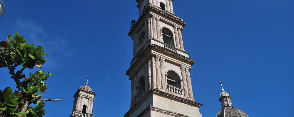
- Catedral de Tampico de Nuestra Señora de la Concepción.1: Jesus Eduardo Arteaga Flores, CC BY-SA 3.0, Wikimedia Commons · read 3 Nov 2026
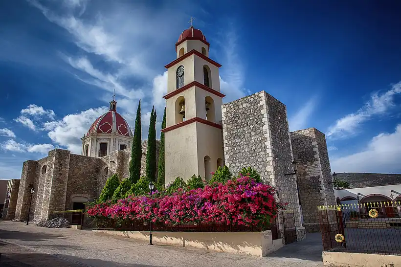
- Iglesia de San Antonio de Padua, Tula, Tampico: Comisión Mexicana de Filmaciones, CC BY-SA 2.0, Wikimedia Commons · read 3 Nov 2026

Where the sources disagree
- Mina's landing: Wikipedia (Spanish, Francisco Xavier Mina and Soto la Marina) gives 15 Apr 1817; Wikipedia (Spanish, Tamaulipas) gives 17 Apr 1817. This page uses 15 Apr.
- Earliest human presence: Wikipedia (English) says at least 8,000 years; Wikipedia (Spanish, Tamaulipas) gives c. 12000 BCE for the Diablo complex. This page uses the more cautious 8,000 years.
- Balcón de Montezuma: Wikipedia (English) gives more than 70 or about 90 circular structures; INAH gives about 100 and two occupations, the first nine centuries CE and 1200-1500. This page says 90 to 100.
Tabasco
From Olmec La Venta and the Chontal Maya cacao lands to pirates, a wandering capital, Garrido's red years and the oil boom of the 1970s.
All 32 on the mapNext →Tlaxcala
From the murals of Cacaxtla and a republic the Mexica never conquered to the alliance of 1519, colonists for the north, a hard-won statehood and industrial corridors.