Baja California
Yuman peoples and their painted rocks, a thin chain of missions, a desert frontier settled late, then irrigated cotton, border towns and the factories of the 1960s.
Capital: Mexicali · Became a state: 1952 · Checked 3 Nov 2026
Interactive maptap or click a state to open its page
Baja California in figures from its history
Yuman bands, desert springs and painted rocks
People reached the peninsula at least 11,000 years ago, moving down the Pacific coast. They never built cities here. The land rewarded mobility, and small bands moved with the seasons between the coast and the sierras, living by gathering, hunting and fishing. In the north lived peoples of the Yuman family, the Kumeyaay (Kumiai), Paipai, Kiliwa and Cucapá, the last of them on the lower Colorado River. Farther south, toward the 28th parallel, lived the Cochimí.
Indigenous languages spoken today
Speakers aged 3 and over, census of 2020 4
INEGI's 2020 census counted 49,130 speakers aged 3 and over (1.36% of that population). INEGI's state panorama gives only the two largest languages, as shares of that total (Mixtec 44.3%, Zapotec 12.1%); the counts above apply those shares to the total and are rounded. The native Yuman languages, Kumiai, Paipai, Kiliwa and Cucapá, are still spoken by small communities; Cochimí is no longer spoken.

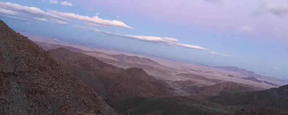
What they left is mostly on stone. Baja California has more than 70 rock art sites. At El Vallecito, near La Rumorosa, the Kumeyaay painted figures about 3,000 years ago, in an area people had used since about 8000 BCE; one figure, El Diablito, is lit by the sun around the winter solstice. These peoples are still here, though in small numbers. The Kiliwa community counted 11 people in 2019, and Cochimí is no longer spoken. In 2020 the census counted 49,130 speakers of Indigenous languages, most of them Mixtec and Zapotec, languages of southern Mexico.
The last missions of the Californias
Spanish ships mapped the coast long before anyone settled it. Francisco de Ulloa reached these shores in 1539 and 1540, Juan Rodríguez Cabrillo entered the bay of San Quintín on 22 Aug 1542 and the bay of Ensenada on 17 Sep, and Sebastián Vizcaíno named it Todos Santos on 2 Nov 1602. Settlement came from the south. The Jesuits, based at Loreto from 1697, pushed north with missions at Santa Gertrudis (1752), San Borja (1762) and Santa María (1767).
Interactive maptap or click a state to open its page
After the Jesuits were expelled in 1768, the Franciscans founded San Fernando Velicatá on 14 May 1769, the first mission of Junípero Serra, and the same year the Portolá expedition set out overland for Alta California. From 1773 the Dominicans took over the frontier and built a chain of missions from El Rosario (1774) to El Descanso (1817), among them Santo Domingo (1775). Mission life rested on Native labour in fields, orchards and herds, with small dams and aqueducts. Epidemics cut the Indigenous population hard; by about 1818 Velicatá had no resident missionary. In 1804 the crown split the Californias at the line between Franciscan and Dominican missions.
Places in its history
San Fernando Velicatá
Mission · 1769
Serra's first mission, in a Cochimí village; ruins, an aqueduct and petroglyphs remain. 10
Santo Domingo de la Frontera
Mission · 1775
Dominican mission among the Kiliwa, moved inland in 1793; adobe walls survive. 12
Ensenada
Port · 1542; 1882
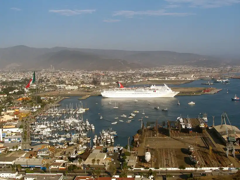
Bay reached by Cabrillo in 1542; seat of the northern district from 1882 to 1915. 8
Tijuana
City · 1889
Founded in 1889; Prohibition resort town, then a centre of the maquiladora from 1965. 6
A frontier the new border drew
Independence was felt here from afar; José Darío Argüello, the last colonial governor, served until 1822, and the peninsula became a federal territory, governed directly from Mexico City, in 1824. In 1829 Santiago Argüello received the Rancho Tía Juana. The missions were secularised in the 1830s, their lands passing from the friars to civil authorities. The 1848 treaty after the war with the USA drew the new border along the northern edge of what are now Tijuana, Tecate and Mexicali, and this thin strip became the northern edge of Mexico. On 29 Nov 1853 the filibuster William Walker, a USA adventurer bent on a republic of his own, raised his flag at Ensenada; Antonio Meléndrez and local ranchers drove him back to the border.
1810 to 1920 in Baja California
From the timeline below, coloured by era
- 1848The Treaty of Guadalupe Hidalgo fixes the new border on 2 Feb. 2
- 1853William Walker raises a filibuster flag at Ensenada on 29 Nov and is driven out by local ranchers. 8
- 1882The seat of the northern district moves from Real del Castillo to Ensenada on 15 May. 8
- 1889Tijuana is founded on 11 Jul on the old Rancho Tía Juana. 6
- 1903Mexicali is created on 14 Mar as Colorado River water opens the valley to farming. 5
- 1911Magonista rebels hold Mexicali and Tijuana before federal troops return. 1
Gold found at Japa in 1873 made Real del Castillo the district seat for a few years, but on 15 May 1882 the seat moved to Ensenada. Under the Porfiriato, Porfirio Díaz's rule of 1876-1911, huge land concessions went to foreign colonisation companies, from Huller and Sisson in 1884 to the International Company of Mexico in 1887, and Tijuana was founded on 11 Jul 1889. In 1900 a canal from the Colorado River opened the Mexicali Valley; Mexicali was created in 1903, and its farms relied on thousands of Chinese labourers. In 1911 the Magonistas, anarchist followers of Ricardo Flores Magón, held Mexicali and Tijuana for some weeks, and in 1915 the capital moved to Mexicali. In 1937 the Asalto a las Tierras, when landless farmers occupied foreign-owned estates, brought the valley's land into Mexican hands.
Cotton, casinos and the assembly line
The 20th century filled the empty north. During Prohibition in the USA, Tijuana's bars and the Agua Caliente resort, opened in 1928 with a hotel, casino and racetrack, drew visitors from California until gambling was banned in 1935. The Mexicali Valley grew cotton on irrigated land, and by the early 1950s it was the country's largest cotton zone. Population rose from 78,907 in 1940 to 226,965 in 1950, and on 16 Jan 1952 the Northern Territory became the 29th state.
The region, c. 1600 and today
What each state turned on, by the era table below; Baja California outlined in gold.
Interactive maptap or click a state to open its page
c. 1600
Baja California: Frontier: missions, presidios, independent peoples
- Frontier: missions, presidios, independent peoples
Today
Baja California: Export manufacturing
- Export manufacturing
- Tourism
- Mining
When synthetic fibres hurt cotton and the Bracero program, the USA guest-worker scheme for Mexican farmhands, ended in 1964, the border turned to industry. The first assembly plants appeared in the 1960s, and the Border Industrialization Program of 1965 made the maquiladora, the export assembly plant, the region's engine; by 1988 Mexicali alone had 100 such factories. Tourism grew on the coast, with a boom at Ensenada in the 1950s and 1960s and wine in the Valle de Guadalupe. Population kept climbing, to 2,487,367 in 2000. In 1989 the state elected its first governor from outside the PRI, the party that had ruled Mexico since 1929.
In 2001 Tijuana's maquiladoras peaked at roughly 820, while migrants from across Mexico kept arriving. In Dec 2015 the Cross Border Xpress opened, a terminal and footbridge linking San Diego directly with Tijuana's airport. A frontier settled late, beside a line drawn in 1848, has made that line its livelihood: Colorado River water built Mexicali, the USA market built Tijuana, and the border remains the reason the state grew from a few thousand people in 1900 to millions.
Baja California, date by date
Before the Spanish before 1519
The colonial centuries 1519 to 1809
- 1539-40
Francisco de Ulloa becomes the first European to reach the shores of the present state. 2
- 1542
Juan Rodríguez Cabrillo enters San Quintín bay on 22 Aug and Ensenada bay on 17 Sep. 2
- 1769
Junípero Serra founds San Fernando Velicatá on 14 May, his first mission. 10
- 1774-1817
The Dominicans build their chain of missions from El Rosario to El Descanso. 1
- 1804
The crown divides the Californias into Alta and Baja. 1
Independence and the Reform 1810 to 1875
The Porfiriato 1876 to 1910
The Revolution 1910 to 1920
- 1911
Magonista rebels hold Mexicali and Tijuana before federal troops return. 1
Modern Mexico after 1920
- 1928
The Agua Caliente resort opens in Tijuana in the Prohibition years. 6
- 1937
The Asalto a las Tierras returns the Mexicali Valley's farmland to Mexican farmers. 13
- 1952
The Northern Territory becomes the state of Baja California on 16 Jan. 1
- 1965
The Border Industrialization Program opens the era of the maquiladora. 6
- 2000
The census counts 2,487,367 people, against 226,965 in 1950. 1
- 2001
Tijuana's maquiladoras reach their peak, roughly 820 plants. 6
- 2015
The Cross Border Xpress opens on 9 Dec, linking San Diego with Tijuana's airport. 14
Where Baja California stood: c. 1600, 1910 and today
Interactive maptap or click a state to open its page
c. 1600
Silver, the heartland and the frontier
Baja California: Frontier: missions, presidios, independent peoples
- Silver mining districts
- Towns, farms and workshops of the old heartland
- Ports, sugar and cacao
- Indigenous south: cochineal, maize, tribute
- Maya lands under encomienda or beyond Spanish rule
- Frontier: missions, presidios, independent peoples
1910
The Porfiriato at its height
Baja California: Ranching frontier
- Mining
- Oil
- Henequén
- Sugar and textile mills
- Haciendas: grain, pulque, cattle
- Export crops: coffee, tobacco, cacao, chicle, timber
- Steel, cotton and the railway north
- Ranching frontier
- The national capital
Today
What each state turns on now
Baja California: Export manufacturing
- Export manufacturing
- Oil and gas
- Tourism
- Farming and agro-exports
- Mining
- Ports and logistics
- Services and government
Why Mexico's own reading of what each state's economy turned on in that period, drawn from the sources listed in each state's room; a classification, not a measurement.
Today's numbers for Baja California
Output, exports, jobs, wages and investment now, each with its source and date.
The bookBook 6, Where to Go in Mexico, chapter 14
Where to Go in Mexico: The Pacific Border, the corridor this state belongs to.
Why MexicoThe national timeline
The turning points of the whole country, each dated, each with its source.
Sources, each with its date
- Wikipedia (English), Baja California, History section and historical population table, 3 Nov 2026 · read 3 Nov 2026 · link
- Wikipedia (Spanish), Baja California, Historia section, 3 Nov 2026 · read 3 Nov 2026 · link
- INEGI, Censo de Población y Vivienda 2020, results for Baja California (press release 30/21), 26 Jan 2021 · read 3 Nov 2026 · link
- INEGI, Panorama sociodemográfico de Baja California, Censo de Población y Vivienda 2020, 2021 · read 3 Nov 2026 · link
- Wikipedia (English), Mexicali, 3 Nov 2026 · read 3 Nov 2026 · link
- Wikipedia (English), Tijuana, 3 Nov 2026 · read 3 Nov 2026 · link
- Wikipedia (English), Ensenada, Baja California, 3 Nov 2026 · read 3 Nov 2026 · link
- Wikipedia (Spanish), Ensenada (Baja California), 3 Nov 2026 · read 3 Nov 2026 · link
- Wikipedia (English), El Vallecito, 3 Nov 2026 · read 3 Nov 2026 · link
- Wikipedia (English), Misión San Fernando Rey de España de Velicatá, 3 Nov 2026 · read 3 Nov 2026 · link
- Wikipedia (Spanish), Misión de San Fernando Rey de España de Velicatá, 3 Nov 2026 · read 3 Nov 2026 · link
- Wikipedia (English), Misión Santo Domingo de la Frontera, 3 Nov 2026 · read 3 Nov 2026 · link
- San Diego Red, 'Mexicali marks 89 years since landmark land movement' (Asalto a las Tierras, 1937), 28 Jan 2026 · read 3 Nov 2026 · link
- Wikipedia (English), Cross Border Xpress, 3 Nov 2026 · read 3 Nov 2026 · link
Pictures
- Carretera Mexicali- Tijuana, México: Christopher Javier Cuenca García, CC BY-SA 4.0, Wikimedia Commons · read 3 Nov 2026
- Puerto Ensenada: cesar bojorquez from Tijuana, Mexico, CC BY 2.0, Wikimedia Commons · read 3 Nov 2026

Where the sources disagree
- First peoples: Wikipedia (English) gives at least 11,000 years ago; Wikipedia (Spanish) gives about 14,000. This page uses 11,000.
- San Fernando Velicatá: Wikipedia (English) gives 14 May 1769; Wikipedia (Spanish) gives 14 Feb 1769. This page uses 14 May.
- Ensenada: Wikipedia (English) says it was founded in 1542 as San Mateo; Wikipedia (Spanish) treats 15 May 1882, when the district seat moved there, as the founding. This page gives both events.
- William Walker, 1853: Wikipedia (English) places his capture at La Paz; Wikipedia (Spanish, Ensenada) has him raising his flag at Ensenada on 29 Nov 1853. This page uses Ensenada.
Aguascalientes
Chichimeca hunting grounds became a rest stop on the silver road, then a state carved from Zacatecas, a railway town and, from 1982, a car-making valley.
All 32 on the mapNext →Baja California Sur
Painted caves of the Cochimí, pearls and Jesuit missions, a French copper town, and a remote territory that became a state and a tourist coast in 1974.