Guanajuato
From Chupícuaro and Cañada de la Virgen to the silver of La Valenciana, the cry of Dolores and the Bajío's grain, Guanajuato has fed Mexico and started its wars.
Capital: Guanajuato · Became a state: 1823 · Checked 3 Nov 2026
Interactive maptap or click a state to open its page
Guanajuato in figures from its history
Chupícuaro, the Bajío towns and the Gran Chichimeca
Between about 800 BCE and 300 CE the Chupícuaro culture flourished in the Bajío, the broad valley of the Lerma, and its influence spread across several of today's states. Farming towns followed. Plazuelas, near Pénjamo, was built between 600 and 900 CE, with an I-shaped ball court, a civic and religious complex on an artificial terrace and a field of thousands of carved boulders. Cañada de la Virgen, near San Miguel de Allende, was built about 540 CE by Otomí people and held until about 1040. Its 7 stepped pyramids are aligned east to west and were used to watch the sky.
Indigenous languages spoken today
Speakers aged 3 and over, census of 2020 15
Guanajuato has few speakers of Indigenous languages: 14,048 people aged 3 and over in the 2020 census, 0.2% of that age group, across 33 languages. Researchers at the Universidad de Guanajuato give the shares of the largest (Otomí 20.6%, Nahuatl 19.7%, Chichimeca Jonaz 17.2%); the counts shown are those shares applied to the INEGI total, rounded to the nearest 10.

These towns traded with Tula and declined with it. A long drought and Tula's fall emptied most of them in the 10th and 11th centuries. By the time the Spanish arrived, the Purépecha held the southern edge, the Aztecs came north looking for minerals, and most of the land belonged to the Gran Chichimeca, where Guachichiles, Guamares and Chichimeca Jonaz lived by hunting and gathering. Chichimeca Jonaz and Otomí communities still live in the state. In 2020 the 3 largest Indigenous languages, Otomí, Nahuatl and Chichimeca Jonaz, each had roughly 2,400 to 2,900 speakers.
The mother lode and the granary of New Spain
Cristóbal de Olid's expedition reached Yuririapúndaro and Pénjamo in 1522, and Acámbaro became the first Spanish town in what is now Guanajuato. Gold and then silver drew settlers to the hills of Guanajuato. A land grant was made there in 1541, a town took shape in 1546 and in 1548 it became the Real de Minas de Guanajuato, a mining town chartered by the Crown. The Rayas mine was found in 1550. To guard the roads against Chichimeca attack the Spanish founded San Miguel in 1555, Celaya in 1570 and León in 1576. Truces were bought with blankets, clothing and food, and the mines were worked by Indigenous labourers brought from elsewhere and by enslaved Africans.
Interactive maptap or click a state to open its page
Guanajuato's peak came in the 18th century. It was named a city in 1741, and in 1774 the Valenciana mine began operations on the city's northern edge; at its height it is said to have produced about two-thirds of the world's silver. Its owners paid for the Valenciana church, built between 1765 and 1788. Below the hills the Bajío became one of the great farming regions of New Spain, growing grain for the mining towns. In 1786 Guanajuato became an intendancy, one of the large provinces created by the Bourbon reforms, and from 1798 its rulers built the Alhóndiga de Granaditas, a great granary for the city's grain.
Places in its history
Guanajuato
City · 1548
State capital and silver city; the pin marks the Alhóndiga de Granaditas, stormed on 28 Sep 1810. 8
Plazuelas
Archaeological site · c. 600-1000
Hilltop town with an I-shaped ball court and thousands of petroglyphs. 5
Cañada de la Virgen
Archaeological site · c. 540-1040
Otomí ceremonial centre of 7 pyramids aligned to watch the sky. 6
Celaya
Battlefield · 1570; 1915
Bajío town founded in 1570, where Obregón broke Villa's army in Apr 1915. 9
Salamanca refinery
Oil field · 1950
Pemex refinery opened in 1950; the pin marks the town of Salamanca. 11
Dolores, the Alhóndiga and the battles of Celaya
The War of Independence began in Guanajuato. In the early hours of 16 Sep 1810 the priest Miguel Hidalgo called his parish to arms at Dolores, with about 800 men. At Celaya on 21 Sep he was proclaimed general of an army said to number about 50,000. On 28 Sep some 20,000 insurgents stormed the Alhóndiga, where about 300 royalists, defenders of Spanish rule, had taken refuge, and killed those inside. When Hidalgo, Allende, Aldama and Jiménez were later executed, their heads hung from the corners of the Alhóndiga for 10 years. Independence was sworn in Guanajuato on 8 Jul 1821, and the state was created on 20 Dec 1823.
1810 to 1920 in Guanajuato
From the timeline below, coloured by era
- 1810Hidalgo calls the parish of Dolores to arms on 16 Sep, starting the War of Independence. 7
- 1810Insurgents storm the Alhóndiga de Granaditas on 28 Sep. 8
- 1823Guanajuato is erected as a state on 20 Dec. 2
- 1858Benito Juárez sets up his government in Guanajuato on 16 Jan. 2
- 1915Obregón defeats Villa in the battles of Celaya in Apr. 10
In Jan 1858, during the Reform War (1858-61), fought over the liberal laws that sold off Church and communal lands, Benito Juárez set up his government in the city of Guanajuato. Troops of the French Intervention took the state in 1863. Under Porfirio Díaz, who ruled from 1876 to 1911 (the Porfiriato), the railway reached the capital in 1882, foreign capital revived the mines and the Bajío became the granary of the Republic, while León, Celaya, Salvatierra and San Francisco del Rincón made shoes, textiles and hats on low wages. In Apr 1915 Álvaro Obregón, fighting for Carranza's Constitutionalists, defeated Pancho Villa at Celaya; Villa lost thousands of men and never recovered. Haciendas, the great landed estates, were then broken up into ejidos, communal farmland granted under land reform. The Cristero War (1926-29), a Catholic rising against President Calles's anticlerical laws, was fiercest around Pénjamo and León, and in 1946 the Sinarquistas, a Catholic nationalist movement, rose in León.
Refinery, leather and the heritage of the mines
The old silver economy faded as the veins ran out. The San Bernabé vein, worked since the 16th century, was exhausted in 1928. Oil brought a new kind of industry. Pemex began buying land at Salamanca in 1943, then a farm town of about 20,000 people, and on 31 Jul 1950 it opened the Ing. Antonio M. Amor refinery with a capacity of 25,000 barrels a day. Crude came by pipeline from Poza Rica and Tabasco. Its first chemical engineers trained at the Universidad de Guanajuato.
The region, c. 1600 and today
What each state turned on, by the era table below; Guanajuato outlined in gold.
Interactive maptap or click a state to open its page
c. 1600
Guanajuato: Silver mining districts
- Silver mining districts
- Towns, farms and workshops of the old heartland
Today
Guanajuato: Export manufacturing
- Export manufacturing
- Farming and agro-exports
- Mining
- Services and government
Its places in the modern era
Numbered as on the map above
- 6Salamanca refinery · 1950
Pemex refinery opened in 1950; the pin marks the town of Salamanca. 11
León kept its old trade in shoes and leather, while the Bajío remained one of Mexico's main grain regions. The capital turned its past into its future. The Alhóndiga, a prison for nearly a century after 1867, opened as a museum in 1958, and José Chávez Morado painted its murals between 1955 and 1966. In 1988 the historic town of Guanajuato and its adjacent mines became a World Heritage Site.
Foreign investment, above all in the car industry, turned the Bajío into a manufacturing region. General Motors had built vehicles at Silao since 1995, beside the Puerto Interior industrial park, and Volkswagen announced an engine plant there in 2010, which opened on 16 Jan 2013. Foreign families followed the plants, and by early 2014 more than 3,000 Japanese immigrants lived in the Bajío. León kept its shoes and leather, and in 2010 Microsoft opened an innovation centre in the city. Migration to the USA went on alongside the new jobs. The valley that fed the silver mines in the 18th century and the Republic in the 19th now feeds assembly lines.
Guanajuato, date by date
Before the Spanish before 1519
The colonial centuries 1519 to 1809
- 1522
Cristóbal de Olid's expedition reaches Yuririapúndaro and Pénjamo. 1
- 1548
The mining town is named the Real de Minas de Guanajuato. 2
- 1555
San Miguel is founded to protect the roads from Chichimeca attack. 1
- 1570
Celaya is founded on 12 Oct in the heart of the Bajío. 9
- 1576
The Villa de León is founded. 1
- 1741
Guanajuato receives the title of city. 2
- 1774
The Valenciana mine begins operations. 3
Independence and the Reform 1810 to 1875
The Revolution 1910 to 1920
- 1915
Obregón defeats Villa in the battles of Celaya in Apr. 10
Where Guanajuato stood: c. 1600, 1910 and today
Interactive maptap or click a state to open its page
c. 1600
Silver, the heartland and the frontier
Guanajuato: Silver mining districts
- Silver mining districts
- Towns, farms and workshops of the old heartland
- Ports, sugar and cacao
- Indigenous south: cochineal, maize, tribute
- Maya lands under encomienda or beyond Spanish rule
- Frontier: missions, presidios, independent peoples
1910
The Porfiriato at its height
Guanajuato: Haciendas: grain, pulque, cattle
- Mining
- Oil
- Henequén
- Sugar and textile mills
- Haciendas: grain, pulque, cattle
- Export crops: coffee, tobacco, cacao, chicle, timber
- Steel, cotton and the railway north
- Ranching frontier
- The national capital
Today
What each state turns on now
Guanajuato: Export manufacturing
- Export manufacturing
- Oil and gas
- Tourism
- Farming and agro-exports
- Mining
- Ports and logistics
- Services and government
Why Mexico's own reading of what each state's economy turned on in that period, drawn from the sources listed in each state's room; a classification, not a measurement.
Today's numbers for Guanajuato
Output, exports, jobs, wages and investment now, each with its source and date.
The bookBook 6, Where to Go in Mexico, chapter 15
Where to Go in Mexico: The Bajío and Center-North, the corridor this state belongs to.
Why MexicoThe national timeline
The turning points of the whole country, each dated, each with its source.
Sources, each with its date
- Wikipedia (English), Guanajuato, History and Demographics sections, 3 Nov 2026 · read 3 Nov 2026 · link
- Wikipedia (Spanish), Guanajuato, 3 Nov 2026 · read 3 Nov 2026 · link
- Wikipedia (English), Guanajuato City, 3 Nov 2026 · read 3 Nov 2026 · link
- Wikipedia (Spanish), Guanajuato (ciudad), 3 Nov 2026 · read 3 Nov 2026 · link
- Wikipedia (English), Plazuelas, 3 Nov 2026 · read 3 Nov 2026 · link
- Wikipedia (English), Cañada de la Virgen, 3 Nov 2026 · read 3 Nov 2026 · link
- Wikipedia (English), Dolores Hidalgo, 3 Nov 2026 · read 3 Nov 2026 · link
- Wikipedia (English), Alhóndiga de Granaditas, 3 Nov 2026 · read 3 Nov 2026 · link
- Wikipedia (English), Celaya, 3 Nov 2026 · read 3 Nov 2026 · link
- Wikipedia (English), Battle of Celaya, 3 Nov 2026 · read 3 Nov 2026 · link
- Wikipedia (English), Salamanca, Guanajuato, 3 Nov 2026 · read 3 Nov 2026 · link
- El CEO, 'Breve historia del sistema nacional de refinación', 11 Jun 2019 · read 3 Nov 2026 · link
- Tercer Censo de Población de los Estados Unidos Mexicanos, 1910, Table VI, population of the federal entities in 1895, 1900 and 1910 (Universidad Veracruzana digital edition), 1910 · read 3 Nov 2026 · link
- INEGI, Censo de Población y Vivienda 2020, results for Guanajuato, press release 45/21, 26 Jan 2021 · read 3 Nov 2026 · link
- Universidad de Guanajuato (D. Vega Macías and P. S. del Carpio Ovando), 'Visibilizando a la población indígena en Guanajuato', 2nd meeting on Indigenous peoples research, from INEGI 2020 census data, Aug 2023 · read 3 Nov 2026 · link
- Automotive World, Volkswagen Group opens new engine plant in Mexico (16 Jan 2013), 16 Jan 2013 · read 3 Nov 2026 · link
- Wikipedia (Spanish), General Motors de México, plant list, 3 Nov 2026 · read 3 Nov 2026 · link
Pictures
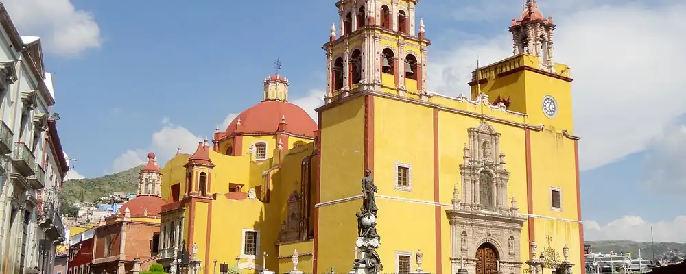
- Basílica Colegiata de Nuestra Señora de Guanajuato, Guanajuato Capital, Guanajuato: Juan Carlos Fonseca Mata, CC BY-SA 4.0, Wikimedia Commons · read 3 Nov 2026
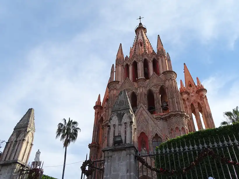
- Parroquia de San Miguel Arcangel - San Miguel de Allende - Mexico (24366843527): Adam Jones from Kelowna, BC, Canada, CC BY-SA 2.0, Wikimedia Commons · read 3 Nov 2026

Where the sources disagree
- Founding of Guanajuato: Wikipedia (Spanish) gives a land grant in 1541, a town in 1546 and the Real de Minas in 1548; Wikipedia (English, city) gives 1548. This page uses 1546 and mentions 1548.
- Mother lode: Wikipedia (English, city) dates the Bocamina de San Ramón lode to 1548; Wikipedia (Spanish) dates the veta madre to 1558. This page gives neither date.
- Grito de Dolores: Wikipedia (English, state) says Hidalgo made the call on 15 Sep 1810; Wikipedia (English, Dolores Hidalgo) and Wikipedia (Spanish) give the early hours of 16 Sep. This page uses 16 Sep.
Durango
Capital of the old Nueva Vizcaya, Durango grew from silver camps and an iron hill into a frontier of forests, Laguna cotton and the first rumblings of the Revolution.
All 32 on the mapNext →Guerrero
Olmec-age painted caves, Taxco silver and Acapulco's galleons to Asia, then the land of Morelos, Guerrero and Álvarez, and in the 20th century the resort coast.