San Luis Potosí
Huastec cities in the eastern lowlands, a gold hill found in 1592, the plan that started the Revolution and a rail junction in central Mexico.
Capital: San Luis Potosí · Became a state: 1823 · Checked 3 Nov 2026
Interactive maptap or click a state to open its page
San Luis Potosí in figures from its history
Huastecs, Pames and the Chichimec plateau
San Luis Potosí sits on the old border between Mesoamerica and Aridoamerica, and its three regions still show it. In the Huasteca, the humid lowlands of the east, Huastec people built Tamtoc near Tamuín. The city emerged around 600 BCE, was redesigned between 600 and 900 CE and reached its height from 900 to 1350, with pyramids, stelae, mural painting and circular buildings across some 210 hectares, before it was abandoned for reasons still unknown. Monument 32, a carved stone found by accident in 2005, may be far older than the city's peak; one estimate places it between 1150 and 700 BCE.
Indigenous languages spoken today
Speakers aged 3 and over, census of 2020 13
The 2020 census counted 231,213 speakers of Indigenous languages aged 3 and over, 8.6% of that population. The counts by language come from the census's extended sample, which estimates about 244,000 speakers in all, so they run higher than the basic count.

The middle zone belonged to Pames and Otomíes, and the high plateau to the west and north to the peoples the Mexica called Chichimecas, their name for the nomadic hunters of the north. The most numerous were the Guachichiles, among the most feared raiders of the 16th century frontier. The Indigenous presence has endured more strongly here than in most of the north-centre, above all in the Huasteca. In 2020, 231,213 people aged 3 and over spoke an Indigenous language, 8.6% of that population. Nahuatl and Teenek (Huastec) each count more than 100,000 speakers, and Pame (Xi'iuy) about 13,000. Each spring the Wixárika (Huichol) travel from neighbouring states to Wirikuta, the desert below Real de Catorce, one of their most sacred places.
A gold hill, Tlaxcalan settlers and a vast intendancy
The Spanish conquest reached the Huasteca first. On 25 Jul 1533 a town was founded under Nuño de Guzmán as Santiago de los Valles de Oxitipa, with 25 Spanish residents; for centuries it was little more than a stop between the plateau and Tampico. The plateau held out far longer. After silver was found at Zacatecas in 1546, Guachichil raids on the settlers, slavers and wagon trains of the silver road fed the Chichimeca War, which lasted into the 1590s. Peace came through purchase rather than conquest: the viceroys gave the Chichimec peoples food, clothing and tools, and Miguel Caldera, a captain of Spanish and Guachichil descent, was an important go-between. In 1591 some 400 families from Tlaxcala, the old Spanish allies of central Mexico, went north to found 8 settlements among the Chichimecas, teaching farming and herding.
Interactive maptap or click a state to open its page
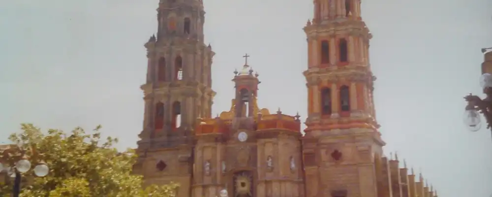
Early in 1592 gold and silver were found at Cerro de San Pedro. The hill had no water, so the town was laid out in a valley nearby, and its legal founding is dated 3 Nov 1592, with Caldera and Juan de Oñate as founders. The name joined Saint Louis of France to Potosí, the great silver mountain of Upper Peru, now Bolivia. Franciscans, Augustinians and Jesuits built churches through the 17th and 18th centuries, and Guadalcázar grew as a mining town from 1620. In 1772 silver was found at Real de Catorce. In 1786 the Bourbon reforms divided New Spain into intendancies, large provinces run by royal officials, and the Intendancy of San Luis Potosí became the largest of them.
Places in its history
San Luis Potosí
City · 1592
Founded 3 Nov 1592 in a well-watered valley below the mines; seat of Juárez's government in 1863. 3
Tamtoc
Archaeological site · c. 600 BCE-1350 CE
Huastec city of some 210 hectares near Tamuín, home of Monument 32. 4
Cerro de San Pedro
Mine · 1592
The gold and silver hill whose discovery led to the founding of the capital. 3
Real de Catorce
Mine · 1772
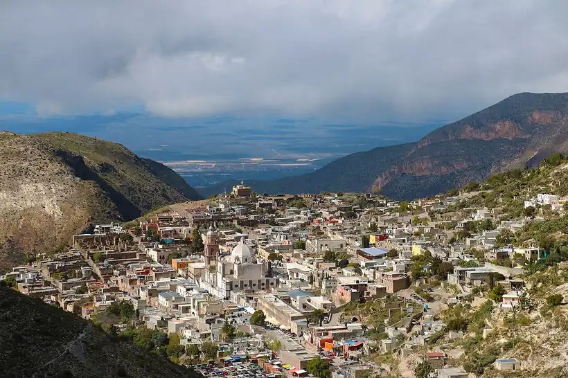
Silver town in the mountains, home to about 15,000 people at its late 19th century peak. 6
Ciudad Valles
City · 1533
Founded as Santiago de los Valles de Oxitipa; grew with the sugar mills of the 1950s. 8
Ciudad del Maíz
City · 1920s-1939
Home ground of Saturnino Cedillo and his agricultural colonies of veterans. 10
From San Luis de la Patria to the Plan of San Luis
In mid-1821 José Antonio Echávarri pressed the city council to hand San Luis to the Army of the Three Guarantees, Agustín de Iturbide's army that sealed Independence, and the city proclaimed its independence. The state was admitted on 22 Dec 1823 and gave itself a constitution on 16 Oct 1826, though the centralist governments, which ruled from Mexico City and turned the states into departments, suppressed its legislature from 1835 until the Constitution of 1857. In the war with the USA of 1846-47 it sent so many officers and troops that it became known as San Luis de la Patria. During the French Intervention (1862-67), when Napoleon III's troops installed Maximilian as emperor, Benito Juárez made the city the seat of the republican government in 1863. Imperial forces held it until late 1866, the year a telegraph line first linked it to Mexico City.
1810 to 1920 in San Luis Potosí
From the timeline below, coloured by era
- 1821The city surrenders to the Army of the Three Guarantees and proclaims independence. 2
- 1823San Luis Potosí is admitted as a state on 22 Dec. 1
- 1846-47The state's part in the war with the USA earns it the name San Luis de la Patria. 2
- 1863Benito Juárez makes the city the seat of the republican government during the French Intervention. 2
- 1888The railway reaches the capital, with stations for the Central Mexicano and the Nacional Mexicano. 11
- 1910Madero dates the Plan of San Luis on 5 Oct and calls for the rising of 20 Nov. 9
The railway arrived in 1888, when the Central Mexicano and the Nacional Mexicano built their stations, and Real de Catorce had its heyday, with a mint, a bullring and some 15,000 people, until silver prices fell after 1900. In 1910 Francisco I. Madero, who had challenged Porfirio Díaz for the presidency, was held in San Luis. On his last day there, 5 Oct, he dated the Plan of San Luis, then crossed into Texas at Laredo on 7 Oct; the plan called the nation to arms for 20 Nov 1910. After the Revolution, Saturnino Cedillo, from a ranch near Ciudad del Maíz, ruled much of the state and settled his veterans and their widows on military farming colonies, land granted in return for armed service. His revolt against Lázaro Cárdenas in 1938, after the president moved to curb his power, ended with his death on 11 Jan 1939.
Rails, sugar cane and the road north
In the 20th century San Luis Potosí became a crossroads. The capital sits on the main railway and highway that run from Mexico City to Monterrey and Piedras Negras, and that position shaped its growth. The state university gained university status in 1923. A new main station, designed in 1936 by Manuel Ortiz Monasterio, opened in Nov 1942 and served until 1996; national passenger trains ran until 1997, and the freight yards then passed to Kansas City Southern de México. Mining, the old base of the economy, had declined sharply after Independence, and the plateau lived largely from corn, beans, wheat and livestock.
The region, c. 1600 and today
What each state turned on, by the era table below; San Luis Potosí outlined in gold.
Interactive maptap or click a state to open its page
c. 1600
San Luis Potosí: Silver mining districts
- Silver mining districts
- Towns, farms and workshops of the old heartland
- Ports, sugar and cacao
- Frontier: missions, presidios, independent peoples
Today
San Luis Potosí: Export manufacturing
- Export manufacturing
- Oil and gas
- Tourism
- Mining
Its places in the modern era
Numbered as on the map above
- 6Ciudad del Maíz · 1920s-1939
Home ground of Saturnino Cedillo and his agricultural colonies of veterans. 10
In the Huasteca the change came with sugar. Mills built in the mid-1950s drove the growth of Ciudad Valles, and cane became the region's main crop. Even so, many Potosinos left, since the dry plateau and its small farms offered little work. By the late 20th century the state was counted in what geographers call Mexico's hollow core, the central states that lost people to Mexico City, the border and the north. Old mining ground found new uses and new disputes: in 1996 Minera San Xavier announced an open-pit mine at Cerro de San Pedro, the hill where the city began, and in 2000 UNESCO recognised Cerro Quemado, the Wixárika ceremonial site above Wirikuta, as a protected area.
After 2000 the crossroads drew factories. In Jun 2019 BMW opened a car plant of 300 hectares in the capital's industrial zone, on the highway and railway that run from Mexico City to Monterrey and the Texas border. Freight trains of Canadian Pacific Kansas City, formed in 2023 as successor to Kansas City Southern de México, run an intermodal service from the city to Chicago. The position that made San Luis a mining town on the road north in 1592, and a rail junction in 1888, has made it a link in the supply chains of North America.
San Luis Potosí, date by date
Before the Spanish before 1519
The colonial centuries 1519 to 1809
- 1533
Santiago de los Valles de Oxitipa, today Ciudad Valles, is founded on 25 Jul. 8
- c. 1550-90
Guachichiles and other Chichimec peoples fight the Spanish along the silver road. 7
- 1591
About 400 Tlaxcalan families move north to found 8 settlements among the Chichimecas. 7
- 1592
Gold and silver are found at Cerro de San Pedro; the city is legally founded on 3 Nov. 3
- 1772
Silver is found in the mountains of Real de Catorce; the town is founded in 1779. 6
- 1786
The Intendancy of San Luis Potosí is created, the largest in New Spain. 2
Independence and the Reform 1810 to 1875
- 1821
The city surrenders to the Army of the Three Guarantees and proclaims independence. 2
- 1823
San Luis Potosí is admitted as a state on 22 Dec. 1
- 1846-47
The state's part in the war with the USA earns it the name San Luis de la Patria. 2
- 1863
Benito Juárez makes the city the seat of the republican government during the French Intervention. 2
The Porfiriato 1876 to 1910
- 1888
The railway reaches the capital, with stations for the Central Mexicano and the Nacional Mexicano. 11
The Revolution 1910 to 1920
- 1910
Madero dates the Plan of San Luis on 5 Oct and calls for the rising of 20 Nov. 9
Modern Mexico after 1920
- 1938-39
Saturnino Cedillo's revolt against the federal government is put down. 10
- 1942
The new railway station by Manuel Ortiz Monasterio opens in Nov. 11
- c. 1955
Sugar mills built in the mid-1950s drive the growth of Ciudad Valles. 8
- 2000
UNESCO recognises Cerro Quemado, the Wixárika ceremonial site near Real de Catorce, as a protected area. 6
- 2019
BMW opens a car plant in Jun in the capital's industrial zone. 3
Where San Luis Potosí stood: c. 1600, 1910 and today
Interactive maptap or click a state to open its page
c. 1600
Silver, the heartland and the frontier
San Luis Potosí: Silver mining districts
- Silver mining districts
- Towns, farms and workshops of the old heartland
- Ports, sugar and cacao
- Indigenous south: cochineal, maize, tribute
- Maya lands under encomienda or beyond Spanish rule
- Frontier: missions, presidios, independent peoples
1910
The Porfiriato at its height
San Luis Potosí: Mining
- Mining
- Oil
- Henequén
- Sugar and textile mills
- Haciendas: grain, pulque, cattle
- Export crops: coffee, tobacco, cacao, chicle, timber
- Steel, cotton and the railway north
- Ranching frontier
- The national capital
Today
What each state turns on now
San Luis Potosí: Export manufacturing
- Export manufacturing
- Oil and gas
- Tourism
- Farming and agro-exports
- Mining
- Ports and logistics
- Services and government
Why Mexico's own reading of what each state's economy turned on in that period, drawn from the sources listed in each state's room; a classification, not a measurement.
Today's numbers for San Luis Potosí
Output, exports, jobs, wages and investment now, each with its source and date.
The bookBook 6, Where to Go in Mexico, chapter 15
Where to Go in Mexico: The Bajío and Center-North, the corridor this state belongs to.
Why MexicoThe national timeline
The turning points of the whole country, each dated, each with its source.
Sources, each with its date
- Wikipedia (English), San Luis Potosí, History and Economy sections, 3 Nov 2026 · read 3 Nov 2026 · link
- Wikipedia (Spanish), San Luis Potosí, Historia section, 3 Nov 2026 · read 3 Nov 2026 · link
- Wikipedia (English), San Luis Potosí (city), 3 Nov 2026 · read 3 Nov 2026 · link
- Wikipedia (English), Tamtoc, 3 Nov 2026 · read 3 Nov 2026 · link
- INAH, Lugares INAH, Tamtoc archaeological zone, 3 Nov 2026 · read 3 Nov 2026 · link
- Wikipedia (English), Real de Catorce, 3 Nov 2026 · read 3 Nov 2026 · link
- Wikipedia (English), Chichimeca War, 3 Nov 2026 · read 3 Nov 2026 · link
- Wikipedia (Spanish), Ciudad Valles, 3 Nov 2026 · read 3 Nov 2026 · link
- Wikipedia (English), Plan of San Luis Potosí, 3 Nov 2026 · read 3 Nov 2026 · link
- Wikipedia (English), Saturnino Cedillo, 3 Nov 2026 · read 3 Nov 2026 · link
- Aguilar-Aguilar, Jiménez-Anguiano and Loredo-Zamarrón, 'Una mirada al patrimonio industrial ferrocarrilero en San Luis Potosí, México', Legado de Arquitectura y Diseño 20 (37), UAEMéx, 2025 · read 3 Nov 2026 · link
- INEGI, Censo de Población y Vivienda 2020, press release 44/21 for San Luis Potosí, 26 Jan 2021 · read 3 Nov 2026 · link
- Data México (Secretaría de Economía), San Luis Potosí profile, Indigenous languages from the 2020 census extended sample, 3 Nov 2026 · read 3 Nov 2026 · link
- Tercer Censo de Población de los Estados Unidos Mexicanos (1910), table VI, population by entity in 1895, 1900 and 1910 (Universidad Veracruzana digital edition), 1910 · read 3 Nov 2026 · link
- Encyclopaedia Britannica, San Luis Potosí (state), 3 Nov 2026 · read 3 Nov 2026 · link
- GeoNames gazetteer, coordinates for the map pins, 3 Nov 2026 · read 3 Nov 2026 · link
Pictures
- Catedral de San Luis Potosí: Heterotrofo, CC BY-SA 4.0, Wikimedia Commons · read 3 Nov 2026
- Panorámica de Real de Catorce: Rafael Saldaña, CC BY 2.0, Wikimedia Commons · read 3 Nov 2026

Where the sources disagree
- Tamtoc: English Wikipedia dates its emergence to c. 600 BCE and its peak to 900-1350 CE; INAH gives 900-1100, 300-1100 and "Middle Preclassic to Late Postclassic". This page follows Wikipedia's three phases.
- Plan of San Luis: Wikipedia's article on the Plan dates it 5 Oct 1910; its article on the city says it was issued 20 Nov 1910, the date set for the rising. This page uses 5 Oct for the plan.
Quintana Roo
Quintana Roo went from Maya Cobá and Tulum to the rebel shrine of the Talking Cross, a chicle frontier on the Belize border, and finally Cancún, built on a near-empty island after 1970.
All 32 on the mapNext →Sinaloa
River peoples on the edge of Mesoamerica, Jesuit missions and mountain silver, a Pacific port at Mazatlán, then dams that made the coastal valleys a granary.