Colima
From the Capacha potters and shaft tombs below the volcano to cacao, salt and the port of Manzanillo, Colima has long been western Mexico's door to the Pacific.
Capital: Colima · Territory, then state: 1824 / 1856 · Checked 3 Nov 2026
Interactive maptap or click a state to open its page
Colima in figures from its history
Capacha, burnished red clay and the lords of the salt
Colima's deep past begins with the Capacha culture, which developed between about 2000 and 1200 BCE, in the same centuries as San Lorenzo on the Gulf and Tlatilco in the Valley of Mexico. Around 500 BCE the Los Ortices phase brought shaft tombs and burnished red pottery. In the Comala phase, about 100 to 600 CE, potters perfected that red clay and modelled people and plump dogs, the figures that made Colima's ancient art known around the world.
Indigenous languages spoken today
Speakers aged 3 and over, census of 2020 13
Colima has few speakers of Indigenous languages: 5,210 people aged 3 and over in the 2020 census, 0.7% of that age group. The counts by language come from the census's extended sample questionnaire, as published by Data México, so they don't add up exactly to the census total.

Larger centres followed. La Campana, now inside the city of Villa de Álvarez, was a ceremonial and administrative centre with stepped pyramids, drains, petroglyphs and shaft tombs, busiest between 700 and 900 CE. El Chanal, 4 km north of the capital, reached its height between 1100 and 1400 CE, with plazas, a ballcourt and stairways carved with images of Tlaloc and Ehécatl. On the eve of the Spanish conquest the Tecos of the lordship of Colliman fought the Purépechas over the salt flats of the coast in what is remembered as the Saltpeter War, about 1480 to 1510. In 2020 the largest Indigenous languages in the state were Nahuatl and Mixtec, with Nahua and Otomí communities near Comala and Villa de Álvarez.
Cacao, coconut wine and a coast watched by pirates
The first Spanish incursion, under Juan Rodríguez de Villafuerte in 1522, was beaten back in the Tecomán valley. Gonzalo de Sandoval, sent by Hernán Cortés, defeated the Tecos and in 1523 founded the town at Caxitlán, near today's Tecomán. On 20 Jan 1527, fleeing disease, the settlers moved it to its present site as San Sebastián de Colima. The Indigenous population fell from an estimated 150,000 in 1523 to 15,000 in 1554, and the Spanish brought in enslaved Africans and Indigenous people from neighbouring regions to work the land in place of the dead.
Interactive maptap or click a state to open its page
Cacao arrived in the 16th century, followed by coconut palms, sugar cane and cotton, and later rice, indigo and vanilla. Distilled coconut wine became a local industry, and the coastal lagoons yielded salt. Ships for Cortés's Pacific ventures were built at Salagua, and in 1527 Álvaro de Saavedra named the bay of Manzanillo Santiago de Buena Esperanza. The coast drew pirates such as Francis Drake and Thomas Cavendish, and in 1615 Sebastián Vizcaíno defended Manzanillo against the Dutch captain Joris van Spilbergen. The province lost Autlán, Amula and the Motines region to its neighbours, and in 1796 Colima became a subdelegation, a subordinate district, of the intendancy of Guadalajara.
Places in its history
El Chanal
Archaeological site · c. 1100-1400
Late ceremonial city with a ballcourt and stairways carved with gods. 6
La Campana
Archaeological site · c. 700-900
Ceremonial centre with shaft tombs, drains and petroglyphs; open since 1995. 7
Manzanillo
Port · 1527; open port 1825
Bay named Santiago de Buena Esperanza in 1527; rail link 1889. 8
Cuyutlán salt works
Mine · pre-Hispanic to today
Sea salt made here since before the conquest; a salt museum tells the story. 9
Comala and Hacienda Nogueras
Hacienda · 18th century
Town of pre-Hispanic roots; the Nogueras estate was founded in the early 1700s. 10
Hidalgo's parish, Juárez's refuge and the line to the sea
Miguel Hidalgo served as a parish priest in Colima from 10 Mar to 26 Nov 1792, and the friendships he made there helped him find support when the war began. At the end of 1810 the insurgent José Antonio Torres took the town without a fight. Royalists retook it in 1811, insurgents in 1812, royalists again in 1813, and the Plan of Iguala, Agustín de Iturbide's programme for independence, was proclaimed there in 1821. Colima became a federal territory, governed from Mexico City, in 1824, was joined to Michoacán in 1837, became a territory again in 1846 and was admitted as a state on 9 Dec 1856.
1810 to 1920 in Colima
From the timeline below, coloured by era
- 1824Colima becomes a federal territory under the first constitution. 1
- 1856Colima is admitted as a state on 9 Dec. 1
- 1858Colima briefly serves as the seat of Juárez's Liberal government. 1
- 1889The railway between Colima and Manzanillo opens. 8
- 1919A salt workers' cooperative receives sole rights to Cuyutlán lagoon. 1
In 1858, during the Reform War, fought over the liberal laws that sold off Church and communal lands, Colima was briefly the seat of Benito Juárez's government. French troops of the Intervention entered in 1864 and Republican forces under Ramón Corona retook the town in 1867. The Porfiriato, Porfirio Díaz's rule from 1876 to 1911, brought textile mills such as La Armonía and San Cayetano, the telegraph in 1869, the telephone in 1883, the railway to Manzanillo in 1889 and a city tram in 1892; in 1908 Manzanillo was made an official port of entry. The Revolution brought no great battles to Colima, but it left the state's first ejido, communal farmland granted under land reform, at Suchitlán, and in 1919 a salt workers' cooperative with sole rights to Cuyutlán lagoon. The Cristero War, a Catholic rising from 1926 against the federal government's anticlerical laws, divided the state deeply.
Limes, iron ore and a Pacific port
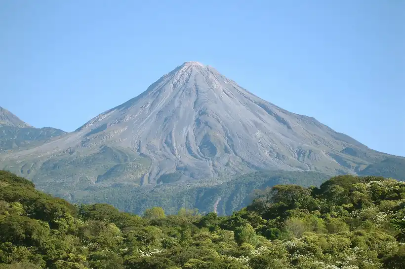
In the 1940s the Tecomán valley was put under intensive cultivation, with limes as the main crop, and packing and juice plants followed. The University of Colima opened in the same decade. The state was small, with 112,321 people in 1950, and it urbanised fast; by 1980 most of its people lived in towns. Earthquakes in 1932 and 1941 damaged buildings in the capital, a hurricane devastated the state in 1959, and the Volcán de Colima erupted again in 1998 and 1999.
The region, c. 1600 and today
What each state turned on, by the era table below; Colima outlined in gold.
Interactive maptap or click a state to open its page
c. 1600
Colima: Ports, sugar and cacao
- Towns, farms and workshops of the old heartland
- Ports, sugar and cacao
Today
Colima: Ports and logistics
- Farming and agro-exports
- Ports and logistics
Manzanillo, open to foreign trade since 1825 and joined to the capital by rail since 1889, grew into a major Pacific port. In the 1980s the Plan Colima of President Miguel de la Madrid built highways such as the Manzanillo-Guadalajara road. Industry came with the port: cement at Apasco, juice and food plants, and the Peña Colorada consortium, which mines iron ore in the mountains of Minatitlán. By 2000 the economy of the old cacao province rested on citrus, iron ore and the port.
In 2012 a liquefied natural gas terminal, owned by Japanese and Korean partners, began receiving imported gas at Manzanillo for the federal power company, CFE, and its power station on the coast. Wikipedia (English) describes Manzanillo as the busiest port in Mexico. Citrus and iron ore remained part of the economy, alongside the port. The bay that Saavedra named in 1527, and that Vizcaíno defended in 1615, is once again the state's door to the Pacific, now on a far larger scale.
Colima, date by date
Before the Spanish before 1519
- c. 2000 BCE
The Capacha culture develops, among the earliest pottery makers of West Mexico. 1
- c. 500 BCE
The Los Ortices phase introduces shaft tombs and burnished red pottery. 1
- c. 100-600 CE
Comala-phase potters make the famous red clay dogs and figures. 1
- c. 700-900
La Campana reaches its busiest period as a ceremonial centre. 7
- c. 1100-1400
El Chanal reaches its height, with plazas, a ballcourt and carved stairways. 6
- c. 1480-1510
The lords of Colliman hold the coastal salt flats against the Purépechas in the Saltpeter War. 1
The colonial centuries 1519 to 1809
- 1523
Gonzalo de Sandoval founds the Spanish town at Caxitlán. 3
- 1527
The town moves to its present site as San Sebastián de Colima on 20 Jan. 3
- 1554
Franciscans found the monastery of San Francisco de Coliman. 1
- 1615
Sebastián Vizcaíno defends Manzanillo against the Dutch captain Joris van Spilbergen. 1
- 1792
Miguel Hidalgo serves as a parish priest in Colima from Mar to Nov. 4
Independence and the Reform 1810 to 1875
The Porfiriato 1876 to 1910
- 1889
The railway between Colima and Manzanillo opens. 8
The Revolution 1910 to 1920
- 1919
A salt workers' cooperative receives sole rights to Cuyutlán lagoon. 1
Where Colima stood: c. 1600, 1910 and today
Interactive maptap or click a state to open its page
c. 1600
Silver, the heartland and the frontier
Colima: Ports, sugar and cacao
- Silver mining districts
- Towns, farms and workshops of the old heartland
- Ports, sugar and cacao
- Indigenous south: cochineal, maize, tribute
- Maya lands under encomienda or beyond Spanish rule
- Frontier: missions, presidios, independent peoples
1910
The Porfiriato at its height
Colima: Export crops: coffee, tobacco, cacao, chicle, timber
- Mining
- Oil
- Henequén
- Sugar and textile mills
- Haciendas: grain, pulque, cattle
- Export crops: coffee, tobacco, cacao, chicle, timber
- Steel, cotton and the railway north
- Ranching frontier
- The national capital
Today
What each state turns on now
Colima: Ports and logistics
- Export manufacturing
- Oil and gas
- Tourism
- Farming and agro-exports
- Mining
- Ports and logistics
- Services and government
Why Mexico's own reading of what each state's economy turned on in that period, drawn from the sources listed in each state's room; a classification, not a measurement.
Today's numbers for Colima
Output, exports, jobs, wages and investment now, each with its source and date.
The bookBook 6, Where to Go in Mexico, chapter 17
Where to Go in Mexico: The West, the corridor this state belongs to.
Why MexicoThe national timeline
The turning points of the whole country, each dated, each with its source.
Sources, each with its date
- Wikipedia (English), Colima, History section, 3 Nov 2026 · read 3 Nov 2026 · link
- Wikipedia (Spanish), Colima, 3 Nov 2026 · read 3 Nov 2026 · link
- Wikipedia (English), Colima City, 3 Nov 2026 · read 3 Nov 2026 · link
- Wikipedia (Spanish), Colima (Colima), 3 Nov 2026 · read 3 Nov 2026 · link
- Wikipedia (Simple English), Colima, Colima (coordinates), 3 Nov 2026 · read 3 Nov 2026 · link
- Wikipedia (English), El Chanal, 3 Nov 2026 · read 3 Nov 2026 · link
- Wikipedia (English), La Campana (archaeological site), 3 Nov 2026 · read 3 Nov 2026 · link
- Wikipedia (English), Manzanillo, Colima, 3 Nov 2026 · read 3 Nov 2026 · link
- Wikipedia (English), Cuyutlán, 3 Nov 2026 · read 3 Nov 2026 · link
- Wikipedia (English), Comala, 3 Nov 2026 · read 3 Nov 2026 · link
- Tercer Censo de Población 1910, population by federal entity in 1895, 1900 and 1910 (digital copy, Universidad Veracruzana), 1910 · read 3 Nov 2026 · link
- INEGI, Censo de Población y Vivienda 2020, results for Colima, press release 46/21, 26 Jan 2021 · read 3 Nov 2026 · link
- Data México (Secretaría de Economía), Colima state profile, Indigenous languages, 2020 census extended questionnaire, 3 Nov 2026 · read 3 Nov 2026 · link
- Global Energy Monitor wiki, Manzanillo (Mexico) LNG Terminal (last edited 3 Nov 2026), 3 Nov 2026 · read 3 Nov 2026 · link
Pictures
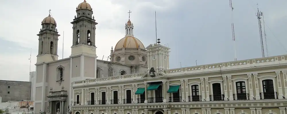
- Edificio de Gobierno y Basílica Menor Catedral de Colima, Colima: Totocheca, CC BY-SA 3.0, Wikimedia Commons · read 3 Nov 2026
- Volcan de Colima 2: Jrobertiko, CC BY-SA 3.0, Wikimedia Commons · read 3 Nov 2026

Where the sources disagree
- Statehood: Wikipedia (English) says Colima became a state in 1856, admitted 9 Dec 1856; Wikipedia (Spanish) says 1857. This page uses 9 Dec 1856.
- Founding of Colima: Wikipedia (English, city) gives 15 Jul 1523 at Caxitlán; Wikipedia (Spanish) gives 20 Jan 1523; both agree on the move to the present site in 1527. This page uses 1523 without a day.
- Busiest port: Wikipedia (English, Manzanillo) calls Manzanillo the busiest port in Mexico; Wikipedia (English, Port of Lázaro Cárdenas) calls Lázaro Cárdenas the busiest cargo port. Neither gives a year. This page attributes the claim.
Coahuila
Desert hunters and lake peoples, Tlaxcalan settlers at Saltillo, a frontier that once included Texas, then cotton ejidos, coal and the steel of Monclova.
All 32 on the mapNext →Chiapas
Maya and Zoque cities, three centuries ruled from Guatemala, its own choice to join Mexico in 1824, then coffee, great dams and the uprising of 1994.