Quintana Roo
Quintana Roo went from Maya Cobá and Tulum to the rebel shrine of the Talking Cross, a chicle frontier on the Belize border, and finally Cancún, built on a near-empty island after 1970.
Capital: Chetumal · Territory, then state: 1902 / 1974 · Checked 3 Nov 2026
Interactive maptap or click a state to open its page
Quintana Roo in figures from its history
Dzibanché, Cobá and the Caribbean ports
People were here at the end of the Ice Age. In 2016 divers in the flooded Chan Hol cave near Tulum found the skeleton of a woman at least 9,900 years old. Maya from the Petén moved into the southeast around 250 CE, and Bacalar began as a Maya town in 415. To the north of it, Dzibanché was settled around 300 BCE and became the first seat of the Kaan, the Snake dynasty, which defeated Tikal in 562 before its court moved to Calakmul. Cobá, settled between 50 BCE and 100 CE, reached perhaps 50,000 people in the Late Classic and sent a causeway about 100 km west to Yaxuná.
Indigenous languages spoken today
Speakers aged 3 and over, census of 2020 7
In all, 204,949 people aged 3 and over spoke an Indigenous language in 2020, 11.7% of that age group, against 16.2% in 2010. Smaller communities speak Mam, Q'anjob'al, Nahuatl, Zoque and other languages.
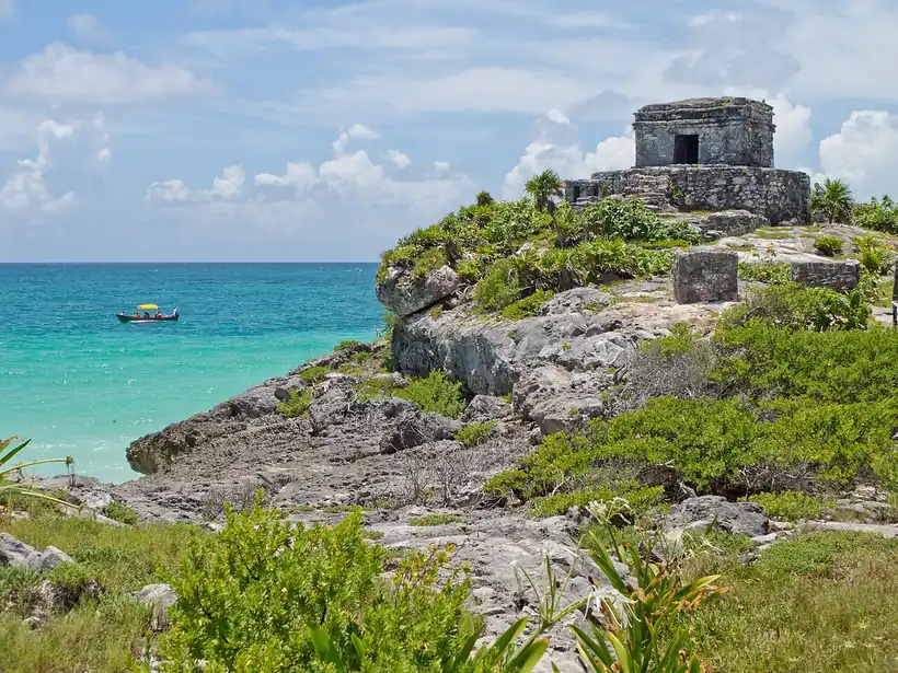

Later the coast took the lead. Tulum, built from about 1200, was a walled port for Cobá, trading obsidian, jade, copper, feathers, salt and textiles by sea and land. On Cozumel, San Gervasio was the shrine of Ix Chel, goddess of childbirth and weaving, where Maya women came on pilgrimage. In the far south, Chactemal ruled a Maya state that reached into what is now Belize. Maya remains the main language. In 2020, 174,817 people in the state spoke it, with Tseltal, Ch'ol and Tsotsil next.
Shipwrecked sailors and the fort at Bacalar
This coast was among the first places where Europeans lived among the Maya. In 1511 a caravel of Diego de Nicuesa's fleet was wrecked near Jamaica, and nearly half of some 20 survivors reached Maya land. Two of them, Jerónimo de Aguilar and Gonzalo Guerrero, lived among the Maya for eight years, until Hernán Cortés reached Cozumel in Feb 1519 and rescued Aguilar. Francisco Hernández de Córdoba had reached Isla Mujeres and Cabo Catoche in 1517, and Juan de Grijalva's expedition sighted Tulum and reached Cozumel in 1518. After Narváez's ships called in 1520, a Spanish judge reported few Maya left on Cozumel and blamed smallpox brought from Cuba.
Interactive maptap or click a state to open its page
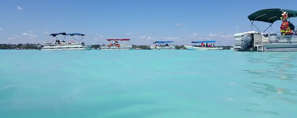
The conquest of the south was slow. The Spanish first took Bacalar in 1543, and Gaspar Pacheco founded Salamanca de Bacalar in 1545, while Chactemal held out until late in the 16th century. Tulum was abandoned by the century's end, and San Gervasio between 1520 and 1600. Pirates sacked Bacalar in the 17th century, and the fort of San Felipe, finished in 1729, guarded the town on its lagoon.
The Talking Cross and a federal territory
The Caste War, the Maya rising that broke out in Yucatán in 1847 over lost land, taxes and debt peonage, made this region a Maya country again. Rebels took Bacalar in 1848. In 1850 a cross that spoke to the faithful appeared in the forest, and the town that grew around it, Chan Santa Cruz, today's Felipe Carrillo Puerto, became the religious and political centre of the resistance. For decades it kept its own trade and treaties with British Honduras, today's Belize, whose merchants supplied its guns and powder. An 1893 treaty with Britain fixed the border and closed that trade.
1810 to 1920 in Quintana Roo
From the timeline below, coloured by era
Mexico then moved in from the sea, to close the border trade and end the rebellion. Othón P. Blanco brought the pontoon Chetumal up the Hondo River in Jan 1898 and founded Payo Obispo on 5 May 1898. General Ignacio Bravo occupied Chan Santa Cruz in 1901, and on 24 Nov 1902 Porfirio Díaz created the Territory of Quintana Roo, named for Andrés Quintana Roo. In 1913 it was folded back into Yucatán, and in 1915 it became a territory again with its capital at Payo Obispo. Salvador Alvarado, the revolutionary governor of Yucatán, declared the war over that Sep, though the last skirmish came in Apr 1933. Chicle, the gum of the sapodilla tree used to make chewing gum, tapped commercially from about 1880, was the territory's wealth, and in 1929 some 8,000 chicleros worked its forests.
Chicle cooperatives, a free zone and Cancún
The territory nearly disappeared. On 14 Dec 1931 it was split between Yucatán and Campeche, and it was restored on 11 Jan 1935. Payo Obispo became Chetumal in the mid-1930s, and Chan Santa Cruz took the name of Felipe Carrillo Puerto in 1932. Chicle carried the south. Its highest recorded output, 3,460 tonnes, came in 1942-43, and from 1940 a federation of cooperatives received the gum. Chetumal had about 5,000 people in 1950 when Hurricane Janet struck on 27 Sep 1955, almost destroying the town and killing around 500. A free-trade zone granted in 1972 brought shoppers from across Mexico.
The region, c. 1600 and today
What each state turned on, by the era table below; Quintana Roo outlined in gold.
Interactive maptap or click a state to open its page
c. 1600
Quintana Roo: Maya lands under encomienda or beyond Spanish rule
- Ports, sugar and cacao
- Indigenous south: cochineal, maize, tribute
- Maya lands under encomienda or beyond Spanish rule
Today
Quintana Roo: Tourism
- Oil and gas
- Tourism
- Farming and agro-exports
- Services and government
The north changed fastest of all. In 1967 the federal government set aside a fund, run by the Banco de México, to find new resort sites, and its agency INFRATUR took on the work. On Isla Cancún, in Jan 1970, lived three caretakers of a coconut grove. Cancún was founded on 20 Apr 1970, and the government financed its first nine hotels. On 8 Oct 1974 Quintana Roo became a state, together with Baja California Sur. Cancún grew to 167,730 people by 1990 and 397,191 by 2000, drawing families from Yucatán, Campeche, Tabasco and Veracruz, while the south kept its forestry.
The build-out then ran south along the coast. The stretch from Cancún to Tulum, renamed the Riviera Maya in 1999, grew into a corridor of resorts, and Playa del Carmen became its largest town. Tulum's international airport was finished in Dec 2023, and the Tren Maya opened that same month, with stations at Cancún airport, Playa del Carmen and Tulum; on 15 Dec 2024 its last segment reached Chetumal by way of Bacalar. Its stated aim is to carry visitors from the coast to the inland Maya sites and towns. A land the Mexican state reached late, by sea and by decree, is now tied to the rest of the country by the visitors it draws.
Quintana Roo, date by date
Before the Spanish before 1519
- c. 7900 BCE
A woman is buried in the Chan Hol cave near Tulum, at least 9,900 years ago. 1
- c. 300 BCE
Dzibanché is first settled; it later becomes the seat of the Snake dynasty. 8
- 562
The Kaan kings of Dzibanché defeat Tikal. 9
- c. 600-900
Cobá reaches its height, with perhaps 50,000 people. 10
- c. 1200
Tulum rises as a walled port on the Caribbean. 11
- 1511
Shipwrecked Spaniards, Aguilar and Guerrero among them, reach Maya land. 4
The colonial centuries 1519 to 1809
Independence and the Reform 1810 to 1875
- 1850
The Talking Cross appears and Chan Santa Cruz becomes the rebel centre. 16
The Porfiriato 1876 to 1910
Modern Mexico after 1920
- 1931-35
The territory is divided between Yucatán and Campeche, then restored. 2
- 1942-43
Chicle output reaches its recorded peak of 3,460 tonnes. 18
- 1955
Hurricane Janet almost destroys Chetumal on 27 Sep. 14
- 1970
Cancún is founded on 20 Apr as a planned resort. 17
- 1974
Quintana Roo becomes a state on 8 Oct. 1
- 2023-24
Tulum's airport and the Tren Maya open in Dec 2023; the line reaches Chetumal on 15 Dec 2024. 20
Where Quintana Roo stood: c. 1600, 1910 and today
Interactive maptap or click a state to open its page
c. 1600
Silver, the heartland and the frontier
Quintana Roo: Maya lands under encomienda or beyond Spanish rule
- Silver mining districts
- Towns, farms and workshops of the old heartland
- Ports, sugar and cacao
- Indigenous south: cochineal, maize, tribute
- Maya lands under encomienda or beyond Spanish rule
- Frontier: missions, presidios, independent peoples
1910
The Porfiriato at its height
Quintana Roo: Export crops: coffee, tobacco, cacao, chicle, timber
- Mining
- Oil
- Henequén
- Sugar and textile mills
- Haciendas: grain, pulque, cattle
- Export crops: coffee, tobacco, cacao, chicle, timber
- Steel, cotton and the railway north
- Ranching frontier
- The national capital
Today
What each state turns on now
Quintana Roo: Tourism
- Export manufacturing
- Oil and gas
- Tourism
- Farming and agro-exports
- Mining
- Ports and logistics
- Services and government
Why Mexico's own reading of what each state's economy turned on in that period, drawn from the sources listed in each state's room; a classification, not a measurement.
Today's numbers for Quintana Roo
Output, exports, jobs, wages and investment now, each with its source and date.
The bookBook 6, Where to Go in Mexico, chapter 19
Where to Go in Mexico: The Peninsula, the corridor this state belongs to.
Why MexicoThe national timeline
The turning points of the whole country, each dated, each with its source.
Sources, each with its date
- Wikipedia (English), Quintana Roo, History section, 3 Nov 2026 · read 3 Nov 2026 · link
- Wikipedia (Spanish), Quintana Roo, history section, 3 Nov 2026 · read 3 Nov 2026 · link
- Wikipedia (English), Yucatán, History section (pre-Hispanic peninsula), 3 Nov 2026 · read 3 Nov 2026 · link
- Wikipedia (Spanish), Historia de Yucatán (the 1511 shipwreck and early expeditions), 3 Nov 2026 · read 3 Nov 2026 · link
- Tercer Censo de Población 1910, Table VI, population by federal entity in 1895, 1900 and 1910 (digital copy, Universidad Veracruzana), 1910 · read 3 Nov 2026 · link
- INEGI, Censo de Población y Vivienda 2020, results for Quintana Roo (press bulletin), Jan 2021 · read 3 Nov 2026 · link
- Ruptura360, "Pierde Quintana Roo a tres mil mayahablantes", INEGI 2020 speaker counts by language, 10 Aug 2022 · read 3 Nov 2026 · link
- INAH, Zona arqueológica de Dzibanché, 14 Jan 2026 · read 3 Nov 2026 · link
- Wikipedia (English), Dzibanche, 3 Nov 2026 · read 3 Nov 2026 · link
- Wikipedia (English), Coba, 3 Nov 2026 · read 3 Nov 2026 · link
- Wikipedia (English), Tulum, 3 Nov 2026 · read 3 Nov 2026 · link
- Wikipedia (English), San Gervasio (Maya site), 3 Nov 2026 · read 3 Nov 2026 · link
- Wikipedia (English), Bacalar, 3 Nov 2026 · read 3 Nov 2026 · link
- Wikipedia (English), Chetumal, 3 Nov 2026 · read 3 Nov 2026 · link
- Wikipedia (English), Caste War of Yucatán, 3 Nov 2026 · read 3 Nov 2026 · link
- Wikipedia (English), Felipe Carrillo Puerto, Quintana Roo, 3 Nov 2026 · read 3 Nov 2026 · link
- Wikipedia (English), Cancún, 3 Nov 2026 · read 3 Nov 2026 · link
- Raúl Arístides Pérez Aguilar, "El chicle en Quintana Roo: sus caminos y voces", Cuicuilco no. 60 (INAH), Universidad de Quintana Roo, 2014 · read 3 Nov 2026 · link
- Wikipedia (English), Riviera Maya, 3 Nov 2026 · read 3 Nov 2026 · link
- Wikipedia (English), Tren Maya, 3 Nov 2026 · read 3 Nov 2026 · link
Pictures
- Boats at the Pirates Channel - Laguna de Bacalar: Bernard DUPONT, CC BY-SA 2.0, Wikimedia Commons · read 3 Nov 2026
- Tulum - 01: Carlos Delgado, CC BY-SA 3.0, Wikimedia Commons · read 3 Nov 2026

Where the sources disagree
- Restoration of the territory: Wikipedia (Spanish, Quintana Roo) gives 11 Jan 1935; Pérez Aguilar (2014) says Cárdenas restored its boundaries in 1936. This page uses 1935.
- Speakers by language: Ruptura360 (2022) reports INEGI 2020 counts that total the census figure of 204,949; DataMexico gives other figures (Maya 194,333, total about 228,000). This page uses Ruptura360.
Querétaro
From Sierra Gorda cinnabar miners to the 1810 conspiracy, the fall of an empire and the 1917 Constitution, Querétaro has joined Mexico's centre to its north.
All 32 on the mapNext →San Luis Potosí
Huastec cities in the eastern lowlands, a gold hill found in 1592, the plan that started the Revolution and a rail junction in central Mexico.