Sonora
From the oldest Clovis camp and the terraces of Trincheras to Kino's missions, Álamos silver, the Yaqui wars, the Sonoran presidents and the irrigated wheat of the Yaqui Valley.
Capital: Hermosillo · Became a state: 1831 · Checked 3 Nov 2026
Interactive maptap or click a state to open its page
Sonora in figures from its history
Clovis hunters, the Trincheras hill and the river peoples
Sonora holds some of the oldest human traces in North America. El Fin del Mundo, in the northwest, is believed to be the oldest Clovis site on the continent, dated to about 13,390 years ago. Farming appeared in the river valleys between about 400 BCE and 200 CE, and pottery by 750 CE. From 750 to 1450 the Trincheras tradition flourished in the Altar, Magdalena and Concepción valleys. At Cerro de Trincheras its people built more than 900 stone-walled terraces on a hillside, and between 1300 and 1450 the town held more than 1,000 people and governed the farming villages around it.
Indigenous languages spoken today
Speakers aged 3 and over, census of 2020 17
INEGI's 2020 census counted 62,808 speakers aged 3 and over. INEGI's state panorama gives the two largest languages as shares of that total (Mayo 43.1%, Yaqui 29.6%); the counts above apply those shares to the total and are rounded. Guarijío, Seri, Pima, Pápago and Cucapá are also spoken.

When the Spanish came, the Seri (Comcaac) lived on the coast and the islands, the Pima and Tohono O'odham in the north, the Opata in the mountain valleys, and the Yaqui and Mayo along the great rivers of the south, where they farmed the floodplains. Guarijío communities held the sierra on the Chihuahua border. In 2020 the census counted 62,808 speakers of Indigenous languages aged 3 and over. Mayo and Yaqui together accounted for about 73% of them, and the state's own count adds Guarijío, Seri, Pima, Pápago and Cucapá among the languages still spoken.
Missions, presidios and the silver of Álamos
Diego de Guzmán's men reached the Yaqui River on 7 Oct 1533, and in 1540 Francisco Vázquez de Coronado passed through and recorded the name Sonora. Lasting Spanish presence began with the Jesuits around 1614. The province was called Nueva Navarra in 1637 and Sonora from 1648. In 1687 Eusebio Francisco Kino arrived and founded a chain of missions in the Pimería Alta, the Pima country of the north. In 1691 Sonora and Sinaloa were joined as the Provincias de Sonora, Ostimuri y Sinaloa, an arrangement that lasted until 1823.
Interactive maptap or click a state to open its page
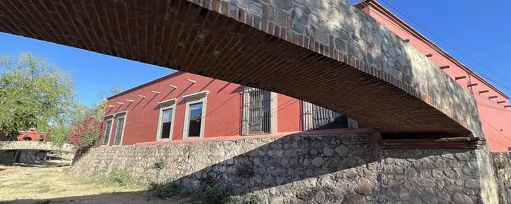
Silver drew settlers to the frontier. Mines at Los Frailes were founded in 1683, and Álamos, founded on 8 Dec 1685, became the northernmost silver city of New Spain, with mansions that still stand. Pitic, the future Hermosillo, began as a village in 1700 and received a presidio, a frontier fort, in 1741. The pressure on land and labour brought revolts: the Seri rose in 1725 and again from 1748, and the Yaqui and Mayo took up arms in 1740 to drive the Spanish out. In 1767 the crown expelled the Jesuits, and the mission system that had organised much of the province came to an end.
Places in its history
Cerro de Trincheras
Archaeological site · c. 1300-1450
Hill of more than 900 stone terraces, centre of the Trincheras tradition. 6
Álamos
Mine · 1685
The northernmost silver city of New Spain; capital of the Estado de Occidente 1827-30. 5
Guaymas
Port · 1769
Gulf port blockaded in 1847, attacked by filibusters in 1854 and occupied by the French in 1865. 10
Ciudad Obregón
City · 1928
Hub of the irrigated Yaqui Valley, where Borlaug's wheat research took root. 11
A frontier lost, the Yaqui wars and the Sonoran presidents
After Independence, Sonora and Sinaloa formed the Estado de Occidente, a joint Western State, from 1824, with its capital at Álamos from 1827 to 1830; Sonora became a state of its own in 1831. In the war with the USA, warships blockaded Guaymas in Oct 1847 and held the coast until 1848. The 1848 treaty took Sonoran land, and the Gadsden Purchase, the sale of land to the USA signed on 30 Dec 1853, took far more, most of today's southern Arizona. Filibusters, private adventurers who tried to seize land by force, followed: Gaston de Raousset-Boulbon attacked Guaymas on 13 Jul 1854 and was defeated. French troops occupied Guaymas in 1865, and republicans beat the imperialists, the backers of Maximilian's French-supported empire, near Ures in 1866.
1810 to 1920 in Sonora
From the timeline below, coloured by era
- 1831Sonora separates from Sinaloa and becomes a state with Hermosillo as capital. 1
- 1853The Gadsden Purchase, signed 30 Dec, takes most of today's southern Arizona. 13
- 1854Raousset-Boulbon's filibusters attack Guaymas on 13 Jul and are defeated. 10
- 1904-08Deportations of the Yaqui reach their peak. 1
- 1906Copper miners strike at Cananea on 1 Jun. 9
- 1920The Plan of Agua Prieta opens the era of the Sonoran presidents. 1
Under the Porfiriato, Porfirio Díaz's rule of 1876-1911, railways tied Sonora to the national and USA economies, and huge land grants went to foreign companies. The Yaqui fought to keep their river lands; deportations peaked from 1904 to 1908, when about a quarter of the Yaqui people were sent away. At Cananea, about 2,000 copper miners struck on 1 Jun 1906 against unequal pay, and the strike was crushed with help from Arizona volunteers. In the Revolution, Sonorans rose to the top: after the Plan of Agua Prieta in 1920, the revolt that overthrew Carranza, De la Huerta, Obregón, Calles and Rodríguez held the presidency into the early 1930s.
Dams, wheat and the Hermosillo plant
Water remade southern Sonora. Canals dug around 1910 opened the Yaqui Valley to settlers, and the railway stop of Cajeme grew into Ciudad Obregón, renamed in 1928. In the 1940s the Mayo delta was cleared for farming and the Mocúzari Dam was finished in 1951. The Álvaro Obregón Dam, built from 1947 to 1952, feeds canals that water about 450,000 hectares in the Yaqui and Mayo valleys. In the 1950s the agronomist Norman Borlaug worked in the valley, helping found a wheat research centre whose seeds later spread the Green Revolution, the high-yield crops that raised grain harvests around the world; he won the Nobel Peace Prize in 1970.
The region, c. 1600 and today
What each state turned on, by the era table below; Sonora outlined in gold.
Interactive maptap or click a state to open its page
c. 1600
Sonora: Frontier: missions, presidios, independent peoples
- Silver mining districts
- Frontier: missions, presidios, independent peoples
Today
Sonora: Mining
- Export manufacturing
- Tourism
- Farming and agro-exports
- Mining
Industry followed. In 1964 a bridge over the Colorado River tied Sonora by road to Baja California, and from 1965 maquiladoras, export assembly plants, spread along the border. In 1986 Ford and Mazda opened a stamping and assembly plant in Hermosillo, first building the 323 and the Tracer. After NAFTA took effect in 1994, maquila employment across the country rose 86% in 5 years. Copper kept its place too: Anaconda began open-pit mining at Cananea in the early 1940s, and the mine changed hands in 1990. By 2000 the state rested on irrigated fields, mines and factories.
From 2003 Ford rebuilt and enlarged it, with a park for its suppliers beside it; it built the Fusion and Lincoln sedans from 2006 to 2020, then switched to the Bronco Sport in 2020 and the Maverick pickup in 2021. Its vehicles cross the line drawn in 1848 and 1853 on their way to the USA market. Sonora's long history as a borderland, from Kino's missions and the presidios to the Cananea copper and the irrigated wheat of the Yaqui Valley, now runs through an assembly line tied to North America.
Sonora, date by date
Before the Spanish before 1519
The colonial centuries 1519 to 1809
- 1533
Diego de Guzmán's expedition reaches the Yaqui River on 7 Oct. 2
- 1540
Francisco Vázquez de Coronado passes through and records the name Sonora. 1
- 1685
Álamos is founded on 8 Dec, two years after its silver mines. 4
- 1687
Eusebio Francisco Kino arrives and begins the missions of the Pimería Alta. 1
- 1700
Pitic, the future Hermosillo, is founded on 18 May. 3
- 1740-42
Yaqui and Mayo rise together to drive out the Spanish. 1
- 1767
The crown expels the Jesuits, ending the mission system. 1
Independence and the Reform 1810 to 1875
The Porfiriato 1876 to 1910
The Revolution 1910 to 1920
- 1920
The Plan of Agua Prieta opens the era of the Sonoran presidents. 1
Modern Mexico after 1920
Where Sonora stood: c. 1600, 1910 and today
Interactive maptap or click a state to open its page
c. 1600
Silver, the heartland and the frontier
Sonora: Frontier: missions, presidios, independent peoples
- Silver mining districts
- Towns, farms and workshops of the old heartland
- Ports, sugar and cacao
- Indigenous south: cochineal, maize, tribute
- Maya lands under encomienda or beyond Spanish rule
- Frontier: missions, presidios, independent peoples
1910
The Porfiriato at its height
Sonora: Mining
- Mining
- Oil
- Henequén
- Sugar and textile mills
- Haciendas: grain, pulque, cattle
- Export crops: coffee, tobacco, cacao, chicle, timber
- Steel, cotton and the railway north
- Ranching frontier
- The national capital
Today
What each state turns on now
Sonora: Mining
- Export manufacturing
- Oil and gas
- Tourism
- Farming and agro-exports
- Mining
- Ports and logistics
- Services and government
Why Mexico's own reading of what each state's economy turned on in that period, drawn from the sources listed in each state's room; a classification, not a measurement.
Today's numbers for Sonora
Output, exports, jobs, wages and investment now, each with its source and date.
The bookBook 6, Where to Go in Mexico, chapter 14
Where to Go in Mexico: The Pacific Border, the corridor this state belongs to.
Why MexicoThe national timeline
The turning points of the whole country, each dated, each with its source.
Sources, each with its date
- Wikipedia (English), Sonora, History section, 3 Nov 2026 · read 3 Nov 2026 · link
- Wikipedia (Spanish), Sonora, Historia and Demografía sections, 3 Nov 2026 · read 3 Nov 2026 · link
- Wikipedia (English), Hermosillo, 3 Nov 2026 · read 3 Nov 2026 · link
- Wikipedia (English), Álamos, Sonora, 3 Nov 2026 · read 3 Nov 2026 · link
- Wikipedia (Spanish), Álamos (Sonora), 3 Nov 2026 · read 3 Nov 2026 · link
- INAH, Lugares INAH, Cerro de Trincheras, 3 Nov 2026 · read 3 Nov 2026 · link
- Wikipedia (English), Trincheras (town and municipality), 3 Nov 2026 · read 3 Nov 2026 · link
- Wikipedia (English), Cananea, 3 Nov 2026 · read 3 Nov 2026 · link
- Wikipedia (English), Cananea strike, 3 Nov 2026 · read 3 Nov 2026 · link
- Wikipedia (English), Guaymas, 3 Nov 2026 · read 3 Nov 2026 · link
- Wikipedia (English), Ciudad Obregón, 3 Nov 2026 · read 3 Nov 2026 · link
- Wikipedia (English), Hermosillo Stamping and Assembly, 3 Nov 2026 · read 3 Nov 2026 · link
- Wikipedia (English), Gadsden Purchase, 3 Nov 2026 · read 3 Nov 2026 · link
- Wikipedia (English), Maquiladora, 3 Nov 2026 · read 3 Nov 2026 · link
- Tercer Censo de Población de los Estados Unidos Mexicanos 1910, Table VI, population by entity at the 1895, 1900 and 1910 censuses (digitised by Universidad Veracruzana), 1910 · read 3 Nov 2026 · link
- INEGI, Censo de Población y Vivienda 2020, results for Sonora (press release 33/21), 26 Jan 2021 · read 3 Nov 2026 · link
- INEGI, Panorama sociodemográfico de Sonora, Censo de Población y Vivienda 2020, 2021 · read 3 Nov 2026 · link
- Consejo Estatal de Población de Sonora, Data Demográfica No. 2, Población indígena en Sonora, 2024 · read 3 Nov 2026 · link
Pictures
- Álamos, Sonora. 06: WendyAvilesR, CC BY-SA 4.0, Wikimedia Commons · read 3 Nov 2026
- Skyline Hermosillo: Wilber magdiel jimenez, CC BY-SA 4.0, Wikimedia Commons · read 3 Nov 2026

Where the sources disagree
- Mayo and Yaqui shares of Indigenous-language speakers: INEGI's 2020 state profile gives 43.1% and 29.6%; Wikipedia (Spanish) gives 46.4% and 26.6% with no census year. This page uses INEGI.
- Battle of 1866: Wikipedia (English) names it Llanos de Ures; Wikipedia (Spanish) names it Guadalupe de Ures. This page says "near Ures".
Sinaloa
River peoples on the edge of Mesoamerica, Jesuit missions and mountain silver, a Pacific port at Mazatlán, then dams that made the coastal valleys a granary.
All 32 on the mapNext →Tabasco
From Olmec La Venta and the Chontal Maya cacao lands to pirates, a wandering capital, Garrido's red years and the oil boom of the 1970s.