Durango
Capital of the old Nueva Vizcaya, Durango grew from silver camps and an iron hill into a frontier of forests, Laguna cotton and the first rumblings of the Revolution.
Capital: Durango · Became a state: 1824 · Checked 3 Nov 2026
Interactive maptap or click a state to open its page
Durango in figures from its history
Mountain peoples and the northern Chalchihuites
Durango spans the Sierra Madre Occidental, the high valleys of the centre and the desert basins of the east, and its first peoples lived in each. The Chalchihuites culture, centred on south-western Zacatecas, reached into central and western Durango and traded turquoise across the region. Its most visible trace in the state is La Ferrería, just south of the capital, inhabited between 600 and 1350 CE. In the Casa Colorada complex, nine rectangular buildings around a plaza, INAH archaeologists recovered in 2021 and 2023 a collective burial of 16 people, 8 adults and 8 children, two of them with deliberate shaping of the skull.
Indigenous languages spoken today
Speakers aged 3 and over, census of 2020 8
The 2020 census counted 47,242 speakers of Indigenous languages aged 3 and over, 2.7% of that population. The counts by language come from the census's extended sample, which estimates about 47,400 speakers in all.

When the Spanish arrived, the Tepehuanes held much of the sierra and the valleys, with Acaxees and Xiximes in the canyons to the west, Wixárika (Huichol) and Náayeri (Cora) in the south, and Zacatecos and other Chichimec groups on the eastern edge. Disease and forced labour in the mines cut the Acaxee and Xixime peoples sharply. The Tepehuanes endured. Today Southern Tepehuan (O'dam) is by far the largest Indigenous language in Durango, with about 40,500 speakers, followed by Huichol and the Nahuatl of the Mexicaneros. In all, 47,242 people aged 3 and over spoke an Indigenous language in 2020.
Nueva Vizcaya: silver, missions and revolt
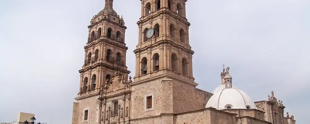
The first Spaniard known in the area, José de Angulo, reached the Sierra de Topia in 1532. In 1552 Ginés Vázquez de Mercado named the Guadiana valley and gave his name to the hill of nearly pure iron ore beside it. Francisco de Ibarra spent the years 1554 to 1567 conquering and holding the territory. Franciscans founded a mission at Nombre de Dios in 1558, the mining towns of Pánuco and Avino followed in 1562, and on 8 Jul 1563 Ibarra founded the town of Durango, named, by one account, after Ibarra's home town, as capital of Nueva Vizcaya, the vast new province of the north, near the mines and the royal road north.
Interactive maptap or click a state to open its page
Nueva Vizcaya stretched across what are now Durango, Chihuahua, Sinaloa, Sonora and part of Arizona. Its mines drew settlers into the canyons of Topia and the sierra, where Acaxees rose against forced mine labour in 1606. In 1616 the Tepehuán revolt, a rising against the missionaries and Spanish labour demands, nearly emptied the capital, and the government withdrew for a time to Parral. Treaties in 1621 and 1622 formally closed the conquest. Durango became a diocese in 1620 and a city in the 1630s, and grew again from 1680. New mines at Guanaceví, Cuencamé and San Juan del Río opened around 1720, and in the 1770s mining fortunes built palaces in the capital and won noble titles.
Places in its history
Durango
City · 1563
Founded 8 Jul 1563 as capital of Nueva Vizcaya; part of the Camino Real World Heritage listing since 2010. 3
La Ferrería
Archaeological site · 600-1350 CE
Pre-Hispanic town south of the capital, with the Casa Colorada complex and its collective burial. 5
Cerro del Mercado
Mine · 1552
Hill of nearly pure iron ore beside the capital, named after Ginés Vázquez de Mercado. 10
Nombre de Dios
Mission · 1558
Site of the first Franciscan mission in the state and its first hospital (1588). 1
Santiago Papasquiaro
Mission · 1597
Founded in 1597 in the Tepehuán country of the sierra foothills. 1
Ojuela
Mine · 1598-1898
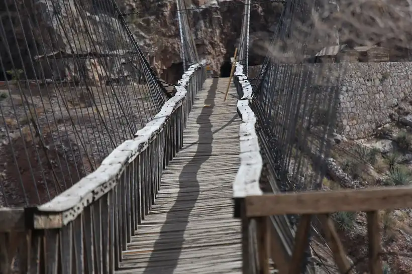
Mine near Mapimí, worked from 1598; its suspension bridge of 1898 was the world's third longest. 4
Gómez Palacio
City · 1910
Industrial hub of the Laguna cotton country, where the state's Revolution began on 19 Nov 1910. 1
Raids, rails and the Revolution's first shots
Independence broke Nueva Vizcaya apart, and the Constitution of 1824 created Durango and Chihuahua as separate states; Durango's congress first met on 8 Sep 1824. The capital was renamed Victoria de Durango in 1826. The new state soon faced the frontier's oldest danger. Apache raids began in the north-east in 1832, and Comanche raids continued into the 1850s, so that haciendas, the large rural estates, and mills built walls; the raids did not stop completely until the 1880s. In the Reform War (1858-61), fought over the liberal Reform laws that sold off Church and communal lands, the liberals held the state from 1858; conservatives and imperialists, the backers of Maximilian's French-supported empire, held it from 1864 to 1866, and Benito Juárez passed through the capital in 1867 on his way north.
1810 to 1920 in Durango
From the timeline below, coloured by era
- 1824Durango becomes a state, separate from Chihuahua; its congress meets on 8 Sep. 2
- 1832Apache raids begin in the north-east, followed by Comanche raids into the 1850s. 1
- 1892A railway links the capital with Piedras Negras. 1
- 1898The Ojuela suspension bridge is built, then the third longest in the world. 4
- 1910On 19 Nov Gómez Palacio sees the state's first revolutionary rising. 1
- 1913Insurgents take the capital on 18 Jun. 3
Under the Porfiriato, Porfirio Díaz's rule of 1876-1911, rail arrived. A line of 1892 tied the capital to Piedras Negras, and a branch reached Tepehuanes in 1902. Cotton, watered by the floods of the Nazas river, dominated La Laguna by the 1870s, and Gómez Palacio and Lerdo grew into the state's second centre. At Ojuela, a mine first worked in 1598, the Peñoles company built a suspension bridge in 1898, then the third longest in the world. Durango's Revolution began early, with a rising in Gómez Palacio on 19 Nov 1910. Francisco Villa was born in the municipality of San Juan del Río, and revolutionary forces took the capital on 18 Jun 1913. Governor Enrique R. Calderón later broke up large haciendas into ejidos, communal farmland granted under land reform, above all in La Laguna.
Ejidos, timber and the film frontier
The decades after the Revolution were unsettled. From 1926 to 1936 armed groups formed around the Cristero War, the Catholic rebellion against the government's anti-clerical laws, and other risings, including the Escobar revolt of 1929, a failed army uprising. In 1936 Lázaro Cárdenas expropriated 225 haciendas in La Laguna to create ejidos; the reform did less than hoped to lift the poorest farmers. Cotton remained the main commercial crop of the Laguna until the 1970s, and droughts in the 1950s and 1960s brought crises that were met with federal investment. The forests of the sierra, about 41% of the state, fed logging and pulp mills and made Durango one of the country's main timber producers.
The region, c. 1600 and today
What each state turned on, by the era table below; Durango outlined in gold.
Interactive maptap or click a state to open its page
c. 1600
Durango: Silver mining districts
- Silver mining districts
- Towns, farms and workshops of the old heartland
- Frontier: missions, presidios, independent peoples
Today
Durango: Mining
- Export manufacturing
- Tourism
- Farming and agro-exports
- Mining
Its places in the modern era
Numbered as on the map above
- 7Gómez Palacio · 1910
Industrial hub of the Laguna cotton country, where the state's Revolution began on 19 Nov 1910. 1
Higher education grew with the Instituto Tecnológico de Durango in 1948 and the Universidad Juárez del Estado de Durango, created from the old Instituto Juárez on 21 Mar 1957. The landscape found another use. Film crews had worked in the state since the 1890s, and after Twentieth Century Fox shot White Feather there in 1954, thirteen major productions followed in ten years, giving Durango a name in Hollywood westerns. Many people still left, since the land and the mills could not employ a growing population: by the late 20th century Durango was part of what geographers call Mexico's hollow core, the central states that sent migrants to Mexico City, the border and the USA.
The 21st century broke the isolation of the sierra. In Jan 2012 the Baluarte Bridge was inaugurated over a canyon on the Sinaloa line, certified at the time as the world's highest cable-stayed bridge, and when the Durango-Mazatlán highway opened to traffic in late 2013 the trip to the Pacific fell from about 6 hours to 2.5. For four centuries Durango's silver, cotton and timber had moved north and east, by the royal road and the railways, because the Sierra Madre that sheltered the Tepehuanes stood between the state and the sea. The new road gave the highland capital a fast way to the coast.
Durango, date by date
Before the Spanish before 1519
- 600-1350
La Ferrería, south of today's capital, is inhabited. 5
The colonial centuries 1519 to 1809
- 1532
José de Angulo, the first Spaniard recorded in the area, reaches the Sierra de Topia. 1
- 1552
Ginés Vázquez de Mercado reaches the Guadiana valley and its iron hill. 1
- 1558
The first Franciscan mission is founded at Nombre de Dios. 1
- 1563
Francisco de Ibarra founds Durango on 8 Jul as capital of Nueva Vizcaya. 3
- 1598
Spanish prospectors find the Ojuela mine near Mapimí. 4
- 1616
The Tepehuán revolt nearly forces the abandonment of the capital. 1
- 1620
Durango becomes the seat of a diocese. 3
- c. 1720
Mines at Guanaceví, Cuencamé and San Juan del Río begin producing. 1
Independence and the Reform 1810 to 1875
The Porfiriato 1876 to 1910
The Revolution 1910 to 1920
Modern Mexico after 1920
- 1936
Lázaro Cárdenas expropriates 225 haciendas in La Laguna to form ejidos. 1
- 1954
White Feather is filmed in Durango, opening a decade of Hollywood westerns. 1
- 1957
The Instituto Juárez becomes the Universidad Juárez del Estado de Durango on 21 Mar. 2
- 2012
The Baluarte Bridge, on the Sinaloa line, is inaugurated on 5 Jan as what is then the world's highest cable-stayed bridge. 12
- 2013
The Durango-Mazatlán highway opens to traffic, cutting the trip to the coast to about 2.5 hours. 12
Where Durango stood: c. 1600, 1910 and today
Interactive maptap or click a state to open its page
c. 1600
Silver, the heartland and the frontier
Durango: Silver mining districts
- Silver mining districts
- Towns, farms and workshops of the old heartland
- Ports, sugar and cacao
- Indigenous south: cochineal, maize, tribute
- Maya lands under encomienda or beyond Spanish rule
- Frontier: missions, presidios, independent peoples
1910
The Porfiriato at its height
Durango: Mining
- Mining
- Oil
- Henequén
- Sugar and textile mills
- Haciendas: grain, pulque, cattle
- Export crops: coffee, tobacco, cacao, chicle, timber
- Steel, cotton and the railway north
- Ranching frontier
- The national capital
Today
What each state turns on now
Durango: Mining
- Export manufacturing
- Oil and gas
- Tourism
- Farming and agro-exports
- Mining
- Ports and logistics
- Services and government
Why Mexico's own reading of what each state's economy turned on in that period, drawn from the sources listed in each state's room; a classification, not a measurement.
Today's numbers for Durango
Output, exports, jobs, wages and investment now, each with its source and date.
The bookBook 6, Where to Go in Mexico, chapter 15
Where to Go in Mexico: The Bajío and Center-North, the corridor this state belongs to.
Why MexicoThe national timeline
The turning points of the whole country, each dated, each with its source.
Sources, each with its date
- Wikipedia (English), Durango, History section, 3 Nov 2026 · read 3 Nov 2026 · link
- Wikipedia (Spanish), Durango, 3 Nov 2026 · read 3 Nov 2026 · link
- Wikipedia (English), Durango City, 3 Nov 2026 · read 3 Nov 2026 · link
- Wikipedia (English), Ojuela, 3 Nov 2026 · read 3 Nov 2026 · link
- INAH, Boletín 485, collective burial found at La Ferrería, Durango, 25 Jul 2023 · read 3 Nov 2026 · link
- SEP, Nueva Escuela Mexicana, Las culturas del Norte: Chalchihuites, 6 Feb 2025 · read 3 Nov 2026 · link
- INEGI, Censo de Población y Vivienda 2020, press release 34/21 for Durango, 26 Jan 2021 · read 3 Nov 2026 · link
- Data México (Secretaría de Economía), Durango profile, Indigenous languages from the 2020 census extended sample, 3 Nov 2026 · read 3 Nov 2026 · link
- Tercer Censo de Población de los Estados Unidos Mexicanos (1910), table VI, population by entity in 1895, 1900 and 1910 (Universidad Veracruzana digital edition), 1910 · read 3 Nov 2026 · link
- Encyclopaedia Britannica, Durango (state), 3 Nov 2026 · read 3 Nov 2026 · link
- GeoNames gazetteer, coordinates for the map pins, 3 Nov 2026 · read 3 Nov 2026 · link
- Wikipedia (English), Baluarte Bridge, 3 Nov 2026 · read 3 Nov 2026 · link
Pictures
- CATEDRAL DE DURANGO - panoramio: M.C. JORGE M. MEJÍA …, CC BY-SA 3.0, Wikimedia Commons · read 3 Nov 2026
- Puente de Ojuela - panoramio: panza.rayada, CC BY-SA 3.0, Wikimedia Commons · read 3 Nov 2026

Where the sources disagree
- Statehood: English Wikipedia gives admission on 22 May 1824; Britannica says Durango and Chihuahua became separate states in 1823. This page uses 1824.
- City status: English Wikipedia's article on the city gives 3 Mar 1630; its article on the state says the city was officially recognised in 1631. This page says "the 1630s".
- Diocese: Wikipedia's article on the city says the diocese was erected in 1620; its article on the state says Pope Paul V created an archdiocese that year. This page says diocese in 1620.
- Baluarte Bridge: Guinness certified it in 2012 as the world's highest cable-stayed bridge; English Wikipedia now ranks it third highest. This page says "at the time".
Mexico City
From Cuicuilco and the island of Tenochtitlan to the capital of New Spain, the Federal District of 1824 and the vast metropolis renamed Mexico City in 2016.
All 32 on the mapNext →Guanajuato
From Chupícuaro and Cañada de la Virgen to the silver of La Valenciana, the cry of Dolores and the Bajío's grain, Guanajuato has fed Mexico and started its wars.