Chiapas
Maya and Zoque cities, three centuries ruled from Guatemala, its own choice to join Mexico in 1824, then coffee, great dams and the uprising of 1994.
Capital: Tuxtla Gutiérrez · Checked 3 Nov 2026
Interactive maptap or click a state to open its page
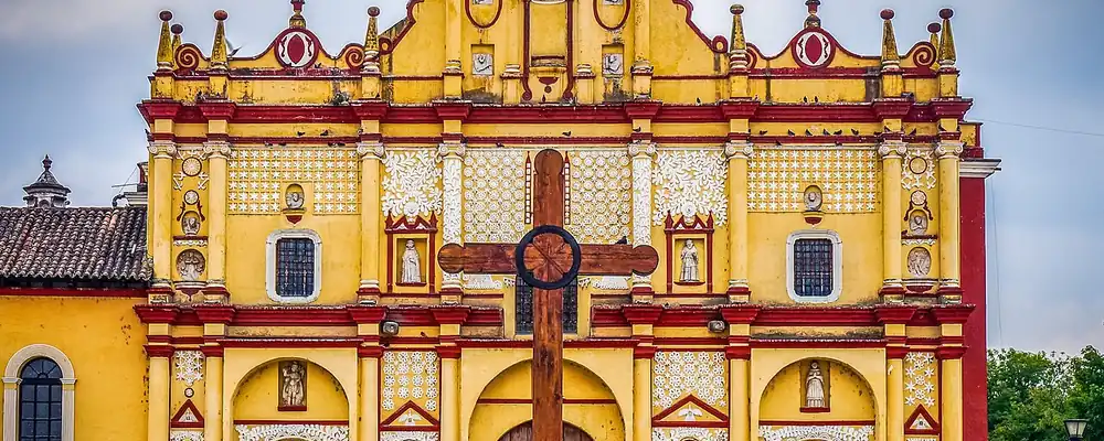
Chiapas in figures from its history
Mokaya, Zoque and Maya, from the Soconusco to Palenque
Hunter-gatherers lived in the central valley of Chiapas from about 7000 BCE. On the Pacific plain of the Soconusco, the Mokaya were growing maize and living in houses by about 1500 BCE; they may be ancestors of the Olmec, and their descendants are the Mixe-Zoque peoples. Izapa, near the foot of the Tacaná volcano, was among the great centres of carved monuments of its time, and it reached its height between about 850 and 100 BCE. Chiapa de Corzo, occupied from about 1200 BCE, was a Zoque centre by 700 BCE and holds the oldest Long Count date yet found, from Dec 36 BCE.
Indigenous languages spoken today
Speakers aged 3 and over, census of 2020 17
In all, 1,459,648 people aged 3 and over spoke an Indigenous language in 2020, 28.2% of that age group. Mam, Q'anjob'al, Lacandón and other Maya languages are spoken by smaller communities.
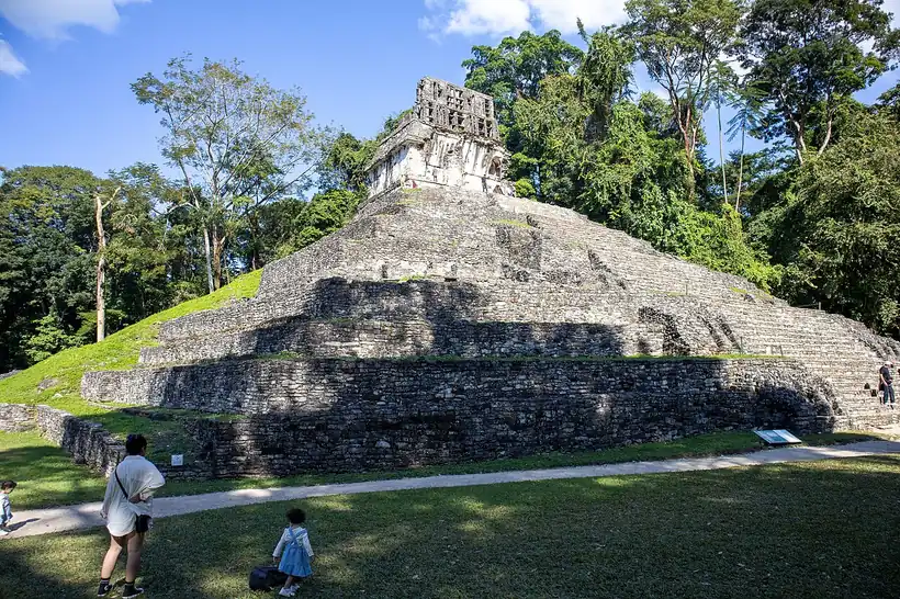

Maya cities of the Classic period (300-900 CE) rose near the Tabasco and Guatemala borders. Palenque flourished under K'inich Janaab' Pakal (615-683), and Yaxchilán, on the Usumacinta, reached its greatest power in the 8th century. Nearly all of them fell silent around 900. Later the Chiapan people settled around Chiapa de Corzo, and in 1486 the Aztec ruler Ahuitzotl conquered the Soconusco for its cacao. Tseltal, Tsotsil, Ch'ol, Tojolabal and Zoque are still spoken by more than 1.4 million people.
Ciudad Real, cacao and the Kingdom of Guatemala
Cortés sent tax collectors in 1522, and Luis Marín led the first armed expedition in 1523. Diego de Mazariegos followed, broke Chiapan resistance and in 1528 founded the Spanish town that became Ciudad Real, today San Cristóbal de las Casas, while the old Chiapan seat became Chiapa de los Indios. At the battle of Tepetchia many Chiapanecs leapt into the Sumidero Canyon rather than surrender. By 1530 most peoples were subdued; the Lacandons held out until 1695. Dominican friars, following the ideals of Bartolomé de las Casas, built churches and the brick fountain of La Pila at Chiapa in 1562.
Interactive maptap or click a state to open its page
Chiapas was governed from Guatemala, not Mexico City, as part of the Captaincy General of Guatemala. The encomienda, a royal grant of Indigenous tribute and labour to a Spanish settler, gave way to haciendas by the end of the 16th century. The Spanish brought sugar cane, wheat, indigo and cattle beside native maize, cotton and cacao, and enslaved Africans arrived in the mid-16th century. The Soconusco, a Spanish province from 1526, was prized for its cacao. Tribute weighed on the highland villages, and in 1712 32 Tzeltal, Tsotsil and Ch'ol towns rose around Cancuc, a revolt crushed in 1713. Chiapas became an intendancy, one of the new Bourbon provinces, in 1790.
Choosing Mexico, then the coffee fincas
In 1821 Comitán, led by friar Matías de Córdova, declared independence from Spain, and in 1822 Iturbide's empire claimed Chiapas. When the empire fell, Chiapas weighed its choices, and on 14 Sep 1824 it joined Mexico by popular vote. The Soconusco stayed apart until Santa Anna's troops occupied it in 1842, and the border with Guatemala was fixed by treaty in 1882. In 1848 San Marcos Tuxtla was renamed Tuxtla Gutiérrez, for the governor Joaquín Miguel Gutiérrez, who had championed union with Mexico, and San Cristóbal gained "de las Casas".
1810 to 1920 in Chiapas
From the timeline below, coloured by era
- 1821Comitán declares independence from Spain under friar Matías de Córdova. 2
- 1824Chiapas joins Mexico by popular vote on 14 Sep 1824. 1
- 1842The Soconusco is joined to Mexico after Santa Anna's troops occupy it. 12
- 1890450 German families are sent to the Tapachula area as coffee takes hold. 12
- 1892The capital moves from San Cristóbal to Tuxtla on 11 Aug 1892. 3
Governor Emilio Rabasa, from 1891, moved the capital from San Cristóbal to Tuxtla on 11 Aug 1892. The Porfiriato opened Chiapas to foreign capital. In 1890, 450 German families were sent to the Tapachula area, coffee fincas took names like Hamburgo and Bremen, and between 1890 and 1910 the Soconusco became Mexico's main coffee producer and exporter. Labour was often bound by debt through the enganche, contracts paid in advance that trapped highland workers in debt to the fincas. The Revolution reached Chiapas late: Tuxtla and San Cristóbal fought in 1911, Carranza's troops arrived in 1914, and the landowners' Mapache guerrillas, raised to defend their estates against Carranza's reforms, resisted until 1920. The state constitution dates from 1921, and land reform under Cárdenas turned some estates into ejidos, communal farmland granted to villages.
Jungle frontier, Grijalva dams and 1994
From the 1930s, landless families moved into the Lacandon Jungle, whose population grew from about 11,000 in 1920 to more than 376,000 in 2000. Coffee, cattle and maize remained the base of the economy, and Tapachula, capital of the Soconusco since 1794, filled with Art Deco buildings paid for by coffee in the early 20th century. Tuxtla grew as the seat of government, and its diocese was created in 1965.
The region, c. 1600 and today
What each state turned on, by the era table below; Chiapas outlined in gold.
Interactive maptap or click a state to open its page
c. 1600
Chiapas: Indigenous south: cochineal, maize, tribute
- Ports, sugar and cacao
- Indigenous south: cochineal, maize, tribute
- Maya lands under encomienda or beyond Spanish rule
Today
Chiapas: Farming and agro-exports
- Oil and gas
- Tourism
- Farming and agro-exports
Its places in the modern era
Numbered as on the map above
- 1Tuxtla Gutiérrez · 1892
Zoque town that became the state capital in 1892. 3
The Grijalva River was harnessed by four great dams: Malpaso, La Angostura, Chicoasén, built from 1974 to 1980 with 2,430 MW installed, and Peñitas. Chiapas came to produce about 55% of Mexico's hydroelectric power, and PEMEX drilled and refined oil in the state. Many highland and jungle communities stayed poor all the same, held back by rugged terrain, poor access to markets and a long history of debt labour. On 1 Jan 1994, the day NAFTA took effect, the EZLN, the Zapatista Army of National Liberation, an Indigenous rebel army, occupied San Cristóbal de las Casas and other towns, and the demands of Indigenous Chiapas reached the whole nation.
Roads through the state and out of it shaped what came next. Hurricane Stan in 2005 wrecked the rail line to Guatemala and much of the flood defences around Tapachula, and that border city remained the main gateway between Mexico and Central America, home to many migrants waiting to travel north. More Chiapans leave the state than arrive, most for Tabasco, Oaxaca, Veracruz and central Mexico. Tourism grew in San Cristóbal de las Casas and Palenque, and on 31 Dec 2023 the Tren Maya opened its station at Palenque, tying the Maya city to the Caribbean coast. The state that chose Mexico in 1824 remains its southern door.
Chiapas, date by date
Before the Spanish before 1519
- c. 7000 BCE
Hunter-gatherers occupy the central valley of Chiapas. 1
- c. 1500 BCE
The Mokaya of the Soconusco grow maize and live in houses. 1
- c. 850-100 BCE
Izapa reaches its height and raises its carved stelae. 6
- 36 BCE
Chiapa de Corzo records the oldest Long Count date yet found. 7
- 615-683
K'inich Janaab' Pakal rules Palenque, which flourishes as never before. 5
- c. 900
Nearly all the Classic Maya cities are abandoned. 1
- 1486
The Aztec ruler Ahuitzotl conquers the cacao-rich Soconusco. 12
The colonial centuries 1519 to 1809
Independence and the Reform 1810 to 1875
The Porfiriato 1876 to 1910
Where Chiapas stood: c. 1600, 1910 and today
Interactive maptap or click a state to open its page
c. 1600
Silver, the heartland and the frontier
Chiapas: Indigenous south: cochineal, maize, tribute
- Silver mining districts
- Towns, farms and workshops of the old heartland
- Ports, sugar and cacao
- Indigenous south: cochineal, maize, tribute
- Maya lands under encomienda or beyond Spanish rule
- Frontier: missions, presidios, independent peoples
1910
The Porfiriato at its height
Chiapas: Export crops: coffee, tobacco, cacao, chicle, timber
- Mining
- Oil
- Henequén
- Sugar and textile mills
- Haciendas: grain, pulque, cattle
- Export crops: coffee, tobacco, cacao, chicle, timber
- Steel, cotton and the railway north
- Ranching frontier
- The national capital
Today
What each state turns on now
Chiapas: Farming and agro-exports
- Export manufacturing
- Oil and gas
- Tourism
- Farming and agro-exports
- Mining
- Ports and logistics
- Services and government
Why Mexico's own reading of what each state's economy turned on in that period, drawn from the sources listed in each state's room; a classification, not a measurement.
Today's numbers for Chiapas
Output, exports, jobs, wages and investment now, each with its source and date.
The bookBook 6, Where to Go in Mexico, chapter 20
Where to Go in Mexico: The Deep South: Guerrero, Oaxaca and Chiapas, the corridor this state belongs to.
Why MexicoThe national timeline
The turning points of the whole country, each dated, each with its source.
Sources, each with its date
- Wikipedia (English), Chiapas, History section, 3 Nov 2026 · read 3 Nov 2026 · link
- Wikipedia (Spanish), Chiapas, history section, 3 Nov 2026 · read 3 Nov 2026 · link
- Wikipedia (English), Tuxtla Gutiérrez, 3 Nov 2026 · read 3 Nov 2026 · link
- Wikipedia (English), San Cristóbal de las Casas, 3 Nov 2026 · read 3 Nov 2026 · link
- Wikipedia (English), Palenque, 3 Nov 2026 · read 3 Nov 2026 · link
- Wikipedia (English), Izapa, 3 Nov 2026 · read 3 Nov 2026 · link
- Wikipedia (English), Chiapa de Corzo (Mesoamerican site), 3 Nov 2026 · read 3 Nov 2026 · link
- Wikipedia (English), Chiapa de Corzo, Chiapas, 3 Nov 2026 · read 3 Nov 2026 · link
- Wikipedia (English), Yaxchilan, 3 Nov 2026 · read 3 Nov 2026 · link
- Wikipedia (English), Comitán, 3 Nov 2026 · read 3 Nov 2026 · link
- Wikipedia (English), Tapachula, 3 Nov 2026 · read 3 Nov 2026 · link
- Wikipedia (English), Soconusco, 3 Nov 2026 · read 3 Nov 2026 · link
- Wikipedia (English), Tzeltal Rebellion of 1712, 3 Nov 2026 · read 3 Nov 2026 · link
- Wikipedia (English), Chicoasén Dam, 3 Nov 2026 · read 3 Nov 2026 · link
- The Statesman's Year-Book 1913, Mexico, table of states with 1900 and 1910 census populations (Wikisource transcription), 1913 · read 3 Nov 2026 · link
- INEGI, Censo de Población y Vivienda 2020, results for Chiapas, press release 37/21, 26 Jan 2021 · read 3 Nov 2026 · link
- CEIEG Chiapas, Población, speakers aged 3+ by language, Censo de Población y Vivienda 2020, 3 Nov 2026 · read 3 Nov 2026 · link
- Wikipedia (English), Tren Maya, 3 Nov 2026 · read 3 Nov 2026 · link
Pictures
- Catedral de San Cristóbal de las Casas 1: GameOfLight, CC BY-SA 3.0, Wikimedia Commons · read 3 Nov 2026
- Zona arqueológica de Palenque 2026 - 19: ProtoplasmaKid, CC BY-SA 4.0, Wikimedia Commons · read 3 Nov 2026

Where the sources disagree
- Luis Marín's first armed expedition: Wikipedia (English) gives 1523; Wikipedia (Spanish) gives early 1524. This page uses 1523.
- Renaming of San Cristóbal: Wikipedia (English, Chiapas) gives San Cristóbal de las Casas in 1828; the city's own article gives Ciudad de San Cristóbal in 1829 and "de las Casas" in 1848. This page mentions only 1848.
- Classic Maya peak: Wikipedia (English) gives 300-900 CE; Wikipedia (Spanish) gives 600-900 CE. This page uses 300-900 CE.
Colima
From the Capacha potters and shaft tombs below the volcano to cacao, salt and the port of Manzanillo, Colima has long been western Mexico's door to the Pacific.
All 32 on the mapNext →Chihuahua
From the adobe city of Paquimé to the silver of Parral, the last days of Hidalgo, Villa's División del Norte and the border factories of Ciudad Juárez.