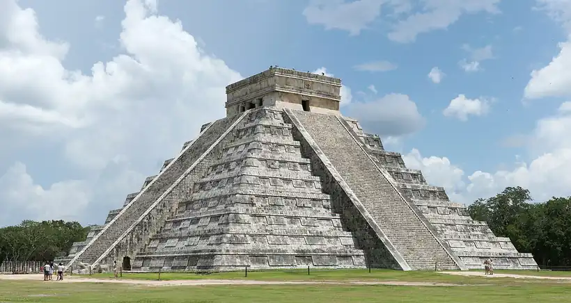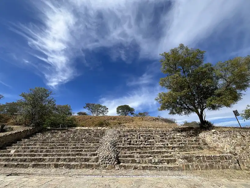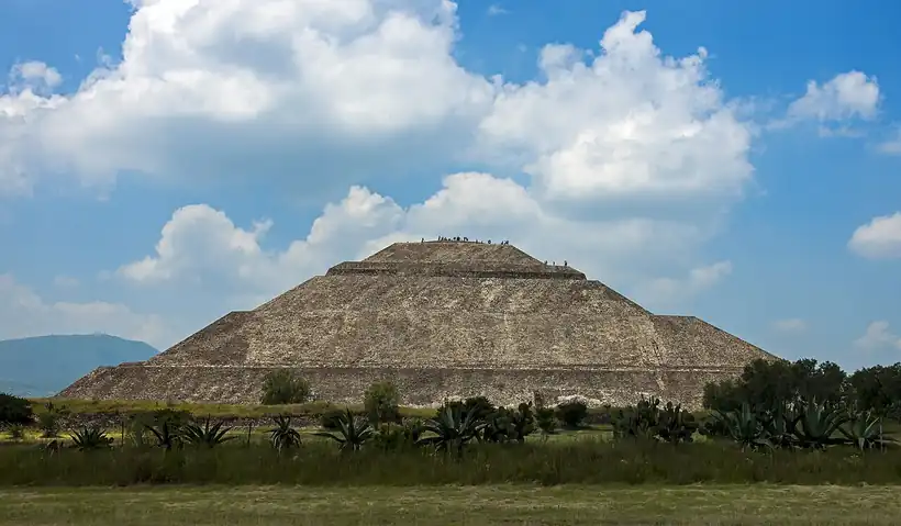
The whole arc, from the first peoples to today

Why Mexico: how a country became what it is.

From the first cities of Mesoamerica to today’s tariffs: how Mexico became Mexico, how it lost more than half of its land to the north and then tied its fortunes to it, and where it stands now. In English and in Spanish, every date with its source.

In 1821 Mexico reached the 42nd parallel, where Oregon begins today. By 1848 more than half of that land belonged to the USA.

Interactive maptap or click a state to open its page

AguascalientesBaja CaliforniaBaja California SurCampecheChiapasChihuahuaCoahuilaColimaDurangoGuanajuatoGuerreroHidalgoJaliscoMexico CityMichoacánMorelosNayaritNuevo LeónOaxacaPueblaQuerétaroQuintana RooSan Luis PotosíSinaloaSonoraState of MexicoTabascoTamaulipasTlaxcalaVeracruzYucatánZacatecasCaliforniaArizonaNew MexicoColoradoWyomingOklahomaCeded 1848after the Mexican-American WarTexas 1836USA 1845Texas claimto the Rio GrandeLa MesillaGadsden Purchase, 1853-5442nd parallel, 1821where Oregon begins todayMexico todaytap a state
Mexico todayTexas, 1836 to 1845Ceded in 1848La Mesilla, 1853-54
Click a state to open its history.Tap a state to open its history. Mexico’s territory, 1821 to today: every change with its date, area and source →
The arc in seven eras

Seven eras, one country

Swipe for all seven eras →

1521 to 1810

New Spain

Conquest and the collapse of the Indigenous population, then silver, missions and haciendas; by the 1700s the crown's richest colony.

Real de Catorce, a silver boom town founded in the 1770s. Photo: Rafael Saldaña, CC BY 2.0, via Wikimedia Commons

163 dated events in our state histories

Open the New Spain room →

Bars: how many of the 609 dated events in our state histories fall in each era.

See the seven eras side by side, on one line from 1521 to today →

Thirty-one states and Mexico City, one room each

Every state has its own history

The Texas-Facing NorthThe Pacific BorderThe Bajío and Center-NorthThe CenterThe WestThe Gulf and the IsthmusThe PeninsulaThe Deep South: Guerrero, Oaxaca and Chiapas

Interactive maptap or click a state to open its page

AguascalientesBaja CaliforniaBaja California SurCampecheChiapasChihuahuaCoahuilaColimaDurangoGuanajuatoGuerreroHidalgoJaliscoMexico CityMichoacánMorelosNayaritNuevo LeónOaxacaPueblaQuerétaroQuintana RooSan Luis PotosíSinaloaSonoraState of MexicoTabascoTamaulipasTlaxcalaVeracruzYucatánZacatecasMexico City
Click a state to open its history: its first peoples, its colonial centuries, its part in Independence and the Revolution, and how its economy turned.Tap a state to open its history: its first peoples, its colonial centuries, its part in Independence and the Revolution, and how its economy turned. All 31 states and Mexico City →

Swipe for the eight corridors →

The country in three moments

What each state turned on: c. 1600, 1910 and today

Interactive maptap or click a state to open its page

c. 1600

Silver, the heartland and the frontier

AguascalientesBaja CaliforniaBaja California SurCampecheChiapasChihuahuaCoahuilaColimaDurangoGuanajuatoGuerreroHidalgoJaliscoMexico CityMichoacánMorelosNayaritNuevo LeónOaxacaPueblaQuerétaroQuintana RooSan Luis PotosíSinaloaSonoraState of MexicoTabascoTamaulipasTlaxcalaVeracruzYucatánZacatecas
  • Silver mining districts
  • Towns, farms and workshops of the old heartland
  • Ports, sugar and cacao
  • Indigenous south: cochineal, maize, tribute
  • Maya lands under encomienda or beyond Spanish rule
  • Frontier: missions, presidios, independent peoples

1910

The Porfiriato at its height

AguascalientesBaja CaliforniaBaja California SurCampecheChiapasChihuahuaCoahuilaColimaDurangoGuanajuatoGuerreroHidalgoJaliscoMexico CityMichoacánMorelosNayaritNuevo LeónOaxacaPueblaQuerétaroQuintana RooSan Luis PotosíSinaloaSonoraState of MexicoTabascoTamaulipasTlaxcalaVeracruzYucatánZacatecas
  • Mining
  • Oil
  • Henequén
  • Sugar and textile mills
  • Haciendas: grain, pulque, cattle
  • Export crops: coffee, tobacco, cacao, chicle, timber
  • Steel, cotton and the railway north
  • Ranching frontier
  • The national capital

Today

What each state turns on now

AguascalientesBaja CaliforniaBaja California SurCampecheChiapasChihuahuaCoahuilaColimaDurangoGuanajuatoGuerreroHidalgoJaliscoMexico CityMichoacánMorelosNayaritNuevo LeónOaxacaPueblaQuerétaroQuintana RooSan Luis PotosíSinaloaSonoraState of MexicoTabascoTamaulipasTlaxcalaVeracruzYucatánZacatecas
  • Export manufacturing
  • Oil and gas
  • Tourism
  • Farming and agro-exports
  • Mining
  • Ports and logistics
  • Services and government

Why Mexico's own reading of what each state's economy turned on in that period, drawn from the sources listed in each state's room; a classification, not a measurement.

Places in the history

Where it happened: 202 places from the state histories

City 64Archaeological site 54Mine 21Mission 16Port 14Battlefield 12Hacienda 6Oil field 6Fort 5Railway 4

Interactive maptap or click a place to open its state's page

AguascalientesBaja CaliforniaBaja California SurCampecheChihuahuaChiapasMexico CityCoahuilaColimaDurangoGuerreroGuanajuatoHidalgoJaliscoState of MexicoMichoacánMorelosNayaritNuevo LeónOaxacaPueblaQuerétaroQuintana RooSinaloaSan Luis PotosíSonoraTabascoTamaulipasTlaxcalaVeracruzYucatánZacatecasFort of San Diego, 1617; rebuilt 1778-83 · GuerreroAcapulco, 1565-1815 · GuerreroYaxchilán, c. 300-900 · ChiapasMitla, c. 850-1521 · OaxacaMonte Albán, c. 500 BCE-1000 CE · OaxacaPalenque, c. 226 BCE-799 CE · ChiapasTeposcolula, c. 700-1521 · OaxacaMacuspana, 1940-60; Ciudad Pemex 1958 · TabascoHuajuapan de León, 1812 · OaxacaAguada Fénix, c. 1000-750 BCE · TabascoLázaro Cárdenas, 1960s-70s · MichoacánCalakmul, Late Classic peak · CampecheComalcalco, c. 550-1000 CE · TabascoTehuacán Valley, c. 3600 BCE; 1660; 1994 · PueblaBecán, c. 550 BCE-1200s · CampecheFrontera, 1519; port 1872 · TabascoTaxco, 1532; 1751-58 · GuerreroCiudad del Carmen, 1717; 1971 · CampecheBacalar, 1545; fort 1729 · Quintana RooZacatepec, 1619; mill 1938 · MorelosXochicalco, c. 650-900 · MorelosCuautla, 1812 · MorelosSultepec, 1531 · State of MexicoCuyutlán salt works, pre-Hispanic to today · ColimaMalinalco, 1476; 1501; 1540-60 · State of MexicoTepoztlán, 1555-80 · MorelosManzanillo, 1527; open port 1825 · ColimaGreat Pyramid of Cholula, 3rd century BCE-9th century CE · PueblaHuejotzingo, 1525; 1544-70 · PueblaBarra de Navidad, 1564 · JaliscoSan Juan de Ulúa, 1535-1825 · VeracruzCacaxtla and Xochitécatl, c. 800 BCE-950 CE · TlaxcalaLa Campana, c. 700-900 · ColimaXochimilco canals, c. 900 to today · Mexico CityEl Chanal, c. 1100-1400 · ColimaCuicuilco, c. 1200 BCE-150 CE · Mexico CityComala and Hacienda Nogueras, 18th century · ColimaChampotón, 1517 · CampecheApizaco, 1866; 1869 · TlaxcalaChapultepec, 13 Sep 1847 · Mexico CityTlatelolco, 1337; 1536; 1968 · Mexico CityBasilica of Guadalupe, Tepeyac, 1531; 1709; 1976 · Mexico CityParicutín volcano, 1943-52 · MichoacánCantona, c. 600-1000 CE · PueblaFelipe Carrillo Puerto, 1850-1901 · Quintana RooCalpulalpan, 10 Apr 1867 · TlaxcalaEdzná, c. 400 BCE-1500 CE · CampecheTzintzuntzan, c. 1450-1530 · MichoacánTeotihuacan, c. 100 BCE-750 CE · State of MexicoTepotzotlán, 1580-1767 · State of MexicoEl Oro, 1787-1958 · State of MexicoTlalpujahua, 1558-1959 · MichoacánYohualichan, Classic period · PueblaTula, c. 700-1150 · HidalgoReal del Monte, 1552-2005 · HidalgoSanta María Regla (Huasca), 1762 · HidalgoTulum, c. 1200-1500s · Quintana RooActopan, 1546-1570s · HidalgoUxmal, c. 700-1200s · YucatánPlazuelas, c. 600-1000 · GuanajuatoEl Tajín, c. 600-1200 · VeracruzCobá, c. 50 BCE-1300s · Quintana RooSan Gervasio, Cozumel, c. 300-1600 · Quintana RooCelaya, 1570; 1915 · GuanajuatoPoza Rica, 1932; town 1951 · VeracruzEl Cerrito, c. 300 BCE-1500 CE · QuerétaroSalamanca refinery, 1950 · GuanajuatoMayapán, 1220s-1441 · YucatánPuerto Vallarta, 1851; resort from 1963 · JaliscoCalderón Bridge, 1811 · JaliscoLos Guachimontones, c. 300 BCE-450 CE · JaliscoChichén Itzá, c. 600-1200 · YucatánNuevo Vallarta, 1970s · NayaritPeña de Bernal, Pre-Hispanic · QuerétaroCañada de la Virgen, c. 540-1040 · GuanajuatoIzamal, 1561 · YucatánLos Toriles, Ixtlán del Río, pre-Hispanic · NayaritDzibilchaltún, Preclassic-1500s · YucatánLanda mission, 1761-68 · QuerétaroCerro Azul, 1916 · VeracruzJalpan mission, 1751-58 · QuerétaroProgreso, 1872 · YucatánNochistlán, 1531-41 · ZacatecasEl Teúl, c. 200-1531 · ZacatecasSan Blas, 1768 · NayaritEl Ocote rock paintings, Undated · AguascalientesMexcaltitán, pre-Hispanic · NayaritTamtoc, c. 600 BCE-1350 CE · San Luis PotosíHacienda de San Blas, Pabellón de Hidalgo, 1811 · AguascalientesCiénega Grande, c. 1570 · AguascalientesCerro de San Pedro, 1592 · San Luis PotosíTepezalá, Colonial era · AguascalientesReal de Asientos, 1620 · AguascalientesMadero refinery, 1914 · TamaulipasTampico, 1554; 1823 · TamaulipasLa Quemada, c. 300-1200 CE · ZacatecasEl Rosario, 1655 · SinaloaTula, 1617 · TamaulipasSan José del Cabo, 1730 · Baja California SurFresnillo (Proaño), 1554 · ZacatecasMazatlán, 1531; port from the 1820s · SinaloaAlta Vista, c. 400-900 CE · ZacatecasBalcón de Montezuma, c. 600-900 · TamaulipasLas Labradas, c. 7000 BCE-1250 CE · SinaloaReal de Catorce, 1772 · San Luis PotosíNombre de Dios, 1558 · DurangoLa Ferrería, 600-1350 CE · DurangoCerro del Mercado, 1552 · DurangoCosalá, 1563 · SinaloaSantiago Papasquiaro, 1597 · DurangoAgua Nueva, 1811 · CoahuilaParras de la Fuente, 1597-98 · CoahuilaTorreón, 1893-1907 · CoahuilaObispado (Bishop's Palace), 1787-88 / 1846 · Nuevo LeónLos Mochis, 1893-1903 · SinaloaOjuela, 1598-1898 · DurangoBoca de Potrerillos, c. 6960 BCE-1760 CE · Nuevo LeónLoreto, 1697 · Baja California SurCerralvo (San Gregorio mines), 1577; 1582 · Nuevo LeónEl Fuerte, 1563; fort 1610 · SinaloaBustamante (San Miguel de Aguayo), 1686 · Nuevo LeónAcatita de Baján, 1811 · CoahuilaMulegé, 1847 · Baja California SurHidalgo del Parral, 1631 · ChihuahuaBatopilas, 1708 · ChihuahuaÁlamos, 1685 · SonoraSanta Rosalía (El Boleo), 1885-1954 · Baja California SurSierra de San Francisco, c. 5500 BCE-1700s · Baja California SurCreel, 1961 · ChihuahuaGuaymas, 1769 · SonoraCuarenta Casas, c. 1205-1350 · ChihuahuaSan Fernando Velicatá, 1769 · Baja CaliforniaPaquimé, c. 1130-1450 · ChihuahuaCerro de Trincheras, c. 1300-1450 · SonoraSanto Domingo de la Frontera, 1775 · Baja CaliforniaCananea, 1906 · SonoraEnsenada, 1542; 1882 · Baja CaliforniaEl Vallecito, c. 1000 BCE · Baja CaliforniaTapachula, 1794 · ChiapasComitán, 1528; 1821 · ChiapasChiapa de Corzo, c. 1200 BCE; 1528 · ChiapasSan Cristóbal de las Casas, 1528 · ChiapasTuxtla Gutiérrez, 1892 · ChiapasOaxaca de Juárez, 1529 · OaxacaGuelatao de Juárez, Birthplace of Benito Juárez, 1806 · OaxacaChilpancingo, 1591; 1813 · GuerreroTixtla, 1851-70 · GuerreroTacotalpa, 1677-1795 · TabascoVillahermosa, 1564 · TabascoIguala, 1821 · GuerreroChetumal, 1898 · Quintana RooAnenecuilco, Birthplace of Emiliano Zapata, 1879 · MorelosYanga, 1618 · VeracruzCuernavaca, c. 1250; city 1834 · MorelosPuebla, 1531 · PueblaApatzingán, 1814 · MichoacánColima, 1527 · ColimaIxtenco, 1532 · TlaxcalaToluca, 1530; capital since 1830 · State of MexicoTlaxcala, 1525 · TlaxcalaHuamantla, 1530s; 1847 · TlaxcalaCiudad Nezahualcóyotl, 1963 · State of MexicoZócalo and Templo Mayor, 1325-1521; capital since 1521 · Mexico CityXalapa, c. 1313; capital 1885 · VeracruzMorelia, 1541 · MichoacánCiudad Sahagún, 1951-2002 · HidalgoCampeche, 1540 · CampechePachuca, 1528 · HidalgoHuichapan, 1812 · HidalgoSan Juan del Río, 1531 · QuerétaroQuerétaro, 1531 · QuerétaroGuadalajara, 1542 · JaliscoTequila, 1530 · JaliscoMérida, 1542 · YucatánGuanajuato, 1548 · GuanajuatoDolores Hidalgo, 1810 · GuanajuatoCancún, 1970 · Quintana RooCompostela, 1530 · NayaritTepic, 1531 · NayaritAguascalientes, 1575 · AguascalientesCiudad Valles, 1533 · San Luis PotosíSan Luis Potosí, 1592 · San Luis PotosíCiudad del Maíz, 1920s-1939 · San Luis PotosíZacatecas, 1546 · ZacatecasCiudad Victoria, 1750 · TamaulipasDurango, 1563 · DurangoLa Paz, 1535; capital c. 1830 · Baja California SurCuliacán, 1531 · SinaloaLinares, 1712 · Nuevo LeónSaltillo, 1577 · CoahuilaGómez Palacio, 1910 · DurangoCadereyta Jiménez, 1637 · Nuevo LeónMonterrey, 1596 · Nuevo LeónMatamoros, 1749; 1913 · TamaulipasReynosa, 1749 · TamaulipasMonclova, 1577; steel 1942 · CoahuilaCiudad Obregón, 1928 · SonoraChihuahua City, 1709 · ChihuahuaHermosillo, 1700 · SonoraCiudad Juárez, 1659 · ChihuahuaTijuana, 1889 · Baja CaliforniaMexicali, 1903 · Baja California
Cities, ancient sites, mines, missions, ports, battles, haciendas and railways, each from a state history. Click a dot to see what it is.Cities, ancient sites, mines, missions, ports, battles, haciendas and railways, each from a state history. Tap a dot to see what it is.
Mexico and the North

What moves between Mexico, the USA and Canada

Goods trade, USA and Mexico
$871.6 billion
2025, against $81.5 billion in 1993
Remittances to Mexico
$61.8 billion
2025, Banco de México; down 4.6% from $64.7 billion in 2024
Mexican-born people in the USA
11.3 million
2024, against 4.5 million in 1990
Pesos per U.S. dollar
19.24
2025 average, against 3.12 in 1993

Sources: U.S. Census Bureau, Trade in Goods with Mexico (public domain) · World Bank, World Development Indicators (updated 8 Oct 2026; CC BY 4.0) · UN DESA Population Division, International Migrant Stock 2024 (CC BY 3.0 IGO)

Trade in goods between the USA and Mexico, 1985 to 2025
U.S. imports from MexicoU.S. exports to MexicoUS$ billions

← Slide the chart to see the earlier years

Trade in goods between the USA and Mexico, 1985 to 2025U.S. exports to Mexico and imports from Mexico in billions of dollars, nominal, from the Census Bureau.0200400600198519901995200020052010201520202025NAFTAUSMCA

Source: U.S. Census Bureau, Trade in Goods with Mexico (public domain)

Trade, money, people and the peso, over decades →

The record

Did the experts get it right?

More often too hopeful than not. A year ahead, the IMF expected more growth than Mexico got in 19 of 34 years; across all 34 years the forecast ran 1.3 points too high on average, and the largest misses came in the shock years.

Mexico's real GDP growth: IMF forecasts against results, 1991 to 2024
Forecast a year ahead (October before)Forecast in April of the yearFirst published resultLatest figure (World Bank)%

← Slide the chart to see the earlier years

Mexico's real GDP growth: IMF forecasts against results, 1991 to 2024Each year shows the IMF's year-ahead and same-year forecasts, the first published result and today's figure.-10%-5%0%5%19911995200020052010201520202024

Sources: International Monetary Fund, World Economic Outlook historical forecasts database (updated 22 Apr 2025) · World Bank, World Development Indicators (updated 8 Oct 2026; CC BY 4.0)

Every IMF forecast since 1990, growth and inflation, beside what happened →

Today, set against the arc

Latest from the blog

All posts →