Tlaxcala
From the murals of Cacaxtla and a republic the Mexica never conquered to the alliance of 1519, colonists for the north, a hard-won statehood and industrial corridors.
Capital: Tlaxcala · Became a state: Territory 1824, state 1856 · Checked 3 Nov 2026
Interactive maptap or click a state to open its page
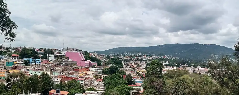
Tlaxcala in figures from its history
Cacaxtla and the republic of 4 lordships
People lived on the hill of La Gloria more than 8,000 years ago, and farming cultures followed one another on the plain, from Tzompantepec (1700-1200 BCE) to Texoloc (800-400 BCE). Xochitécatl, on a volcanic dome in the south, was built from about 800 BCE; its Pyramid of the Flowers held more than 2,000 clay figurines. An eruption of Popocatépetl emptied it around 150 CE. From about 650 to 900 CE its neighbour Cacaxtla ruled the region, and its murals, among them the Battle Mural painted before 700, are some of the finest in Mesoamerica. Tradition credits the Olmeca-Xicalanca, though archaeologists now question it. Farmers found the murals in 1975.
Indigenous languages spoken today
Speakers aged 3 and over, census of 2020 6
27,174 people aged 3 and over spoke an Indigenous language in 2020 (2.2%). Nahuatl accounts for the great majority; Otomí, the state's other old language, survives mainly at Ixtenco.
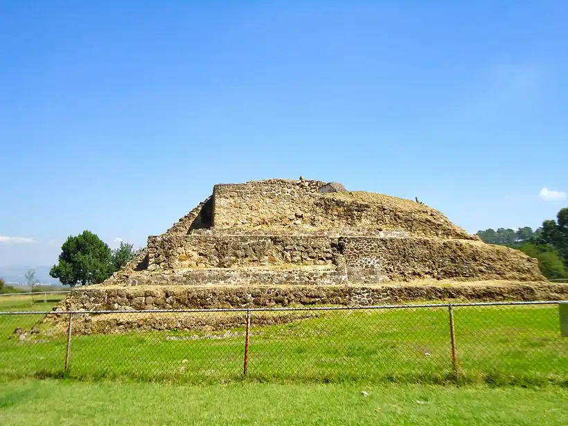

Teochichimec settlers founded Tizatlán in the 13th century, and in the 14th the Tlaxcaltecs, a Nahua people, made the plain their own. Their state was a republic of 4 lordships, Tepeticpac, Ocotelulco, Tizatlán and Quiahuixtlán, ringed almost entirely by the Mexica empire but never conquered by it. A Mexica attack in 1504 failed, and the blockade that followed cut Tlaxcala off from trade. Otomí people settled the east, around Ixtenco and Huamantla, as vassals who held land in return for military service. Nahuatl is still spoken by 23,171 people in the state, and Otomí survives at Ixtenco.
Allies of the conquest, colonists of the north
When Cortés arrived in 1519, Xicohténcatl Axayacatzin fought him, and the battles of early Sep went against the Tlaxcaltecs. The lordships, worn down by decades of Mexica blockade, then chose alliance, sealed at Tizatlán. Cortés stayed 20 days and left with 6,000 Tlaxcalan warriors. After the Spanish were driven from Tenochtitlan in 1520, Tlaxcala took them in, on its own conditions: exemption from tribute forever, a share of the spoils and control of 2 border provinces. Tenochtitlan fell in Aug 1521 with Tlaxcalan armies at its gates.
Interactive maptap or click a state to open its page
The alliance bought Tlaxcala privileges few other Indigenous nations kept. It stayed under the direct protection of the Crown and kept its own Indigenous government for about 300 years. Franciscans arrived in 1524, the Spanish city was laid out in 1525, Charles V granted its coat of arms on 22 Apr 1535, and the monastery of the Assumption went up between 1537 and 1542. In 1591 more than 400 Tlaxcalan families went north to settle among the Chichimecs, freed from tribute and personal service. The price was steep. Wars, expeditions, epidemics and migration to the mining country emptied the province; the city had only about 700 people in 1625, and by the mid-18th century 217 haciendas, large landed estates worked by peons, held almost half its land.
Places in its history
Tlaxcala
City · 1525
Spanish city laid out beside the old lordships, with the Franciscan monastery of 1537-42. 11
Cacaxtla and Xochitécatl
Archaeological site · c. 800 BCE-950 CE
Hilltop city with the great murals of the Epiclassic, beside the pyramids of Xochitécatl. 8
Apizaco
Railway · 1866; 1869
Town born from the Mexico City-Veracruz railway, home of its rail workers. 12
Huamantla
City · 1530s; 1847
Town of haciendas, named heroic in 1847, with factories from the 1940s. 13
Calpulalpan
Battlefield · 10 Apr 1867
Gateway to the west of the state, where republicans beat imperial troops in 1867. 15
A territory that fought to be a state
Tlaxcala's cabildo, its town council, pressed to be heard at the Cortes of Cádiz, the Spanish parliament of 1810-14, and its deputy José Miguel Guridi y Alcocer helped defeat a plan to annex it to Puebla. Under the republic it became a federal territory on 24 Nov 1824, was folded into the Department of Mexico in 1836, when a centralist government replaced the states with departments, and regained territory status in May 1847. That year Huamantla earned the title of heroic for its stand against the invading army in the war with the USA. After the Ayutla revolution, the revolt of 1854-55 that drove Santa Anna from power, the Constituent Congress approved statehood on 9 Dec 1856, and in 1857 Tlaxcala took its seat as the 22nd state.
1810 to 1920 in Tlaxcala
From the timeline below, coloured by era
- 1824Tlaxcala becomes a federal territory on 24 Nov. 1
- 1856The Constituent Congress approves statehood on 9 Dec. 2
- 1867Republican forces defeat imperial troops near Calpulalpan on 10 Apr. 15
- 1869The Mexico City-Apizaco-Puebla railway opens on 16 Sep. 12
- 1885-1911Próspero Cahuantzi, a governor of Indigenous origin, rules the state. 1
- 1910Anti-reelectionists led by Juan Cuamatzi plan a rising for 26 May. 2
Governor Miguel Lira y Ortega gave it a constitution with the Reform laws, the liberal measures that sold off Church and communal lands, new municipalities and 6 textile mills. On 10 Apr 1867 republican forces defeated imperial troops near Calpulalpan, which was reunited with Tlaxcala in the 1860s. The railway between Mexico City and Veracruz created Apizaco, and on 16 Sep 1869 the line from Mexico City through Apizaco to Puebla opened. Próspero Cahuantzi, a governor of Indigenous origin, ruled from 1885 to 1911, through most of the Porfiriato, Porfirio Díaz's rule of 1876-1911. Anti-reelectionists, opponents of Díaz's endless re-election, led by Juan Cuamatzi planned a rising for 26 May 1910. In the Revolution, Domingo Arenas divided hacienda lands among villages in his zone, and the state only settled down around 1927.
Ejidos, rail shops and industrial corridors
Land reform broke up the old haciendas of Huamantla and the plain. Families received ejido plots, farmland granted to communities under the reform, of about 4 hectares on average, and at the end of 1972 disguised estates were also taken, benefiting 750 farmers. Apizaco lived by the railway: its workers' mutual societies became Section 3 of the national railway union, and diesel engines replaced steam from 1940. In Huamantla the first modern factories opened in the 1940s, making powdered milk, biscuits, cold meats, fertilizer and mole, and later clothing.
The region, c. 1600 and today
What each state turned on, by the era table below; Tlaxcala outlined in gold.
Interactive maptap or click a state to open its page
c. 1600
Tlaxcala: Towns, farms and workshops of the old heartland
- Silver mining districts
- Towns, farms and workshops of the old heartland
- Ports, sugar and cacao
Today
Tlaxcala: Export manufacturing
- Export manufacturing
- Oil and gas
- Tourism
- Services and government
The great change came after 1977, when the state created an institute for industrial and tourist development. Within a few years 250 companies had settled in industrial parks in 8 municipalities, with 33,200 jobs. Corridors grew along the highways, from Malinche and Panzacola to the Apizaco-Xaloztoc-Huamantla line, many of them in textiles and clothing. Apizaco's old cotton mill now houses an arts centre. The rediscovery of Cacaxtla in 1975 and the protective roof built over its murals in the 1980s opened the state to visitors. The population, 172,315 in 1900, reached 962,646 in 2000.
The corridors went on making clothing, textiles, plastics, paper and auto parts, and the state remained a link on the routes between Mexico City and the port of Veracruz. The Arco Norte toll road, whose first phase opened in Jul 2009, crosses the state on its way around Greater Mexico City, and on 30 Sep 2016 Audi opened a car plant at San José Chiapa, in neighbouring Puebla. Visitors come for Cacaxtla, Xochitécatl and the colonial towns. The small nation that bargained its way through the conquest, and fought for decades to be a state, now makes its living between the larger economies that surround it.
Tlaxcala, date by date
Before the Spanish before 1519
The colonial centuries 1519 to 1809
- 1519
After battles in Sep, Tlaxcala allies with Cortés at Tizatlán. 10
- 1521
Tlaxcalan armies help bring down Tenochtitlan in Aug. 1
- 1524
Franciscans arrive and begin their mission. 2
- 1535
Charles V grants the city its coat of arms on 22 Apr. 2
- 1591
More than 400 Tlaxcalan families set out to colonize the north. 1
Independence and the Reform 1810 to 1875
The Porfiriato 1876 to 1910
- 1885-1911
Próspero Cahuantzi, a governor of Indigenous origin, rules the state. 1
The Revolution 1910 to 1920
- 1910
Anti-reelectionists led by Juan Cuamatzi plan a rising for 26 May. 2
Modern Mexico after 1920
- 1972
Disguised estates are taken for 750 farmers at the end of the year. 2
- 1975
Farmers at San Miguel del Milagro find the murals of Cacaxtla. 7
- 1977
The state's industrial development institute opens the way to 250 firms in industrial parks. 2
- 2009
The first phase of the Arco Norte toll road, which crosses the state, opens in Jul 2009. 16
Where Tlaxcala stood: c. 1600, 1910 and today
Interactive maptap or click a state to open its page
c. 1600
Silver, the heartland and the frontier
Tlaxcala: Towns, farms and workshops of the old heartland
- Silver mining districts
- Towns, farms and workshops of the old heartland
- Ports, sugar and cacao
- Indigenous south: cochineal, maize, tribute
- Maya lands under encomienda or beyond Spanish rule
- Frontier: missions, presidios, independent peoples
1910
The Porfiriato at its height
Tlaxcala: Sugar and textile mills
- Mining
- Oil
- Henequén
- Sugar and textile mills
- Haciendas: grain, pulque, cattle
- Export crops: coffee, tobacco, cacao, chicle, timber
- Steel, cotton and the railway north
- Ranching frontier
- The national capital
Today
What each state turns on now
Tlaxcala: Export manufacturing
- Export manufacturing
- Oil and gas
- Tourism
- Farming and agro-exports
- Mining
- Ports and logistics
- Services and government
Why Mexico's own reading of what each state's economy turned on in that period, drawn from the sources listed in each state's room; a classification, not a measurement.
Today's numbers for Tlaxcala
Output, exports, jobs, wages and investment now, each with its source and date.
The bookBook 6, Where to Go in Mexico, chapter 16
Where to Go in Mexico: The Center, the corridor this state belongs to.
Why MexicoThe national timeline
The turning points of the whole country, each dated, each with its source.
Sources, each with its date
- Wikipedia (English), Tlaxcala (state), History section, 3 Nov 2026 · read 3 Nov 2026 · link
- Wikipedia (Spanish), Tlaxcala (estado), Historia section, 3 Nov 2026 · read 3 Nov 2026 · link
- INEGI / 1910 census, Table VI, population of the federal entities in 1895, 1900 and 1910 (Universidad Veracruzana transcription), 1910 · read 3 Nov 2026 · link
- SEMARNAT compendium table based on INEGI, 2000 Census (population by state), 2008 · read 3 Nov 2026 · link
- INEGI, 2020 Census main results for Tlaxcala, press release 54/21, 26 Jan 2021 · read 3 Nov 2026 · link
- Milton Gabriel Hernández García (Centro INAH Tlaxcala), Lenguas indígenas en Tlaxcala, INAH journal article citing the 2020 Census, 2023 · read 3 Nov 2026 · link
- Wikipedia (English and Spanish), Cacaxtla, 3 Nov 2026 · read 3 Nov 2026 · link
- NGA GEOnames, Zona Arqueológica Cacaxtla (coordinates), 3 Nov 2026 · read 3 Nov 2026 · link
- Wikipedia (English), Xochitecatl, 3 Nov 2026 · read 3 Nov 2026 · link
- Wikipedia (Spanish), Tizatlán, 3 Nov 2026 · read 3 Nov 2026 · link
- Wikipedia (English), Tlaxcala (city), 3 Nov 2026 · read 3 Nov 2026 · link
- Wikipedia (Spanish), Apizaco, 3 Nov 2026 · read 3 Nov 2026 · link
- Wikipedia (English), Huamantla, 3 Nov 2026 · read 3 Nov 2026 · link
- Wikipedia (English), Ixtenco, 3 Nov 2026 · read 3 Nov 2026 · link
- Wikipedia (English), Calpulalpan, 3 Nov 2026 · read 3 Nov 2026 · link
- Wikipedia (English), Arco Norte, 3 Nov 2026 · read 3 Nov 2026 · link
- Audi MediaCenter, 'Future is an attitude: Audi México celebrates five years of production in San José Chiapa' (press release, 2021), 2021 · read 3 Nov 2026 · link
Pictures
- Tlaxcala patrimonio: El Sombrerero, CC BY-SA 4.0, Wikimedia Commons · read 3 Nov 2026
- Basamento en Cacaxtla, Tlaxcala: Erickin Kirin, CC BY-SA 3.0, Wikimedia Commons · read 3 Nov 2026

Where the sources disagree
- Indigenous-language speakers: INEGI's 2020 bulletin and the INAH article give 27,174; a press report (Urbano Puebla, 26 Jan 2021) gave 29,008. This page uses 27,174.
- Cacaxtla: Wikipedia (English) gives 650-900 CE for its prosperity; Wikipedia (Spanish) gives 650-1100. This page uses c. 650-900.
Tamaulipas
Huastec villages on the edge of Mesoamerica, Escandón's ranching frontier of 1748, a border state shaped by the Rio Grande, Tampico's oil and the cotton of Matamoros.
All 32 on the mapNext →Veracruz
From the Olmec heads of San Lorenzo and the niches of El Tajín to the gateway port of New Spain, Yanga's free town and the oil of the Golden Lane.