Baja California Sur
Painted caves of the Cochimí, pearls and Jesuit missions, a French copper town, and a remote territory that became a state and a tourist coast in 1974.
Capital: La Paz · Became a state: 1974 · Checked 3 Nov 2026
Interactive maptap or click a state to open its page
Baja California Sur in figures from its history
Pericú, Guaycura, Cochimí and the painted sierras
People have lived at the southern tip of the peninsula for at least 10,000 years, and some finds on Isla Espíritu Santo may be far older. They lived as hunters, gatherers and fishers, sheltering in caves and rock overhangs. When the Spanish arrived they recorded distinct peoples. The Pericú lived in the cape region, the Guaycura in the centre, and the Monqui and the Cochimí in the north. None of them built cities, and all of them knew the desert, the sierras and the sea in great detail.
Indigenous languages spoken today
Speakers aged 3 and over, census of 2020 4
INEGI's 2020 census counted 13,581 speakers aged 3 and over (1.79% of that population). INEGI's state panorama gives only the two largest languages, as shares of that total (Nahuatl 29.6%, Mixtec 23.6%); the counts above apply those shares to the total and are rounded. The original languages of the peninsula's south, Pericú, Guaycura and Cochimí, are no longer spoken.
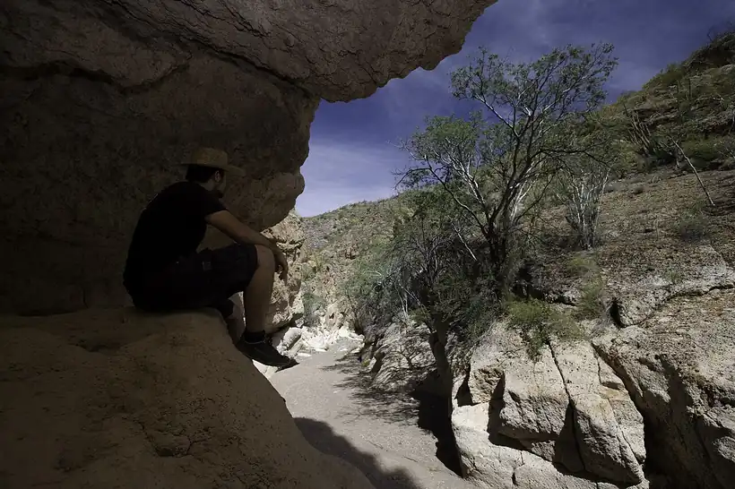

Their great work is on rock. The state holds one of the largest concentrations of rock painting sites in Mexico. In the Sierra de San Francisco some 250 sites carry the Great Murals, human figures and animals painted larger than life high on cave walls. Radiocarbon dates run from as early as 5500 BCE to the 18th century, and the paintings are likely the work of the Cochimí. UNESCO inscribed them as World Heritage in 1993. The peoples themselves, worn down by epidemics, war and mission life, did not survive the colonial centuries, and only a few words of their languages remain. The 13,581 speakers of Indigenous languages counted in 2020 speak mainly Nahuatl and Mixtec.
Pearls, Jesuits and the long mission road
The first Spanish attempts failed. In 1533 a ship sent by Hernán Cortés mutinied under the pilot Fortún Ximénez, who landed on the bay and was killed in a clash with its people. Cortés himself arrived on 3 May 1535 and named it Santa Cruz; his colony lasted almost two years, and Francisco de Ulloa abandoned it in 1539. Pearls kept drawing ships back, and the name La Paz was adopted in 1596.
Interactive maptap or click a state to open its page
Lasting settlement came with the Jesuits. Juan María de Salvatierra founded the mission of Loreto on 25 Oct 1697, and Loreto served as capital of the Californias until 1777. In all, 16 missions were founded in what is now the state, among them Santiago (1724) and San José del Cabo (1730). The missions rested on Indigenous labour, and the diseases that came with the colonists cut Native numbers hard. In 1734 the Pericú rose, angered by the missionaries' attacks on their customs, sacked Santiago and killed its missionary, Lorenzo José Carranco. After the Jesuits were expelled in 1768, the Franciscans used Loreto as a base for the north; the Portolá expedition left it on 24 Mar 1769 for Alta California. The Dominicans followed in 1773, and by the early 19th century most missions had closed.
Places in its history
La Paz
City · 1535; capital c. 1830
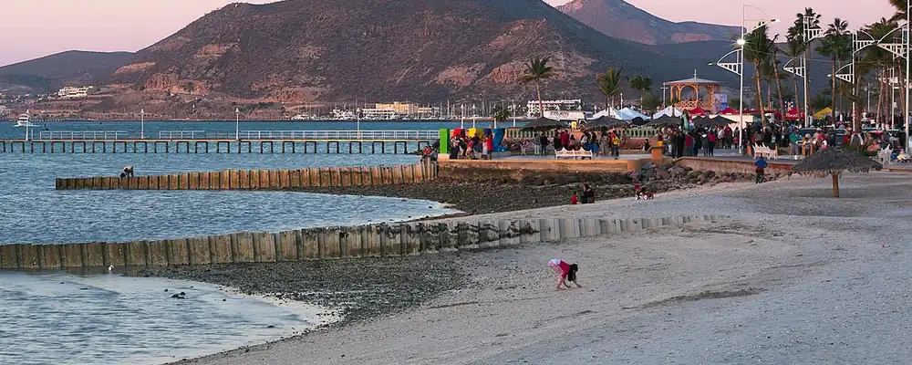
Bay where Cortés landed in 1535; pearl port and capital since about 1830. 5
Sierra de San Francisco
Archaeological site · c. 5500 BCE-1700s
Some 250 rock art sites with the Great Murals; World Heritage since 1993. 9
Loreto
Mission · 1697
First permanent mission in the present state; capital of the Californias until 1777. 6
Santa Rosalía (El Boleo)
Mine · 1885-1954
French-built copper town with its metal church of Santa Bárbara. 10
San José del Cabo
Mission · 1730
Jesuit mission of 1730 in Pericú country; later the heart of Los Cabos. 7
Mulegé
Battlefield · 1847
Mission town (1754) where local militia under Manuel Pineda repelled a USA landing on 2 Oct 1847. 13
A distant territory defends itself
Independence reached the peninsula as news from far away. In 1822 it was divided into four municipalities, and from 1824 it was a federal territory, governed directly from Mexico City. Loreto, wrecked by heavy rains in 1828, gave up its role as capital, and by 1830 La Paz held it for good. During the war with the USA, American forces landed on the peninsula, but local militia held on; at Mulegé on 2 Oct 1847, Manuel Pineda's men drove off a landing party of marines and sailors. In 1853 the filibuster William Walker, a USA adventurer bent on a republic of his own, seized La Paz with about 45 men before Mexican forces expelled him.
1810 to 1920 in Baja California Sur
From the timeline below, coloured by era
- 1830After rains ruin Loreto, La Paz becomes the capital. 1
- 1847Militia under Manuel Pineda repel a USA landing at Mulegé on 2 Oct. 11
- 1853William Walker seizes La Paz with about 45 men and is driven out. 1
- 1885-1954The French Compagnie du Boleo mines copper at Santa Rosalía. 10
- 1914Local revolutionary troops take La Paz. 1
Under the Porfiriato, Porfirio Díaz's rule of 1876-1911, the south became a separate federal territory and foreign capital was invited in. The French Compagnie du Boleo founded Santa Rosalía in 1884 and mined copper there from 1885 to 1954 and set up the metal church of Santa Bárbara. Pearl fishing in the bay of La Paz remained an industry. The Revolution, fought far from the peninsula, arrived late, when local troops took La Paz in 1914. In 1931 the Territorio Sur de Baja California was set up as its own unit, and until 1974 it was run by governors appointed by the federal government.
From copper and fishing to the road and the resorts
For half of the 20th century the territory stayed small and isolated. It had fewer people in 1921 (39,294) than in 1910 (42,512), and only 60,864 in 1950. Fishing shaped the cape: in 1917 an American company set up a floating tuna platform off Cabo San Lucas, and about ten years later a fish-processing plant followed. When the French company closed El Boleo in 1954, a state-owned Mexican firm reopened the mines, which finally shut in the 1980s.
The region, c. 1600 and today
What each state turned on, by the era table below; Baja California Sur outlined in gold.
Interactive maptap or click a state to open its page
c. 1600
Baja California Sur: Frontier: missions, presidios, independent peoples
- Silver mining districts
- Frontier: missions, presidios, independent peoples
Today
Baja California Sur: Tourism
- Export manufacturing
- Tourism
- Farming and agro-exports
- Mining
Its places in the modern era
Numbered as on the map above
- 4Santa Rosalía (El Boleo) · 1885-1954
French-built copper town with its metal church of Santa Bárbara. 10
The turn came in the 1970s. The Transpeninsular Highway, 1,711 km from Tijuana to Cabo San Lucas, was finished in 1973 and tied the south to the rest of the country by land. From 1974 the federal government built infrastructure to make Cabo San Lucas a major tourist centre, and on 8 Oct 1974 the territory became Mexico's 31st state, with three municipalities. Los Cabos became a municipality of its own in 1981 and Loreto in 1992. Cabo San Lucas grew to 16,059 people by 1990, and the state as a whole went from 128,019 in 1970 to 424,041 in 2000, with tourism as its most dynamic sector.
Tourism carried the state into the 21st century, and Los Cabos grew into a resort area for foreign visitors, most of them from the USA, Canada and the United Kingdom. That dependence showed in Sep 2014, when Hurricane Odile came ashore near Cabo San Lucas, tied as the strongest storm to strike the peninsula in the satellite era. About 26,000 foreign visitors were stranded, the Los Cabos airport lost part of its terminal roof, and full reopening was expected to take about 10 days. A territory once too remote to govern itself, joined to the mainland by road only in 1973, was by 2014 living largely from the people who flew in.
Baja California Sur, date by date
Before the Spanish before 1519
The colonial centuries 1519 to 1809
- 1533
Fortún Ximénez, leader of a mutiny on a ship sent by Cortés, lands at the bay of La Paz and is killed. 1
- 1535
Hernán Cortés lands at the bay of Santa Cruz, today La Paz, on 3 May. 5
- 1697
Juan María de Salvatierra founds the mission of Loreto on 25 Oct, the first permanent one in the present state. 6
- 1730
The mission of San José del Cabo is founded on the Río San José. 7
- 1734
The Pericú revolt begins at Santiago, where the missionary Lorenzo José Carranco is killed. 8
- 1768
The Jesuits are expelled and the Franciscans take over the missions. 1
- 1769
The Portolá expedition leaves Loreto on 24 Mar for Alta California. 6
Independence and the Reform 1810 to 1875
The Porfiriato 1876 to 1910
- 1885-1954
The French Compagnie du Boleo mines copper at Santa Rosalía. 10
The Revolution 1910 to 1920
- 1914
Local revolutionary troops take La Paz. 1
Modern Mexico after 1920
- 1931
The Southern Territory of Baja California is formally set apart from the north. 1
- 1973
The Transpeninsular Highway is completed from Tijuana to Cabo San Lucas. 14
- 1974
Baja California Sur becomes a state on 8 Oct; tourism building begins at Cabo San Lucas. 1
- 1993
UNESCO inscribes the rock paintings of the Sierra de San Francisco as World Heritage. 9
- 2014
Hurricane Odile comes ashore near Cabo San Lucas in Sep, stranding about 26,000 foreign visitors. 15
Where Baja California Sur stood: c. 1600, 1910 and today
Interactive maptap or click a state to open its page
c. 1600
Silver, the heartland and the frontier
Baja California Sur: Frontier: missions, presidios, independent peoples
- Silver mining districts
- Towns, farms and workshops of the old heartland
- Ports, sugar and cacao
- Indigenous south: cochineal, maize, tribute
- Maya lands under encomienda or beyond Spanish rule
- Frontier: missions, presidios, independent peoples
1910
The Porfiriato at its height
Baja California Sur: Mining
- Mining
- Oil
- Henequén
- Sugar and textile mills
- Haciendas: grain, pulque, cattle
- Export crops: coffee, tobacco, cacao, chicle, timber
- Steel, cotton and the railway north
- Ranching frontier
- The national capital
Today
What each state turns on now
Baja California Sur: Tourism
- Export manufacturing
- Oil and gas
- Tourism
- Farming and agro-exports
- Mining
- Ports and logistics
- Services and government
Why Mexico's own reading of what each state's economy turned on in that period, drawn from the sources listed in each state's room; a classification, not a measurement.
Today's numbers for Baja California Sur
Output, exports, jobs, wages and investment now, each with its source and date.
The bookBook 6, Where to Go in Mexico, chapter 14
Where to Go in Mexico: The Pacific Border, the corridor this state belongs to.
Why MexicoThe national timeline
The turning points of the whole country, each dated, each with its source.
Sources, each with its date
- Wikipedia (English), Baja California Sur, History section and historical population table, 3 Nov 2026 · read 3 Nov 2026 · link
- Wikipedia (Spanish), Baja California Sur, Historia section, 3 Nov 2026 · read 3 Nov 2026 · link
- INEGI, Censo de Población y Vivienda 2020, results for Baja California Sur (press release 31/21), 26 Jan 2021 · read 3 Nov 2026 · link
- INEGI, Panorama sociodemográfico de Baja California Sur, Censo de Población y Vivienda 2020, 2021 · read 3 Nov 2026 · link
- Wikipedia (English), La Paz, Baja California Sur, 3 Nov 2026 · read 3 Nov 2026 · link
- Wikipedia (English), Loreto, Baja California Sur, 3 Nov 2026 · read 3 Nov 2026 · link
- Wikipedia (English), San José del Cabo, 3 Nov 2026 · read 3 Nov 2026 · link
- Wikipedia (English), Misión Santiago de Los Coras, 3 Nov 2026 · read 3 Nov 2026 · link
- Wikipedia (English), Rock Paintings of Sierra de San Francisco, 3 Nov 2026 · read 3 Nov 2026 · link
- Wikipedia (English), Santa Rosalía, Baja California Sur, 3 Nov 2026 · read 3 Nov 2026 · link
- Wikipedia (English), Battle of Mulegé, 3 Nov 2026 · read 3 Nov 2026 · link
- Wikipedia (English), Cabo San Lucas, 3 Nov 2026 · read 3 Nov 2026 · link
- Wikipedia (English), Mulegé, 3 Nov 2026 · read 3 Nov 2026 · link
- Wikipedia (English), Mexican Federal Highway 1, 3 Nov 2026 · read 3 Nov 2026 · link
- Wikipedia (English), Hurricane Odile, 3 Nov 2026 · read 3 Nov 2026 · link
Pictures
- La Paz malecon 1702 p2: Cvmontuy, CC BY-SA 4.0, Wikimedia Commons · read 3 Nov 2026
- Sierra de San Francisco, Baja California Sur- San Francisco mountain range (21139621129): Comisión Mexicana de Filmaciones from México D. F., México, CC BY-SA 2.0, Wikimedia Commons · read 3 Nov 2026

Where the sources disagree
- Earliest presence: Wikipedia (English, state) reports remains on Isla Espíritu Santo dated to 40,000 years but most evidence at 10,000-21,000; Wikipedia (Spanish) gives about 14,000. This page says "at least 10,000 years".
- Fortún Ximénez: Wikipedia (English) and Wikipedia (Spanish, state) give 1533; Wikipedia (Spanish, Baja California) gives 1534. This page uses 1533.
- Southern Territory: Wikipedia (English) says the peninsula was divided in 1888 and formalised in 1931; Wikipedia (Spanish) gives 1930, and 14 Dec 1887 for the districts. This page uses 1931.
- Loreto as capital: Wikipedia (English, state) says rains destroyed Loreto in 1828 and La Paz was capital by 1830; its Loreto article says Loreto stayed capital until 1829. This page says "by 1830".
- Jesuit expulsion: Wikipedia (English, state) gives 1768; its Loreto article gives 1767 for the order. This page uses 1768, when it took effect on the peninsula.
Baja California
Yuman peoples and their painted rocks, a thin chain of missions, a desert frontier settled late, then irrigated cotton, border towns and the factories of the 1960s.
All 32 on the mapNext →Campeche
Campeche runs from Calakmul's Snake Kingdom to a walled port that shipped logwood and fought off pirates, then to chicle camps in the forest and the oil of Cantarell.