Nayarit
From the Cora and Wixárika sierras and the island of Mexcaltitán to the shipyards of San Blas and the tobacco fields of the coast, Nayarit was the west's last frontier.
Capital: Tepic · Territory, then state: 1884 / 1917 · Checked 3 Nov 2026
Interactive maptap or click a state to open its page
Nayarit in figures from its history
Round temples, Aztatlán and the island of Mexcaltitán
People may have settled in Nayarit as early as 5000 BCE. Its farming villages shared the shaft-tomb customs of West Mexico, and at Los Toriles, by Ixtlán del Río, later builders raised a round temple about 25 meters across, dedicated to Ehécatl, the god of wind. Along the coast, the Aztatlán tradition spread from about 900 CE, with some evidence pointing as early as 520 CE, and its descendants were the coastal peoples the Spanish met.
Indigenous languages spoken today
Speakers aged 3 and over, census of 2020 21
In the 2020 census 69,069 people aged 3 and over spoke an Indigenous language in Nayarit, 5.9% of that age group, and 11,473 of them did not speak Spanish. The counts by language come from the census's extended sample questionnaire, as published by Data México. Nahuatl-speaking Mexicaneros also live in the sierra.
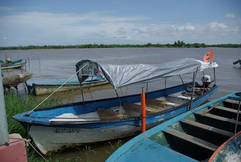

In the mountains, the Cora appear around 400 CE and reached their height around 1200, while Tepehuanes and Huicholes moved into the region between the 9th and 12th centuries. The state's name comes from the Cora word Naáyarite. In the lagoons of the north coast lies the island town of Mexcaltitán, which some historians since the late 19th century have proposed as Aztlán, the homeland the Mexica left before founding Tenochtitlan; the idea is still debated. The sierra peoples kept their languages through five centuries of pressure, and they remain the largest Indigenous language groups in the state: in 2020 about 34,900 people spoke Cora, 26,000 Huichol and 2,600 Southern Tepehuan.
Compostela, the unconquered Nayar and the shipyards of San Blas
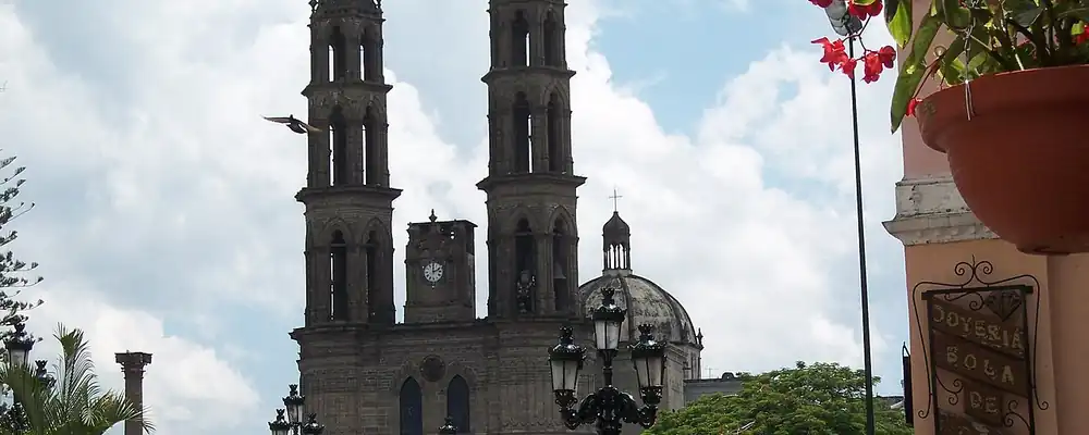
Hernán Cortés passed briefly through the region in 1523, but the conquest came with Nuño de Guzmán, whose brutal campaign of 1530-31 founded Compostela and, in 1531, Tepic as the Villa del Espíritu Santo. A royal order of 25 Jan 1531 created the Kingdom of Nueva Galicia with its capital at Compostela, and the Audiencia, the kingdom's royal court and governing council, sat there from 13 Feb 1548 until it moved to Guadalajara in 1560. Guzmán's violence fed the great Indigenous rising of the 1540s, the Mixtón War, and in 1538 his successor, Diego Pérez de la Torre, was killed in a revolt.
Interactive maptap or click a state to open its page
The Cora of the Nayar sierra, protected by its steep canyons and mesas, held out for almost two centuries. They allowed no missionaries to live among them, beat back an expedition in 1716, and fell only when Spanish forces seized the Mesa del Nayar in Feb 1722; Jesuit missions followed. On the coast, the English corsair Thomas Cavendish raided Chacala in 1587. In 1768 José de Gálvez, the inspector general (visitador) sent by the Crown to reform New Spain, founded the port and shipyard of San Blas as the base for expeditions to the Californias: Junípero Serra sailed from there that year, Juan Francisco de la Bodega y Quadra reached Alaska in 1775, and from 1789 to 1795 San Blas supplied the Spanish post at Nootka Sound.
Places in its history
San Blas
Port · 1768
Naval base and shipyard for the Californias; its 1769 church inspired Longfellow's last poem. 5
Mexcaltitán
Archaeological site · pre-Hispanic
Island town in the coastal lagoons, proposed by some historians as Aztlán. 6
Los Toriles, Ixtlán del Río
Archaeological site · pre-Hispanic
Round temple to Ehécatl, about 25 meters across, 1.5 km east of the town. 7
Nuevo Vallarta
Port · 1970s
Resort built on land of the Bahía de Banderas trust, with a large marina. 13
Mercado, Lozada and the long road to statehood
In Nov 1810 the priest José María Mercado took Tepic for the insurgency without a battle, and in Dec he captured the port of San Blas; within a year royalist forces had retaken most of the region, and Mercado was defeated and executed. After independence the area was the 7th canton of Jalisco. Under the centralist republic, which turned the states into departments, it became the Department of Tepic on 13 Mar 1837, with 62,620 inhabitants, and in the second half of the century it was one of the most turbulent corners of Mexico, its villages in open revolt over land.
1810 to 1920 in Nayarit
From the timeline below, coloured by era
- 1810José María Mercado takes Tepic in Nov and San Blas in Dec for the insurgency. 15
- 1837The Department of Tepic is created on 13 Mar, with 62,620 inhabitants. 2
- 1859Lozada attacks Tepic on 2 Nov; Miramón decrees the Territory of Tepic on 24 Dec. 9
- 1873Manuel Lozada is captured and executed on 19 Jul. 9
- 1884Tepic becomes a federal territory in Dec. 4
- 1917The new Constitution makes the territory the state of Nayarit. 4
The leader of that revolt was Manuel Lozada, born in 1828, called the Tiger of Álica. From 1857 his Cora and mestizo followers defeated government troops, attacked Tepic on 2 Nov 1859 and pressed the land claims of Indigenous communities; he sided with the French Intervention and Maximilian's empire in 1865-66, and Maximilian rewarded him with a province of San José de Nayarit. The conservative president Miguel Miramón had already split Tepic from Jalisco by decree on 24 Dec 1859, and Benito Juárez made it a military district on 7 Aug 1867. Lozada was captured and shot on 19 Jul 1873. Tepic became a federal territory in Dec 1884, run from Mexico City, and the Constitution of 1917 finally made it the free and sovereign state of Nayarit.
Tobacco ejidos, the Santiago dams and the Bay of Banderas
Sugar cane, tobacco and tropical fruit carried the 20th-century economy. Tobacco was grown under contract from at least the 1940s: companies financed the crop and ejido farmers, holders of communal land-reform plots, most with two or three hectares each, planted and cured it, and from the 1950s the leaf was cured in central industrial plants. In 1972 the government created Tabamex, a state company that ran the trade until it was sold off in 1990; by the late 1990s Nayarit grew over 80% of Mexico's blond tobacco. On the Río Grande de Santiago, the Aguamilpa dam was built from 1989, inaugurated on 21 Jul 1993 and began producing power in 1994.
The region, c. 1600 and today
What each state turned on, by the era table below; Nayarit outlined in gold.
Interactive maptap or click a state to open its page
c. 1600
Nayarit: Frontier: missions, presidios, independent peoples
- Silver mining districts
- Towns, farms and workshops of the old heartland
- Frontier: missions, presidios, independent peoples
Today
Nayarit: Tourism
- Export manufacturing
- Tourism
- Mining
Tourism came from the south. As Puerto Vallarta drew international attention after 1965, the federal government created the Bahía de Banderas trust in Nov 1970, and early in 1971 it took 5,162 hectares from ejidos such as Bucerías, Jarretaderas, Cruz de Huanacaxtle, Higuera Blanca and Sayulita. Hotels, timeshares, a marina and a golf course grew quickly between 1975 and 1984 at Nuevo Vallarta, and in 1989 the coast became its own municipality, Bahía de Banderas. By 2000 the state that had been a remote territory in 1900 had joined the Pacific resort economy, while the sierra kept its own language and calendar.
Both halves of Nayarit, the sierra and the coast, were reshaped by large works. On the Río Grande de Santiago the El Cajón dam was built between 2003 and 2007 to generate power and to regulate the river's flow for the Aguamilpa station. On the shore, the coast north of Banderas Bay has been promoted as the Riviera Nayarit, extending the resort economy that began with the Bahía de Banderas trust in 1970. The Cora and Wixárika communities of the sierra still keep their languages. The frontier the Spanish conquered last is now tied to the national power grid and to the Pacific resort trade.
Nayarit, date by date
Before the Spanish before 1519
The colonial centuries 1519 to 1809
- 1531
Nuño de Guzmán founds Tepic; a royal order of 25 Jan creates Nueva Galicia with its capital at Compostela. 3
- 1548
The Audiencia of Nueva Galicia is installed at Compostela on 13 Feb. 14
- 1587
Thomas Cavendish raids Chacala on the coast. 14
- 1722
Spanish forces seize the Mesa del Nayar in Feb, ending Cora independence. 16
- 1768
José de Gálvez founds the port and shipyard of San Blas; Junípero Serra sails for California. 5
- 1775
Bodega y Quadra sails from San Blas and reaches Alaska. 5
Independence and the Reform 1810 to 1875
- 1810
José María Mercado takes Tepic in Nov and San Blas in Dec for the insurgency. 15
- 1837
The Department of Tepic is created on 13 Mar, with 62,620 inhabitants. 2
- 1859
Lozada attacks Tepic on 2 Nov; Miramón decrees the Territory of Tepic on 24 Dec. 9
- 1873
Manuel Lozada is captured and executed on 19 Jul. 9
The Porfiriato 1876 to 1910
- 1884
Tepic becomes a federal territory in Dec. 4
The Revolution 1910 to 1920
- 1917
The new Constitution makes the territory the state of Nayarit. 4
Modern Mexico after 1920
- 1970-71
The Bahía de Banderas trust is created and takes 5,162 hectares of ejido land for tourism. 12
- 1972
The state tobacco company Tabamex is created; it is sold off in 1990. 17
- 1993
The Aguamilpa dam on the Río Grande de Santiago is inaugurated on 21 Jul. 11
- 2003-07
The El Cajón dam is built on the Río Grande de Santiago, upstream of Aguamilpa. 22
Where Nayarit stood: c. 1600, 1910 and today
Interactive maptap or click a state to open its page
c. 1600
Silver, the heartland and the frontier
Nayarit: Frontier: missions, presidios, independent peoples
- Silver mining districts
- Towns, farms and workshops of the old heartland
- Ports, sugar and cacao
- Indigenous south: cochineal, maize, tribute
- Maya lands under encomienda or beyond Spanish rule
- Frontier: missions, presidios, independent peoples
1910
The Porfiriato at its height
Nayarit: Export crops: coffee, tobacco, cacao, chicle, timber
- Mining
- Oil
- Henequén
- Sugar and textile mills
- Haciendas: grain, pulque, cattle
- Export crops: coffee, tobacco, cacao, chicle, timber
- Steel, cotton and the railway north
- Ranching frontier
- The national capital
Today
What each state turns on now
Nayarit: Tourism
- Export manufacturing
- Oil and gas
- Tourism
- Farming and agro-exports
- Mining
- Ports and logistics
- Services and government
Why Mexico's own reading of what each state's economy turned on in that period, drawn from the sources listed in each state's room; a classification, not a measurement.
Today's numbers for Nayarit
Output, exports, jobs, wages and investment now, each with its source and date.
The bookBook 6, Where to Go in Mexico, chapter 17
Where to Go in Mexico: The West, the corridor this state belongs to.
Why MexicoThe national timeline
The turning points of the whole country, each dated, each with its source.
Sources, each with its date
- Wikipedia (English), Nayarit, History section, 3 Nov 2026 · read 3 Nov 2026 · link
- Wikipedia (Spanish), Nayarit, 3 Nov 2026 · read 3 Nov 2026 · link
- Wikipedia (English), Tepic, 3 Nov 2026 · read 3 Nov 2026 · link
- Wikipedia (English), Tepic Territory, 3 Nov 2026 · read 3 Nov 2026 · link
- Wikipedia (English), San Blas, Nayarit, 3 Nov 2026 · read 3 Nov 2026 · link
- Wikipedia (English), Mexcaltitán de Uribe, 3 Nov 2026 · read 3 Nov 2026 · link
- Wikipedia (English), Ixtlán del Río, 3 Nov 2026 · read 3 Nov 2026 · link
- Wikipedia (English), Compostela, Nayarit, 3 Nov 2026 · read 3 Nov 2026 · link
- Wikipedia (English), Manuel Lozada, 3 Nov 2026 · read 3 Nov 2026 · link
- Wikipedia (English), Cora people, 3 Nov 2026 · read 3 Nov 2026 · link
- Wikipedia (English), Aguamilpa Dam, 3 Nov 2026 · read 3 Nov 2026 · link
- Wikipedia (Spanish), Bahía de Banderas (municipality), 3 Nov 2026 · read 3 Nov 2026 · link
- Wikipedia (English), Nuevo Vallarta, 3 Nov 2026 · read 3 Nov 2026 · link
- Wikipedia (Spanish), Historia de Jalisco (Nueva Galicia, Compostela, coastal raids), 3 Nov 2026 · read 3 Nov 2026 · link
- HISTORY.com Editors, Nayarit (published 2 Dec 2009, updated 28 May 2025), 28 May 2025 · read 3 Nov 2026 · link
- John Schmal, Indigenous Nayarit: Resistance in the Sierra Madre, Indigenous Mexico, 2019 · read 3 Nov 2026 · link
- Horacio Mackinlay, Concentración de tierras, eficiencia y productividad en la rama del tabaco, Alteridades 14 (27), UAM, 2004 · read 3 Nov 2026 · link
- Tercer Censo de Población 1910, population by federal entity in 1895, 1900 and 1910 (digital copy, Universidad Veracruzana), 1910 · read 3 Nov 2026 · link
- INEGI, Censo de Población y Vivienda 2020, results for Nayarit, press release 49/21, 26 Jan 2021 · read 3 Nov 2026 · link
- INEGI, Censo de Población y Vivienda 2020, presentation of results for Nayarit, 2021 · read 3 Nov 2026 · link
- Data México (Secretaría de Economía), Nayarit state profile, Indigenous languages, 2020 census extended questionnaire, 3 Nov 2026 · read 3 Nov 2026 · link
- Wikipedia (English), El Cajón Dam (Mexico), 3 Nov 2026 · read 3 Nov 2026 · link
- Wikipedia (English), Riviera Nayarit, 3 Nov 2026 · read 3 Nov 2026 · link
- Wikipedia (Spanish), Riviera Nayarit, 3 Nov 2026 · read 3 Nov 2026 · link
Pictures
- Catedral de Tepic, Nayarit, MEXICO: Christian Frausto Bernal, CC BY-SA 2.0, Wikimedia Commons · read 3 Nov 2026
- Mexcaltitán - Pueblo Magico - barcos: mickou, CC BY 2.0, Wikimedia Commons · read 3 Nov 2026

Where the sources disagree
- Founding of Tepic: Wikipedia (English) gives 1531; HISTORY.com says Guzmán founded Espíritu Santo on the ruins of Tepic about 1528; the Compostela article gives 1530. The tile uses 1531.
- Cora conquest: Schmal dates the seizure of the Mesa del Nayar to Feb 1722 and the full conquest to 1723; Wikipedia gives 1722. This page uses 1722.
- Riviera Nayarit: Wikipedia (English) gives about 320 km of coast, from San Blas south to the Ameca river; Wikipedia (Spanish) extends it north to Boca de Teacapán. Neither dates the name.
Morelos
From Chalcatzingo and Xochicalco to Cortés's sugar estates, the siege of Cuautla and Zapata's fight for land, the valleys of Morelos turned on who held the soil.
All 32 on the mapNext →Nuevo León
From the carved rocks of desert hunters to the foundries and breweries of Monterrey, Nuevo León turned a poor frontier kingdom into Mexico's industrial north.