Guerrero
Olmec-age painted caves, Taxco silver and Acapulco's galleons to Asia, then the land of Morelos, Guerrero and Álvarez, and in the 20th century the resort coast.
Capital: Chilpancingo · Became a state: 1849 · Checked 3 Nov 2026
Interactive maptap or click a state to open its page
Guerrero in figures from its history
Painted caves, Mezcala stone and the peoples of the south
Hunter-gatherers left early traces in Guerrero's caves (a 2005 state encyclopedia dates the first to about 20,000 years ago, a date no broadly accepted site in the Americas supports), and pottery at Puerto Marqués, near Acapulco, is some 5,000 years old. In the Formative period, the age of the first farming villages and towns, the region had close Olmec ties. The paintings of the Juxtlahuaca and Oxtotitlán caves, from about 1200 to 900 BCE, are the earliest sophisticated painted art known in Mesoamerica. Teopantecuanitlán, near the meeting of the Amacuzac and Mezcala rivers, sat on the trade routes between the Gulf and the west. Along the Mezcala River, the Mezcala culture carved spare stone figures and later took up Teotihuacan ways, the ballgame among them.
Indigenous languages spoken today
Speakers aged 3 and over, census of 2020 15
In all, 515,487 people aged 3 and over spoke an Indigenous language in 2020, 15.5% of that age group; 2,394 spoke other languages.

By the 15th century the land held no great cities but many peoples: Purépecha and Cuitlatecs in the Tierra Caliente, Chontales and Tlahuicas in the northern sierra, Tlapanecs and Mixtecs in La Montaña, Amuzgos on the Costa Chica, and the Yopes, whom the Aztecs never subdued. Aztec campaigns began in 1414, by 1440 the Aztecs held La Montaña, and the modern state came to span seven of their tributary provinces. Nahuatl, Mixtec (Tu'un savi), Tlapanec (Me'phaa) and Amuzgo are still spoken by 515,487 people.
Taxco silver and the port of the Manila galleon
In 1521 Rodrigo de Castañeda entered Taxco, while Juan Rodríguez de Villafuerte took the Costa Grande and in 1523 reached Acapulco. Zihuatanejo was among the first Spanish ports on the Pacific. Hernán Cortés founded the Spanish town of Taxco in 1529, and silver lodes found around 1532 began commercial mining. The land was divided into 76 encomiendas, grants that gave Spaniards the tribute and labour of Indigenous towns. Disease and forced labour emptied many villages in the first half of the 16th century, and enslaved Africans were brought to the Costa Chica to replace the lost workers.
Interactive maptap or click a state to open its page
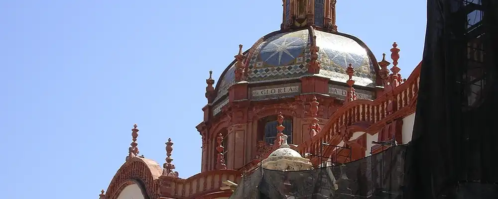
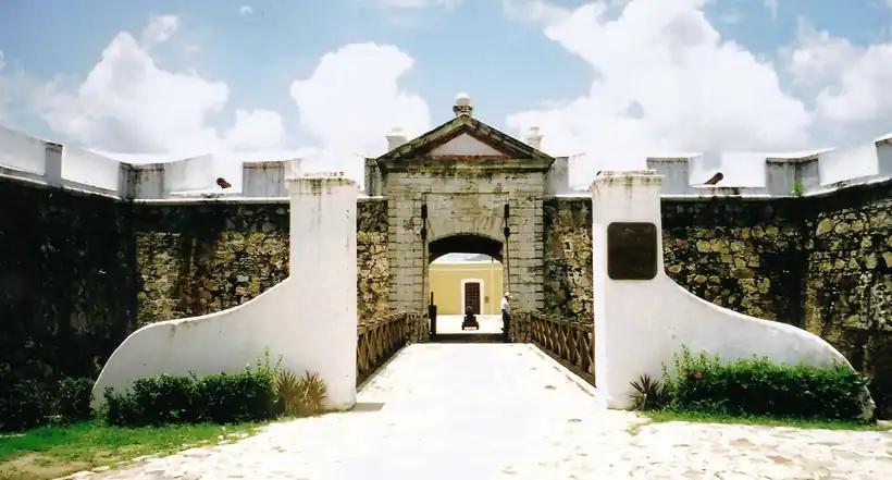
Acapulco became New Spain's window on Asia. In 1550, 30 Spanish families were sent to settle it, and from 1565, once Andrés de Urdaneta found the way back across the Pacific, the Manila galleons carried Chinese silk and porcelain, spices and ivory to Acapulco and sailed back with American silver. From 1593 only two ships a year were allowed. The Fort of San Diego, finished in 1617 and rebuilt in 1778-83 after an earthquake, guarded the port, and a Japanese embassy under Hasekura Tsunenaga landed there in 1614. In the 18th century the miner José de la Borda, who struck a major vein, revived Taxco's mines and built the church of Santa Prisca (1751-58).
Places in its history
Chilpancingo
City · 1591; 1813
The capital, where Morelos installed the Congress of Anáhuac in 1813. 3
Acapulco
Port · 1565-1815
Pacific port of the Manila galleons, later one of Mexico's best-known resorts. 8
Fort of San Diego
Fort · 1617; rebuilt 1778-83
Fort that guarded the galleons; Morelos took it in 1813. 6
Morelos's Congress, Iguala and the state of Álvarez
The south was Morelos's ground. The Fort of San Diego fell to his forces on 19 Aug 1813, and in Sep 1813 he installed the Congress of Anáhuac in Chilpancingo, where he presented the Sentimientos de la Nación, his programme for an independent republic. Vicente Guerrero, born in Tixtla, kept the insurgency alive in the mountains after Morelos fell, and on 24 Feb 1821 he and Agustín de Iturbide signed the Plan de Iguala, which ended the war. Mexicans of Filipino descent on the coast, heirs of the galleon trade, led by Isidoro Montes de Oca, also fought for independence.
1810 to 1920 in Guerrero
From the timeline below, coloured by era
Nicolás Bravo and Vicente Guerrero asked for a state of the south from 1823. It came on 27 Oct 1849, with Juan Álvarez as first governor and Tixtla as first capital; Chilpancingo became the capital in 1870. On 1 Mar 1854 Álvarez's movement proclaimed the Plan de Ayutla, which forced Santa Anna out in 1855 and opened the Reform, the liberal laws of the 1850s and 1860s that sold off Church and communal lands. During the Porfiriato, Porfirio Díaz's rule of 1876-1911, the state was quiet, but land gathered in few hands and revolts broke out in 1873, 1887 and 1891. In Feb 1911 the Figueroa brothers rose at Atenango del Río, by 1914 the Zapatistas, the peasant army of Emiliano Zapata, held nearly the whole state, and in 1921 governor Rodolfo Neri began the land reform, which broke up estates into ejidos, communal farmland granted to villages.
Spratling's silver and the rise of Acapulco
The 1930s brought strikes, new crops such as coconut, sesame and coffee, and small industries in Iguala and Chilpancingo. William Spratling, an American who found Taxco in 1929, set up silver design workshops there and helped revive the old mining town as a centre of fine silverwork. In Acapulco, Carlos Barnard opened the first 12 rooms of Hotel El Mirador on the cliffs of La Quebrada in 1933, and the cliff divers began their leaps in the same decade.
The region, c. 1600 and today
What each state turned on, by the era table below; Guerrero outlined in gold.
Interactive maptap or click a state to open its page
c. 1600
Guerrero: Ports, sugar and cacao
- Silver mining districts
- Towns, farms and workshops of the old heartland
- Ports, sugar and cacao
- Indigenous south: cochineal, maize, tribute
Today
Guerrero: Tourism
- Export manufacturing
- Oil and gas
- Tourism
- Farming and agro-exports
- Ports and logistics
- Services and government
In the early 1950s, to open the port to visitors from the capital, President Miguel Alemán gave the port power lines, drainage and roads and built the first highway to Mexico City, and the seafront avenue took his name in 1950. Hollywood came on holiday, hotels multiplied through the 1960s and 1970s, and Acapulco grew from 28,512 people in 1950 to 174,378 in 1970. In the 1970s and 1980s the federal government developed Ixtapa and Zihuatanejo, adding a second resort to the coast that the galleons had once made famous.
In the 2020s tourism was still the single most important part of Guerrero's economy, though by about 2010 Acapulco's visitors came mostly from Mexico itself, and Taxco's silverwork, heir to the colonial mines and Spratling's workshops, is the state's best-known craft. Lack of jobs and schooling made Guerrero one of the leading sources of migrants to the USA, and in many villages women carry most of the farming, crafts and trade. On 25 Oct 2023 Hurricane Otis came ashore just west of Acapulco, the first Pacific hurricane on record to reach land at Category 5, after its winds rose by 165 km/h in 21 hours; about 80% of the port's hotels were damaged. The coast that the galleons and the resorts made famous is rebuilding once more.
Guerrero, date by date
Before the Spanish before 1519
- c. 20,000 years ago (unproven)
Hunter-gatherers leave early traces in Guerrero's caves; a 2005 state encyclopedia dates the first to about 20,000 years ago, older than any site broadly accepted in the Americas. 1
- c. 1200-900 BCE
Olmec-style paintings are made in the Juxtlahuaca cave. 11
- c. 1000-500 BCE
Teopantecuanitlán is inhabited near the Amacuzac and Mezcala rivers. 1
- 1414
Aztec incursions into the region begin. 1
The colonial centuries 1519 to 1809
- 1521
Rodrigo de Castañeda enters the mining district of Taxco. 2
- c. 1532
Silver lodes are found at Taxco and commercial mining begins. 5
- 1550
Thirty Spanish families are sent to settle Acapulco. 8
- 1565
The Manila galleon trade with Acapulco begins; it lasts until 1815. 7
- 1591
Chilpancingo is founded on 1 Nov 1591. 3
- 1614
A Japanese embassy under Hasekura Tsunenaga lands at Acapulco. 1
- 1617
The Fort of San Diego is completed to guard Acapulco. 6
- 1751-58
José de la Borda builds the church of Santa Prisca at Taxco. 5
Independence and the Reform 1810 to 1875
Where Guerrero stood: c. 1600, 1910 and today
Interactive maptap or click a state to open its page
c. 1600
Silver, the heartland and the frontier
Guerrero: Ports, sugar and cacao
- Silver mining districts
- Towns, farms and workshops of the old heartland
- Ports, sugar and cacao
- Indigenous south: cochineal, maize, tribute
- Maya lands under encomienda or beyond Spanish rule
- Frontier: missions, presidios, independent peoples
1910
The Porfiriato at its height
Guerrero: Haciendas: grain, pulque, cattle
- Mining
- Oil
- Henequén
- Sugar and textile mills
- Haciendas: grain, pulque, cattle
- Export crops: coffee, tobacco, cacao, chicle, timber
- Steel, cotton and the railway north
- Ranching frontier
- The national capital
Today
What each state turns on now
Guerrero: Tourism
- Export manufacturing
- Oil and gas
- Tourism
- Farming and agro-exports
- Mining
- Ports and logistics
- Services and government
Why Mexico's own reading of what each state's economy turned on in that period, drawn from the sources listed in each state's room; a classification, not a measurement.
Today's numbers for Guerrero
Output, exports, jobs, wages and investment now, each with its source and date.
The bookBook 6, Where to Go in Mexico, chapter 20
Where to Go in Mexico: The Deep South: Guerrero, Oaxaca and Chiapas, the corridor this state belongs to.
Why MexicoThe national timeline
The turning points of the whole country, each dated, each with its source.
Sources, each with its date
- Wikipedia (English), Guerrero, History section, 3 Nov 2026 · read 3 Nov 2026 · link
- Wikipedia (Spanish), Estado de Guerrero, history and population sections, 3 Nov 2026 · read 3 Nov 2026 · link
- Wikipedia (English), Chilpancingo, 3 Nov 2026 · read 3 Nov 2026 · link
- Wikipedia (Spanish), Chilpancingo de los Bravo, 3 Nov 2026 · read 3 Nov 2026 · link
- Wikipedia (English), Taxco, 3 Nov 2026 · read 3 Nov 2026 · link
- Wikipedia (English), Fort of San Diego, 3 Nov 2026 · read 3 Nov 2026 · link
- Wikipedia (English), Manila galleon, 3 Nov 2026 · read 3 Nov 2026 · link
- Wikipedia (English), Acapulco, 3 Nov 2026 · read 3 Nov 2026 · link
- Wikipedia (English), Iguala, 3 Nov 2026 · read 3 Nov 2026 · link
- Wikipedia (English), Tixtla, 3 Nov 2026 · read 3 Nov 2026 · link
- Wikipedia (English), Juxtlahuaca, 3 Nov 2026 · read 3 Nov 2026 · link
- Wikipedia (English), Plan of Ayutla, 3 Nov 2026 · read 3 Nov 2026 · link
- The Statesman's Year-Book 1913, Mexico, table of states with 1900 and 1910 census populations (Wikisource transcription), 1913 · read 3 Nov 2026 · link
- INEGI, Censo de Población y Vivienda 2020, results for Guerrero, press release 53/21, 26 Jan 2021 · read 3 Nov 2026 · link
- Omnia (republishing Proceso), 'El etnocidio lingüístico en Guerrero', speakers by language from the INEGI 2020 census, 21 Feb 2026 · read 3 Nov 2026 · link
- Wikipedia (English), Hurricane Otis, 3 Nov 2026 · read 3 Nov 2026 · link
Pictures
- Taxco Santa Prisca 2: Labé, CC BY-SA 3.0, Wikimedia Commons · read 3 Nov 2026
- Fuerte de San Diego, Acapulco, Guerreri (32450053994): Comisión Mexicana de Filmaciones from México D. F., México, CC BY-SA 2.0, Wikimedia Commons · read 3 Nov 2026

Where the sources disagree
- Chilpancingo as capital: Wikipedia (English) gives 1870; Wikipedia (Spanish) gives 1872. This page uses 1870.
- Congress of Anáhuac: Wikipedia (Spanish, Chilpancingo) gives 13 Sep 1813; Wikipedia (Spanish, Estado de Guerrero) gives 6 Sep 1813. This page gives only Sep 1813.
- Teopantecuanitlán: Wikipedia (English) gives 1000-500 BCE; Wikipedia (Spanish) gives the 2nd millennium BCE. This page uses 1000-500 BCE.
- Plan of Ayutla: Wikipedia (English, Guerrero) says the rising was quelled; Wikipedia's Plan of Ayutla article says Santa Anna abdicated on 12 Aug 1855 and Álvarez took the presidency. This page follows the Plan of Ayutla article.
- Earliest traces: Wikipedia (English, Guerrero) gives about 20,000 years ago, citing the Enciclopedia de los Municipios de México (2005); most scholars place the first arrival in the Americas 15,000 to 20,000 years ago, and the oldest firmly dated site in our state histories is El Fin del Mundo, Sonora, about 13,390 years ago. This page marks the date unproven.
Guanajuato
From Chupícuaro and Cañada de la Virgen to the silver of La Valenciana, the cry of Dolores and the Bajío's grain, Guanajuato has fed Mexico and started its wars.
All 32 on the mapNext →Hidalgo
From Toltec Tula to the silver of Pachuca and Real del Monte, then to Cornish engines, a state born in 1869, and the factories and refinery of the 20th century.